Water
History
PHL
Show/Hide Menu
Items
Articles
Topics
About
Blog
Show/Hide Search
Search!
Topics
Landscape Changes
Map Lovers’ Monday: Schuylkill River from Wissahickon Creek to Norristown, 1913
Map of Historic Dock Creek
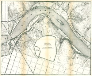
Fairmount Park topographical map, showing East Park Reservoir, 1872
Wingohocking Sewer outfall into Frankford Creek
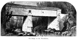
Thomas Mill Covered Bridge over Wissahickon Creek (Picturesque America)
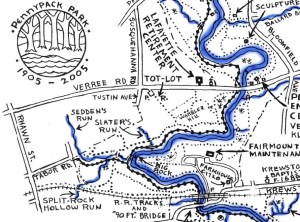
Plans and maps of the Pennypack Creek Watershed in Philadelphia
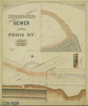
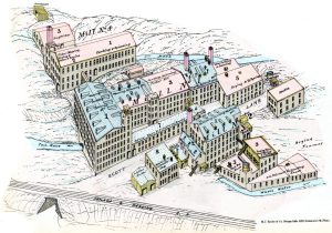
Wingohocking Sewer across Penn St.
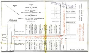
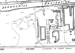
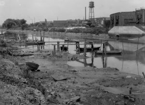
Frankford Creek Watershed: A historical overview of the Philadelphia section
Frankford Creek Watershed Historical Timeline
Down Under III: A walk in the Dobson’s Run Storm Relief Sewer, June 15, 2010
Requiem for a stream: A brief history of Dobson’s Run
Drawing Dock Creek
Down Under, Part 2: Beaver Creek as it appears today
Overbrook, as it was
Cobbs Creek in the Days of the Old Powder Mill
Requiem for a stream: Adams Run in Oak Lane
Requiem for a stream: Still House Run in Manayunk
The Manayunk Expressway
Dock Creek Sewer in 1849
Cobbs Creek: A Brief Historical Overview
High Water: Flooding in Philadelphia
Manayunk and the Schuylkill Navigation
Aramingo Canal, Then and Now
Down Under!
Posts navigation
1
2
Next