Fairmount Park topographical map, showing East Park Reservoir, 1872
This map is likely a reduction of a large-scale topographic survey done of Fairmount Park in Philadelphia a few years after its official creation by the State Legislature. The focus is the proposed East Park Reservoir, construction of which began in 1869 but was not completed until 1889.

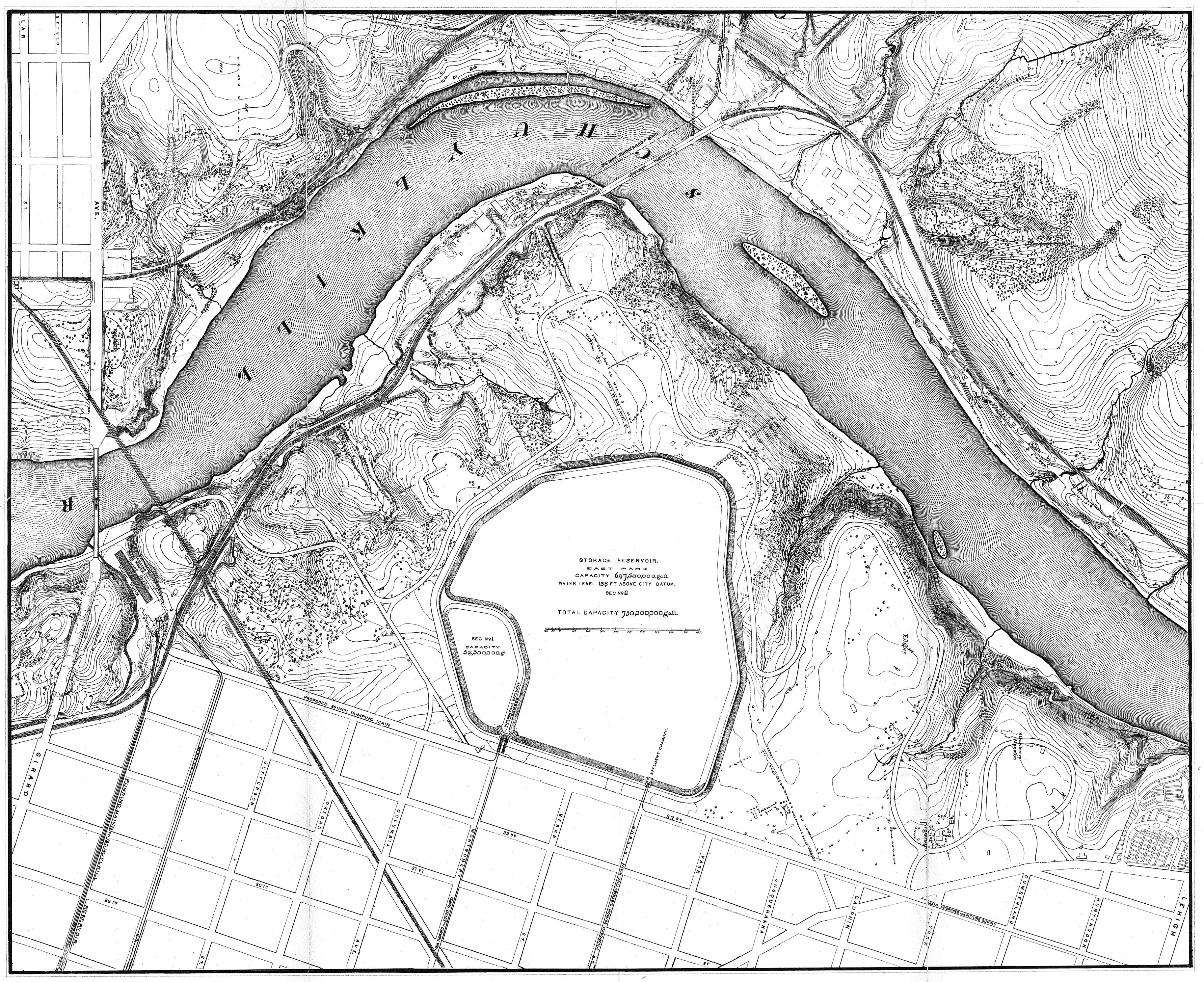
The map was bound into the PWD 1872 annual report: "Department for supplying the city with water. Annual Report of the Chief Engineer of the Water Department City of Philadelphia. Presented to councils January 30, 1873." The yellowing on the map shows where it was folded to fit into the book. I have also included a "bleached out" grayscale version where I tried to remove most of these marks.
To see what East Park Reservoir looks like today, visit this blog post on WaterHistoryPHL. To see a large-scale topographic survey of Fairmount Park made in 1938, visit the Greater Philadelphia Geohistory Project. You can also read Jane Mork Gibson's overview and notes on the construction of this reservoir.