Plans and maps of the Pennypack Creek Watershed in Philadelphia

With only slight edits, this post appears here as it was first published on PhillyH2o in 2006.

In March 2006 I gave a talk to the Friends of Pennypack Park (FOPP), a very active group that cares intensely about the well-being of the creek and the surrounding 1,600 acres of Philadelphia parkland. From the tone of the well-attended meeting that preceded my presentation, the group’s collective membership seems to know everything that goes on in the Park, every minute of the day or night.

The Park, created beginning in 1905, protects one of the few watersheds in Philadelphia that was not either obliterated (after the burying of the streams) or badly encroached upon. With miles of biking, hiking and equestrian trails, the Pennypack is one of the gems of the Philadelphia park system.

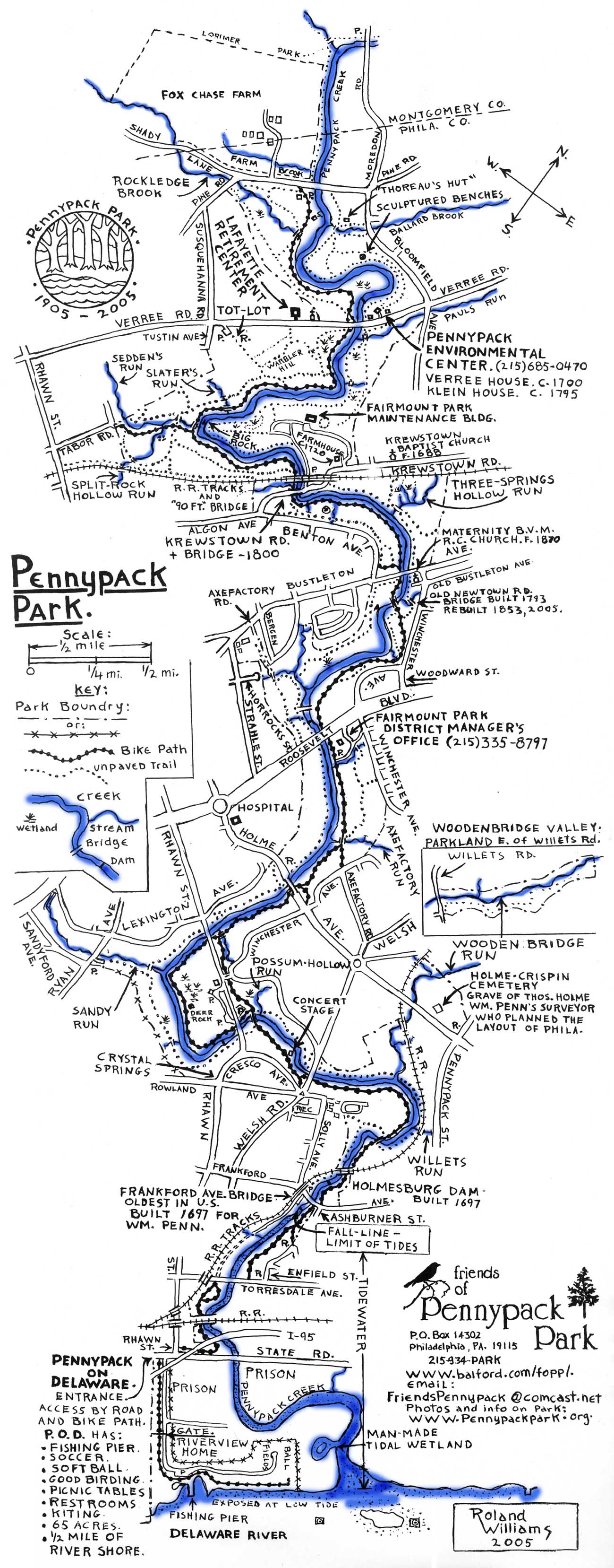
After my talk, FOPP member Roland Williams gave me permission to post his map of the park on this site, which you can find below. The detailed map reflects Roland’s lifelong love of the area, and I hope he doesn’t take offense at the liberty I have taken by coloring the creek and its tributaries in blue.

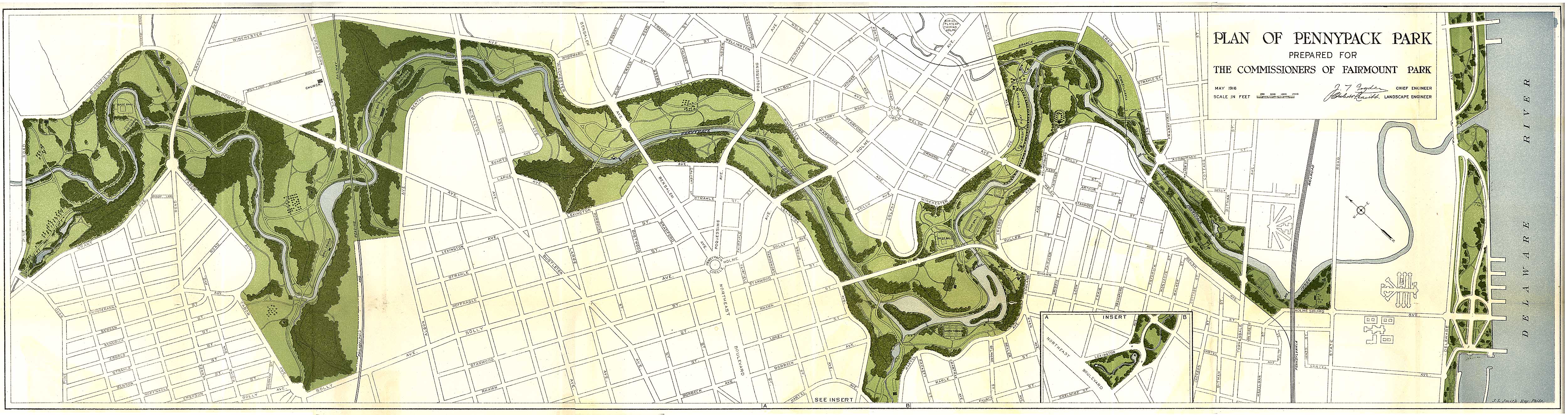
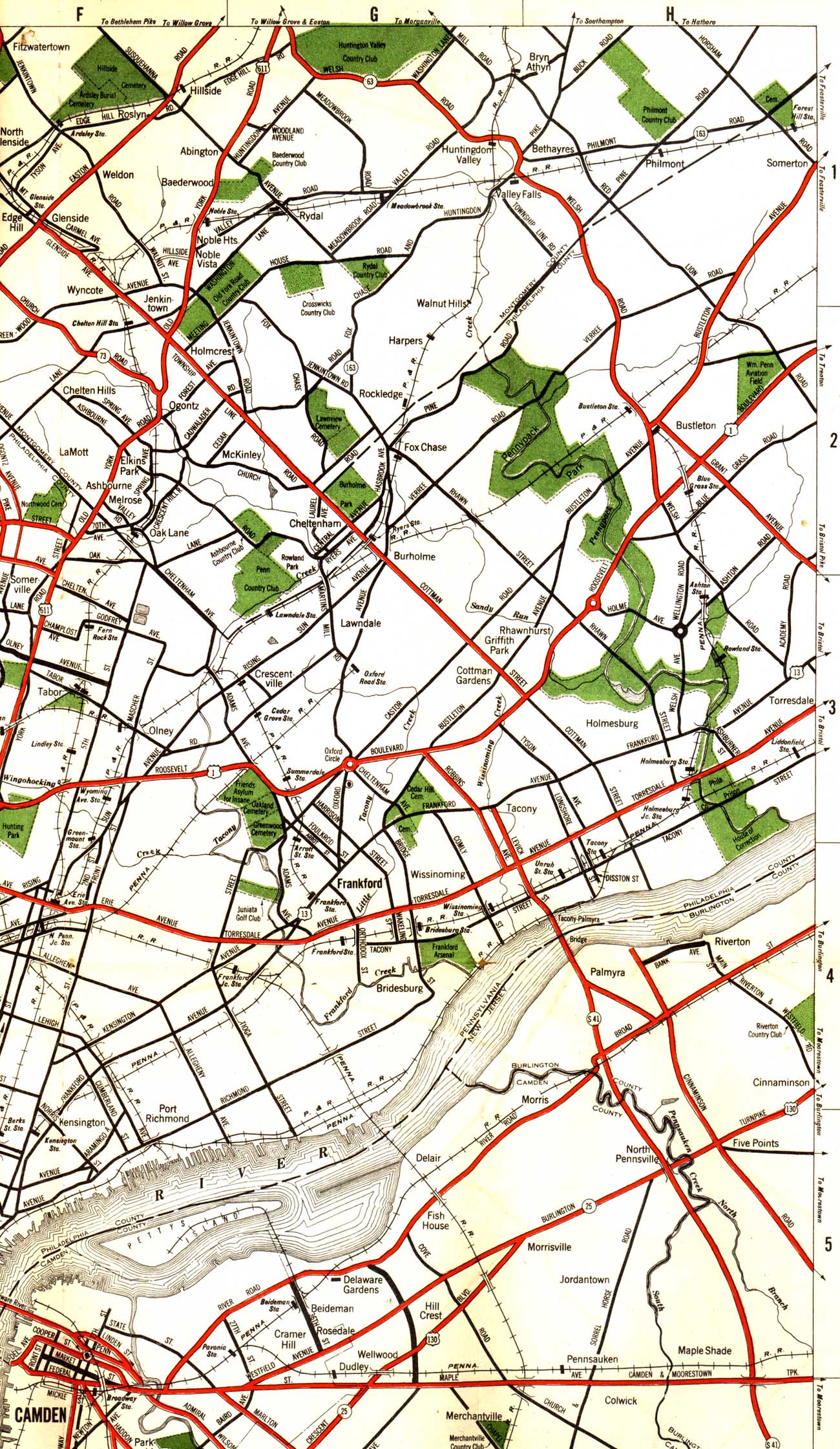
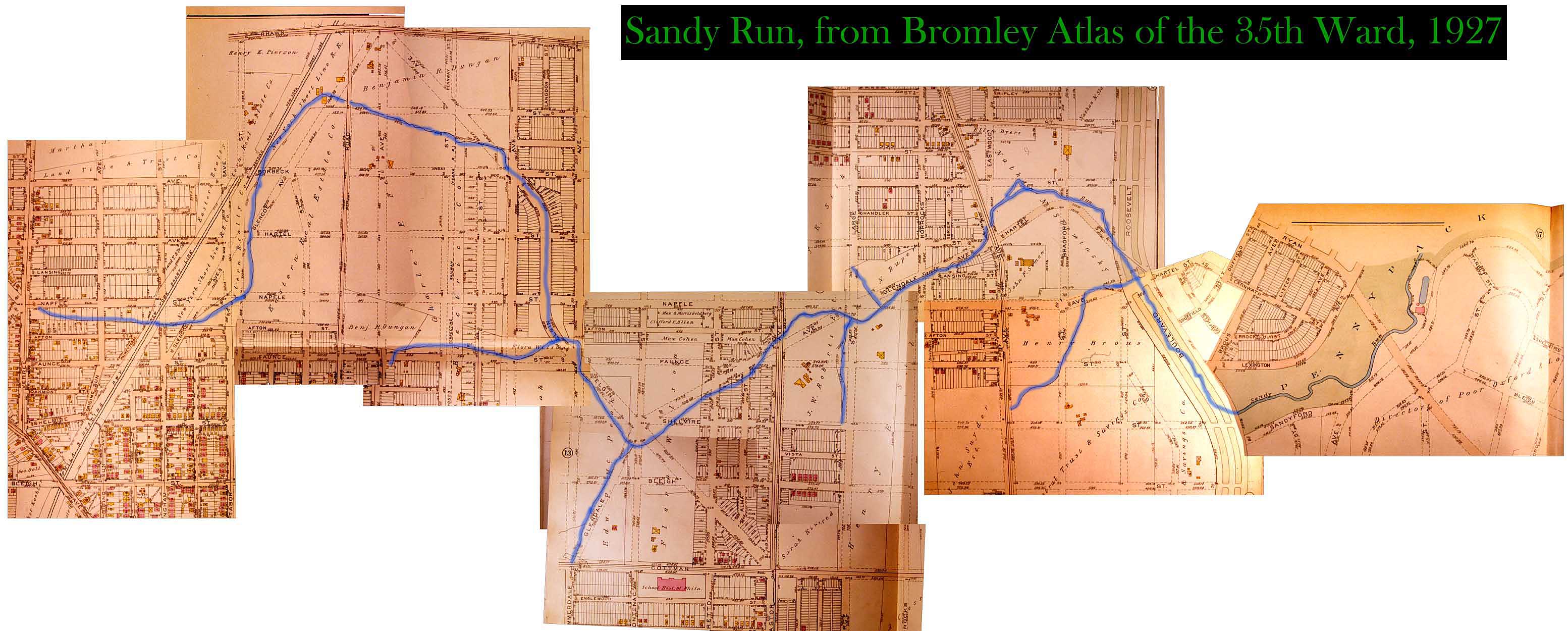
The day after my talk I visited Theresa Stuhlman and Rob Armstrong at the Fairmount Park Historic Resource Archives, and they gave me permission to scan and post the 1916 Report on Pennypack Park, with its beautifully rendered plan and informative text. I have also posted a piece of a road map from my own collection, and a map of the Pennypack’s largest tributary, Sandy Run, which is now mostly buried in a sewer.

Plan of Pennypack Park prepared for the Commissioners of Fairmount Park, May 1916. Jesse T. Vodges, Chief Engineer. Charles W. Leavitt, Landscape Engineer. Click here to read the report that accompanied the plan. (Courtesy of Fairmount Park Historic Resource Archives)
Pennypack Park, as drawn by Roland Williams in 2005. The detail of this map is remarkable, and its effort to include even the smallest tributaries to the creek is laudable. This map reflects a deep love of the natural world that I wish more city dwellers would share. (Courtesy of Roland Williams)
Pennypack Park, including Sandy Run, from a 1930 road map of Philadelphia and vicinity. Also shown is the Frankford Creek and part of its tributary, Wingohocking Creek. Unfortunately, By this time the Wingohocking (with two branches and 21 miles of streams) had already been buried underground, and should have been wiped off this map, but sometimes the mapmakers couldn’t keep up with sewer-builders! (Collection of Adam Levine)
Sandy Run, as pieces of it appeared in the 1927 Bromley Alas of the 35th Ward. Sandy Run is now mostly-obliterated from the map, with only the lower reach from Roosevelt Boulevard to the Pennypack, and a small section near Rhawn and Dugan streets, still flowing on the surface. The rest flows under the streets, as part of the city sewer system. [NOTE from Adam Levine: This map of a historic stream is much quicker and easier to do today, using the Greater Philadelphia Geohistory Network’s interactive map feature. In this version I worked for hours, resizing and rotating seven scanned plates, each with a different orientation some with different scales, to get them to line up properly.)

FEEDBACK