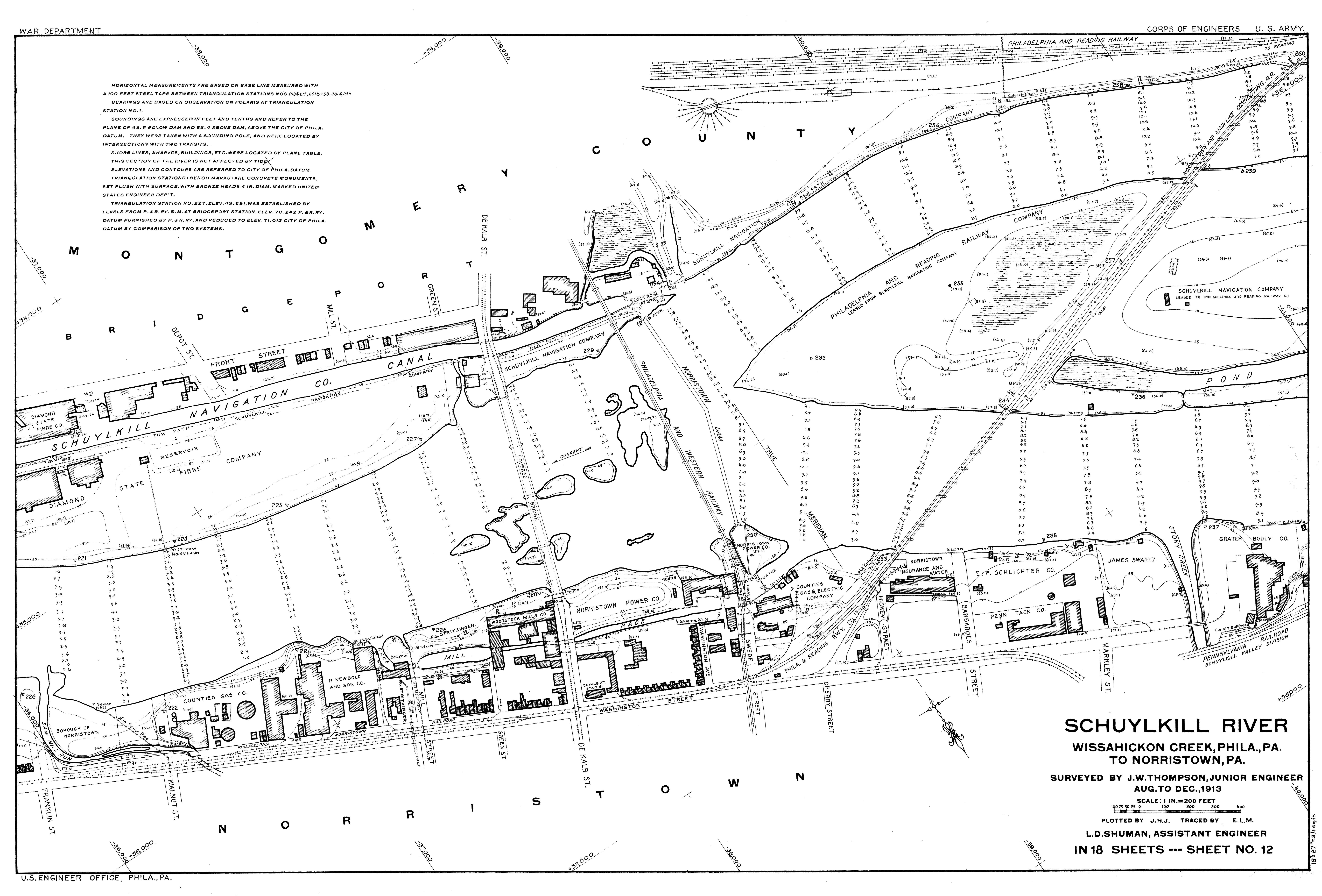
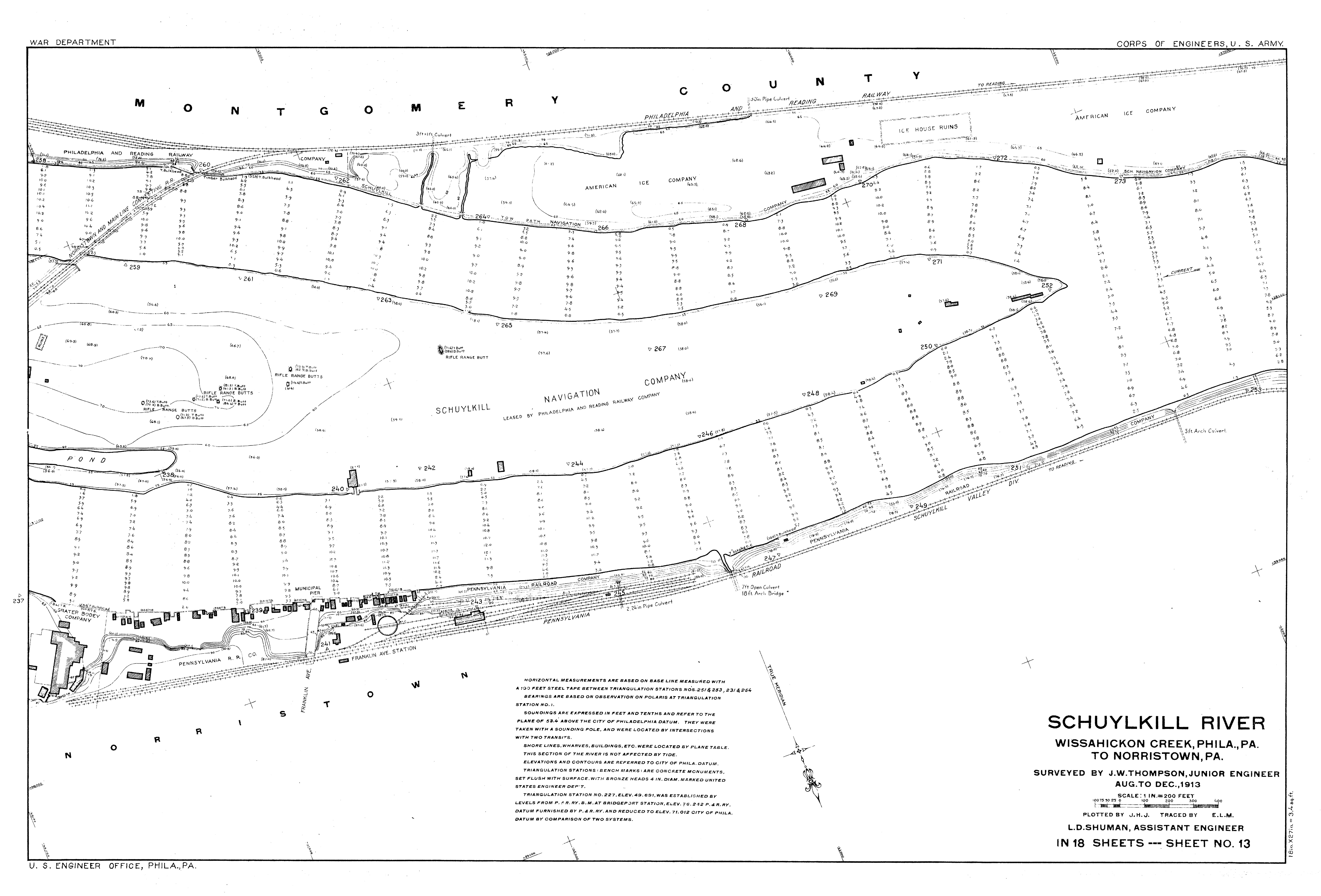
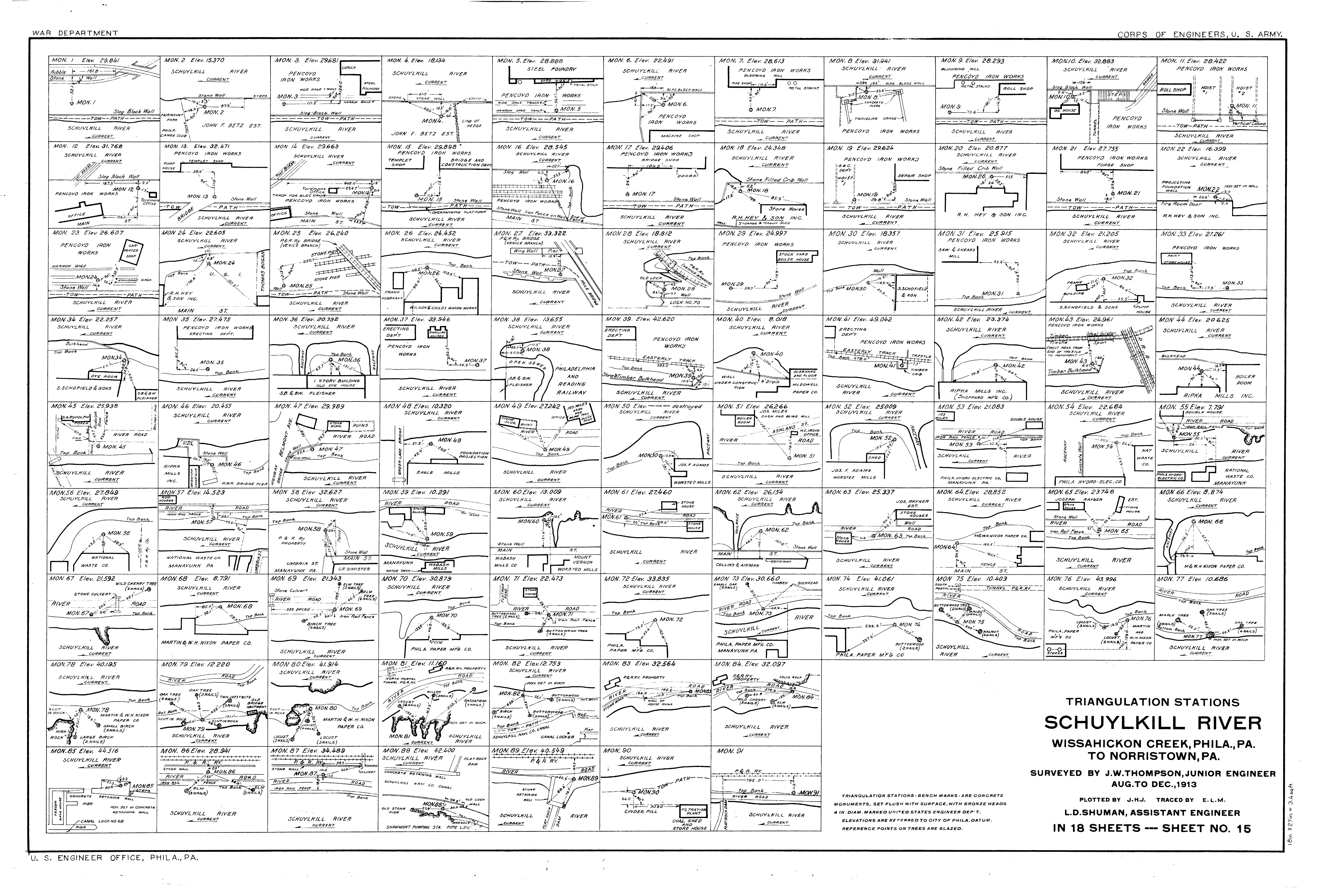
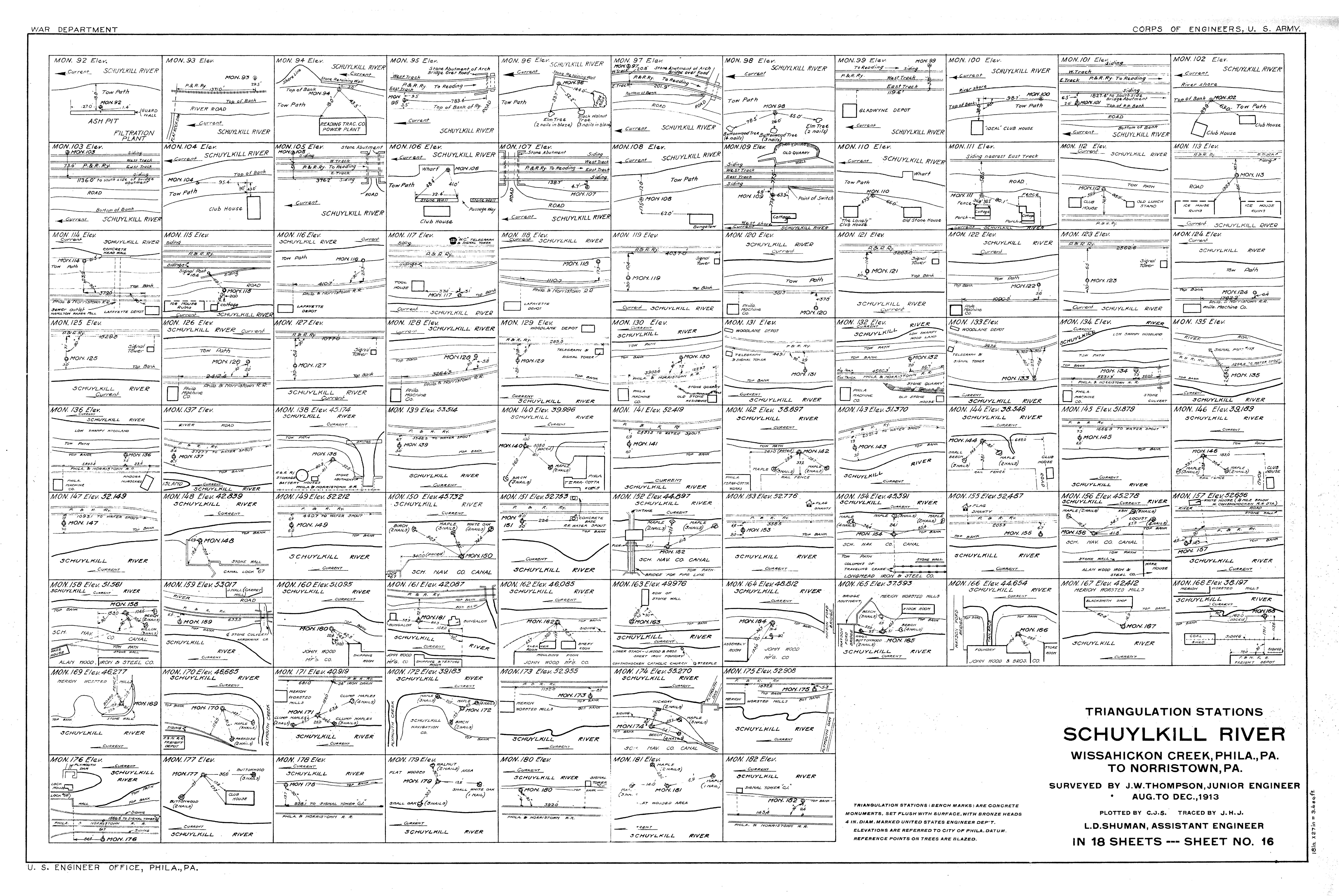
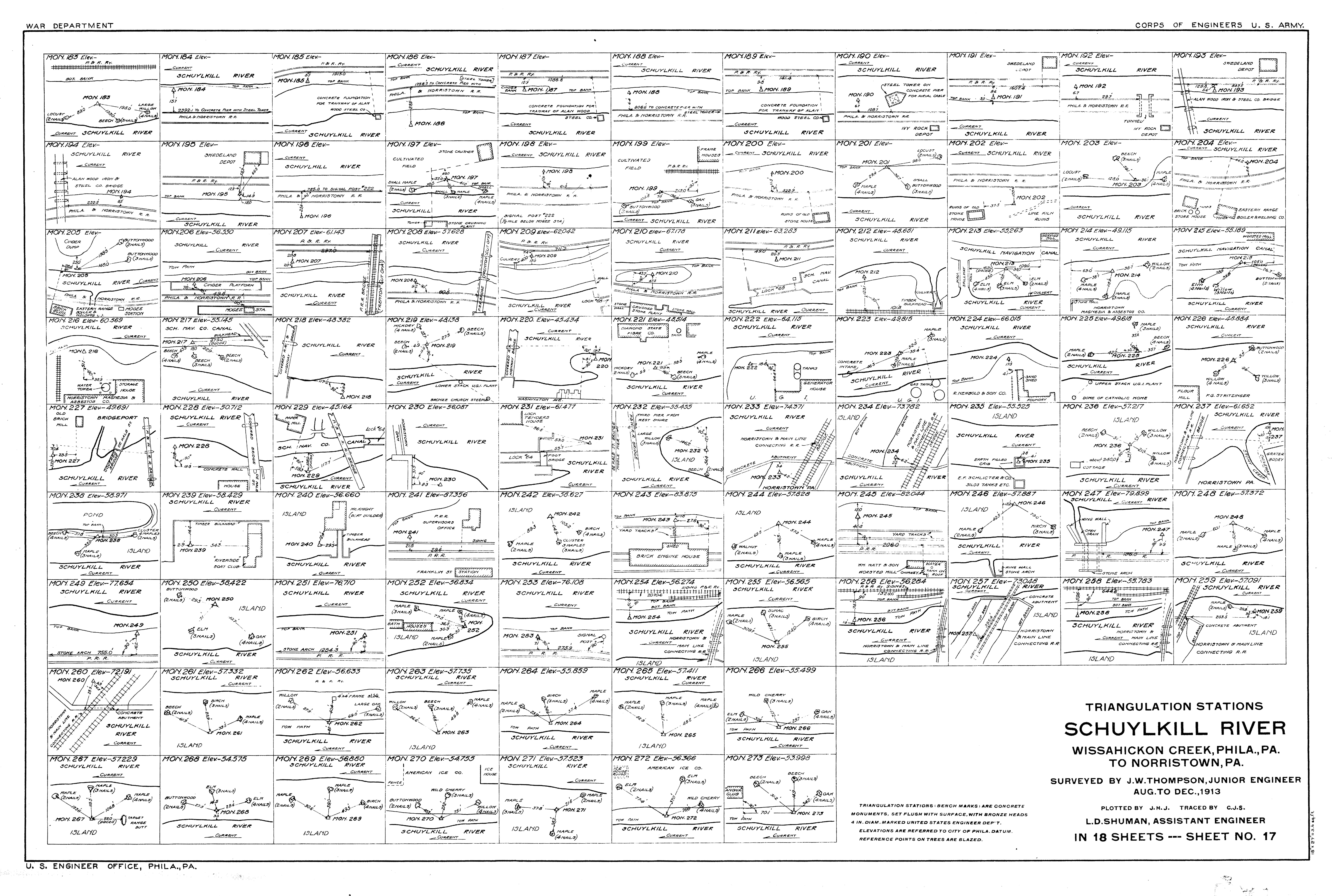
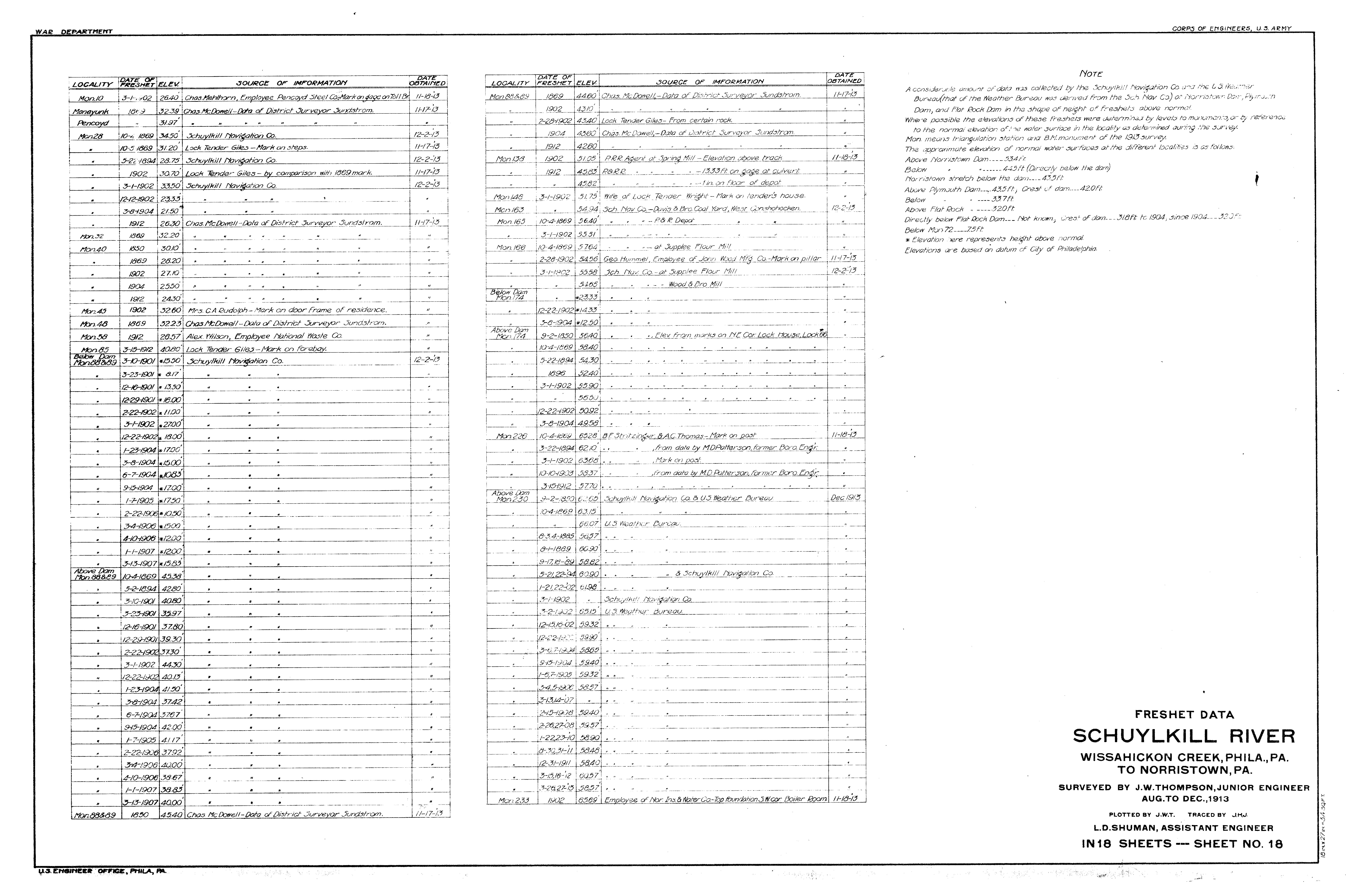
FULL TITLE War Department, Corps of Engineers, U.S. Army. Schuylkill River, Wissahickon Creek, Phila., PA. to Norristown, PA. Surveyed by J. W. Thompson, Junior Engineer, Aug. to Dec. 1913. L. D. Schuman, Assistant Engineer. Plotted by J.H.J. Traced by E.L.M. In 18 sheets.
DATE 1913
EXTENT 18 maps showing both sides of the developed Schuylkill River front from Wissahickon Creek to Norristown. Of the 18, five show only soundings of the river depth, three show the triangulation stations used to create the maps, one lists freshets (or floods) on the river up to 1913, and one is an index map. Sheet 1 begins at the Wissahickon, and the set continues upstream from there.
SOURCE These maps were found in the collection of the Survey and Design Bureau of the Philadelphia Streets Department. They were scanned by Adam Levine using a roll-through plotter at the Survey office, set to produce uncompressed .tiff files at bitmap resolution. The original plans are positive blueprints, with blue ink on white or yellowing paper. Each is 18 x 27 inches, with a scale of 1 inch = 200 feet.
WHY DO I LIKE THESE MAPS? It may be difficult for people today to realize how much industry once was found in Philadelphia and vicinity, along both the Schuylkill and Delaware Rivers as well as their tributaries. These maps (and many others) offer proof that, yes, Philadelphia once was rightfully called The Workshop of the World. Many of the industrial buildings shown on the maps have either been converted to residential use, or demolished. I also like the final Map 18, which is a chart of information on some of the major freshets (or floods) that have plagued the Schuylkill from time to time.
SIMILAR MAPS If you find the bare outlines of the factories shown on these maps a little cryptic and unsatisfying, many of them are depicted in more detail (sometimes with color isometric drawings) in the Hexamer General Surveys. This collection, part of the Free Library of Philadelphia Map Collection, is online at the Greater Philadelphia Geohistory Project of The Athenaeum of Philadelphia. Besides using the search boxes provided, I have found that the best way to search the surveys is to open up the entire index and use the “find” feature on your browser.
NOTE
The map files are large and may take a few seconds to open.
You can download a PDF of the entire set of 1913 Schuylkill maps here.