Water
History
PHL
Show/Hide Menu
Items
Articles
Topics
About
Blog
Show/Hide Search
Search!
Topics
Landscape Changes
Map Lovers’ Monday: Topography of Philadelphia from 1863
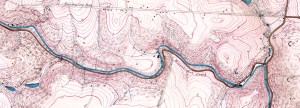
Map Lovers’ Monday: Schuylkill River from Wissahickon Creek to Norristown, 1913
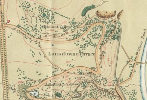
Map Lover’s Monday: Fairmount Park, 1869
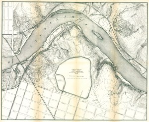
Fairmount Park topographical map, showing East Park Reservoir, 1872
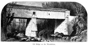
Thomas Mill Covered Bridge over Wissahickon Creek (Picturesque America)
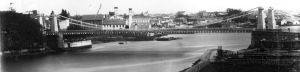
Early photographs of Fairmount and vicinity, 1848
Down Under III: A walk in the Dobson’s Run Storm Relief Sewer, June 15, 2010
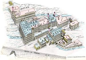
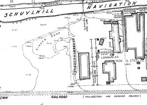
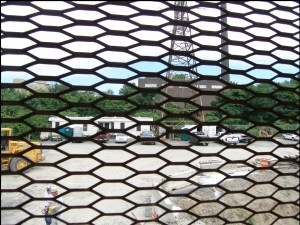
Requiem for a stream: A brief history of Dobson’s Run
Down Under, Part 2: Beaver Creek as it appears today
Overbrook, as it was
Requiem for a stream: Still House Run in Manayunk
Leverington Avenue Stormwater Sewer
The Manayunk Expressway
High Water: Flooding in Philadelphia
The Schuylkill and Wissahickon banks in 1858
Visions of the Schuylkill, 1884 and Now
Manayunk and the Schuylkill Navigation
Streams, islands, and ferries of early Philadelphia
Fairmount Gardens with the Schuylkill Bridge, 1839
Images from “A Day in the Ma’sh” by Maurice F. Egan, Scribner’s Monthly, July 1881
Schuylkill River Hydrographical Survey 1861-66 by H. P. M. Birkinbine
View of Fairmount Water Works, ca. 1827
Plan of Lemon Hill and Sedgley Park, Fairmount and Adjoining Property, 1851