![](https://waterhistoryphl.org/wp-content/uploads/CA-601-wissahickon-featured.jpg?w=300)
![](https://waterhistoryphl.org/wp-content/uploads/High-Water-flooding-lecture-tile.png?w=300)
High Water: An Informal History of Flooding in Philadelphia
![](https://waterhistoryphl.org/wp-content/uploads/Manayunk_2016.002.0097_half.jpg?w=300)
Rebirth of the Rivers: Water History Video 3
![](https://waterhistoryphl.org/wp-content/uploads/PWD-AR-1885-Watersheds_PlateII-edit-crop.jpg?w=300)
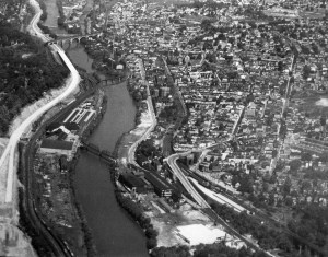
Map Lover’s Monday: Looking for Cleaner Water
![](https://waterhistoryphl.org/wp-content/uploads/RC-R_Schuylkill-07-crop.jpg?w=300)
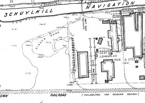
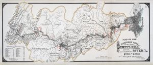
Map Lovers’ Monday: Schuylkill River from Wissahickon Creek to Norristown, 1913
![](https://waterhistoryphl.org/wp-content/uploads/Fairmount-park-1870-ar-improvements-crop.jpg?w=300)
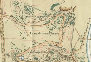
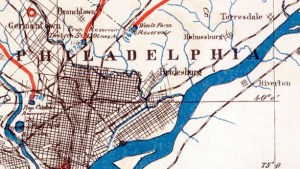
Map Lover’s Monday: Fairmount Park, 1869
![](https://waterhistoryphl.org/wp-content/uploads/Schuylkill_from-Belmont_PictAm_AEL-scaled.jpg?w=300)
Philadelphia from Belmont, West Park (Picturesque America)
![](https://waterhistoryphl.org/wp-content/uploads/Schuylkill_aboveBelmont_PictAm_AEL-scaled.jpg?w=300)
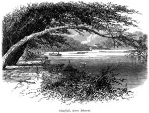
Schuylkill River above Belmont (Picturesque America)
![Wissahickon near Paper Mill Bridge, 1873](https://waterhistoryphl.org/wp-content/uploads/Wissahickon_nearPaperMillBr_PictAm_AEL-scaled.jpg?w=300)
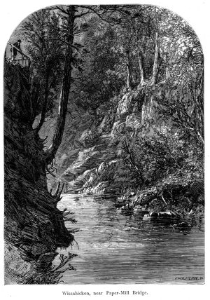
Wissahickon Creek near the Paper Mill Bridge (Picturesque America)
![Drive Along the Wissahickon](https://waterhistoryphl.org/wp-content/uploads/Wissahickon_Drive_PictAm_AEL-scaled.jpg?w=300)
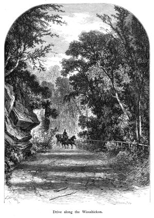
Drive along the Wissahickon Creek Vallley (Picturesque America)
![Thomas Mill Covered Bridge on the Wissahickon](https://waterhistoryphl.org/wp-content/uploads/Wissahickon_CoveredBr_PictAm_AEL-scaled.jpg?w=300)
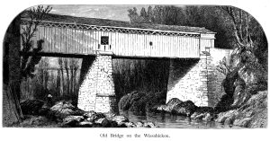
Thomas Mill Covered Bridge over Wissahickon Creek (Picturesque America)
![Hand-drawn and colored map depicting a river with streams branching off of it](https://waterhistoryphl.org/wp-content/uploads/SchuyNav_1891_01_Watershed.jpg?w=300)