Drinking water for Philadelphia from the Schuylkill Navigation system
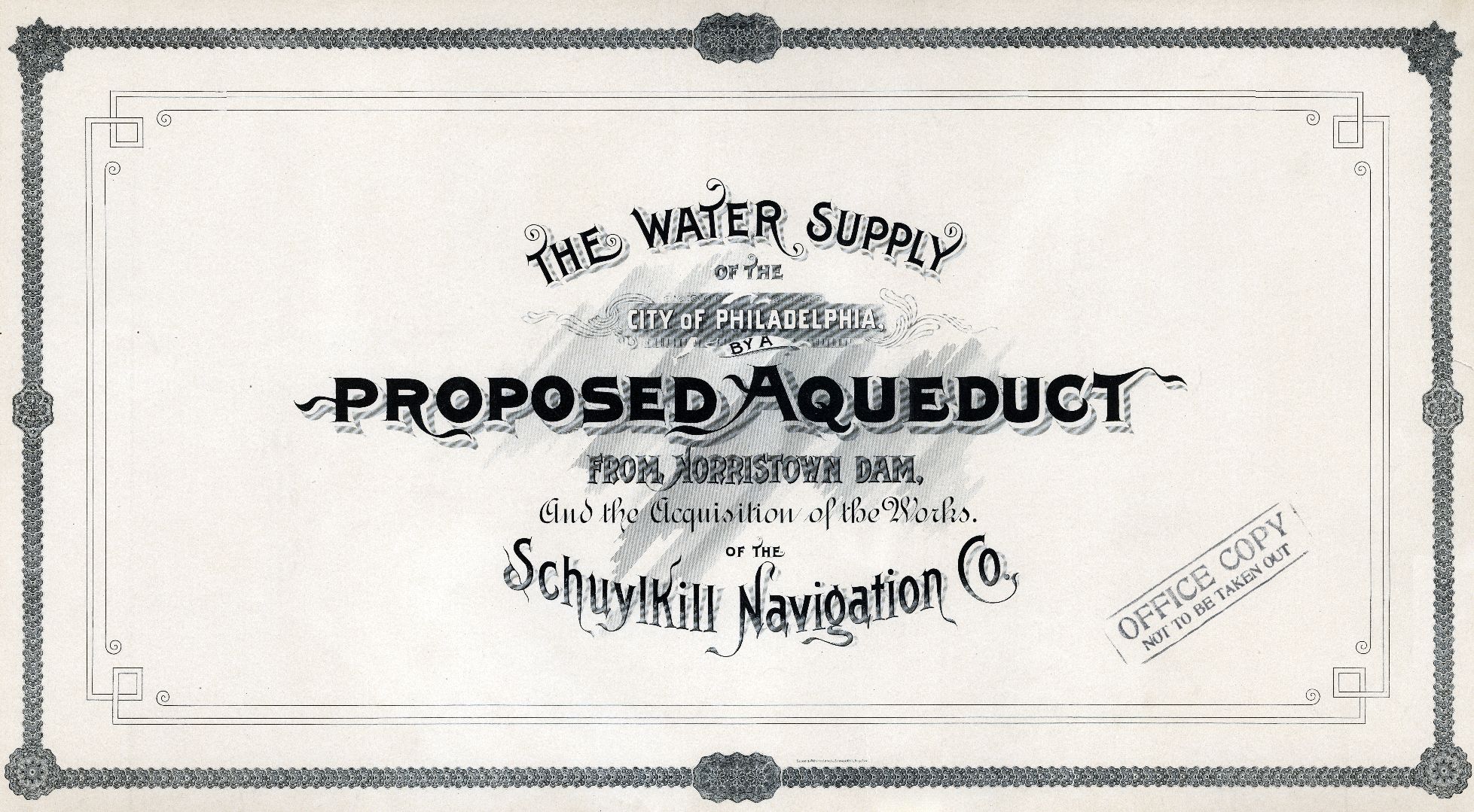
TITLE BLOCK The water supply of the City of Philadelphia by a proposed aqueduct from Norristown Dam, and the acquisition of the works of the Schuylkill Navigation Company. Collection of 16 oversized plates, folded and bound between boards. Click here to read a detailed description of the full plan.
DATE 1891
EXTENT Schuylkill River Watershed, with detailed plans showing the river between Norristown and Philadelphia, and architectural renderings by Frank Furness of some of the necessary buildings.
WHY I LIKE THESE MAPS This is one of many plans proposed between the 1860s and 1940s, in response to the increasing pollution of the Delaware and Schuylkill Rivers, to being cleaner drinking water into Philadelphia via aqueduct. This plan, which proposed to bring water from the Schuylkill River above Norristown, was more modest than some of the other plans, which reached farther upstate, or even into New Jersey, for cleaner sources of water. (To learn more about other similar proposals, see Part 6 of our 7-part Water and Drainage History Course.)
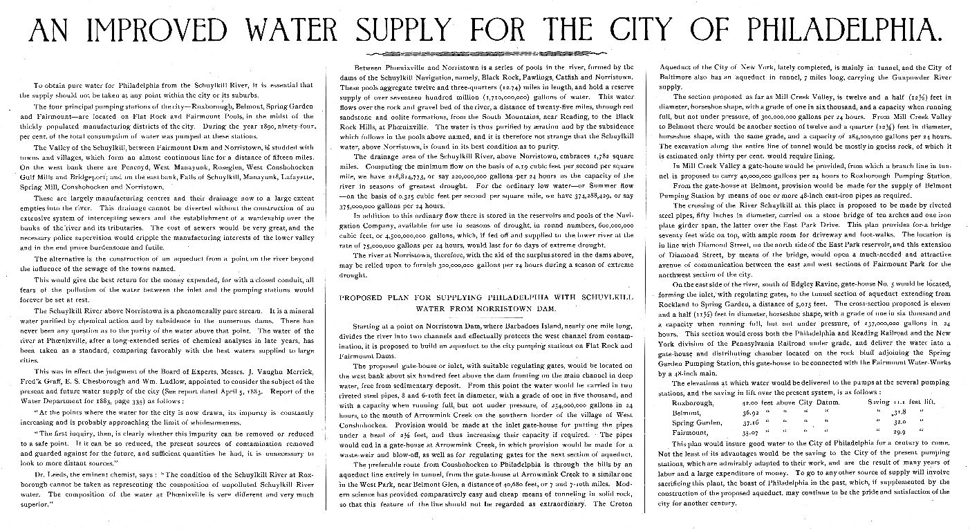
This plan (more fully described in this excerpt from a PWD annual report) proposed using the storage capacity of the river and the canals of the Schuylkill Navigation Company to assure an adequate supply of water. It was never implemented, and Philadelphia continues to this day to get its drinking water from the Schuylkill and Delaware Rivers within the city limits.
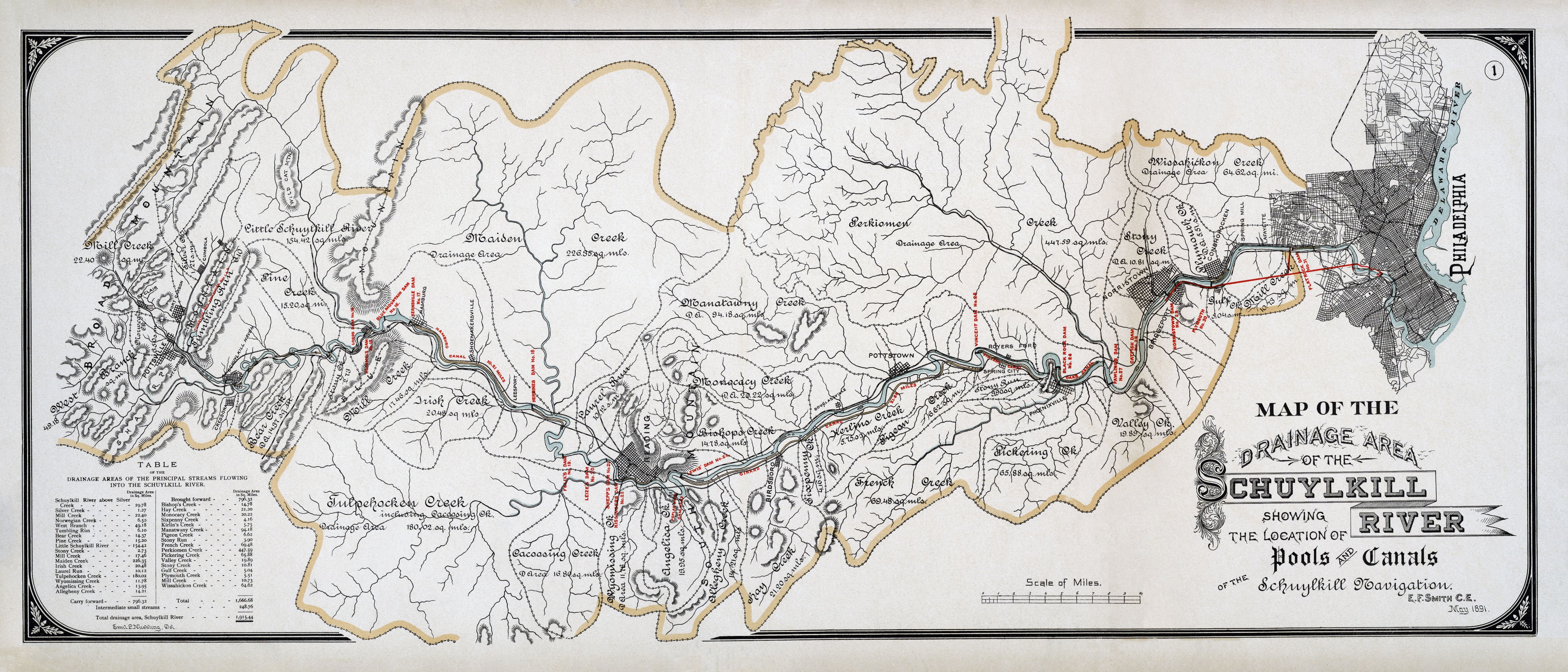
The best thing to come out of this proposal, from a historian’s perspective, was this collection of detailed plans. These show the proposed aqueduct and gate houses (designed by Philadelphia architect Frank Furness), the Schuylkill Navigation Company’s canals, locks and dams from Tumbling Run to Norristown, and an exquisitely drawn map showing the entire Schuylkill River watershed, shown at the top of this page.
Click here to start a slideshow of all the maps in this report.
Titles below, followed by PWD catalog numbers, are for reference only.
Map of the drainage area of the Schuylkill River showing the location of ponds and canals of the Schuylkill Navigation. E. F. Smith C.E. May 1891. 2008.003.0005.003
Map showing route of proposed aqueduct from Norristown Dam to the pumping stations of the City of Philadelphia on the Schuylkill River. May, 1891, E.F. Smith C.E. Emil L. Neubling, del. 2008.003.0005.004
Profile and details of the proposed aqueduct to convey the water of the Schuylkill River from the Norristown Dam to the Pumping Stations of the City of Philadelphia. May, 1891. E.F. Smith C.E. 2008.003.0005.005
Plan elevation and section of Schuylkill River Bridge near Belmont and other crossings on line of proposed aqueduct from Norristown to the pumping stations of the City of Philadelphia. May, 1891. E.F. Smith C.E. W.S. Davis, del. 2008.003.0005.006
Plans and elevations of inlet and gate houses on the line of a proposed aqueduct for the water supply of the City of Philadelphia from Norristown Dam. Elevations by Furness, Evans and Co., Architects. Ground plans and section by E.F. Smith, C.E. May, 1891 2008.003.0005.007
0. Map of the valley of Tumbling Run showing the lands of the Schuylkill Navigation Co. with the existing and proposed reservoirs therein and its drainage area. E.F. Smith C.E. May, 1891. Emil L. Neubling, del. 2008.003.0005.008
I. Plan of property and works of the Schuylkill Navigation from Tumbling Run to head of Lords Dam No. 14. E.F. Smith C.E. May, 1891. Emil L. Neubling, del. 2008.003.0005.009
II. Plan of property and works of the Schuylkill Navigation from head of Lords Dam No. 14, to Red Hill, Shoemakersville. E.F. Smith C.E. May, 1891. 2008.003.0005.010
III. Plan of property and works of the Schuylkill Navigation from Red Hill, Shoemakersville to Felix’s Dam No. 19. E.F. Smith C.E. May, 1891. Emil L. Neubling, del. 2008.003.0005.011
IV. Plan of property and works of the Schuylkill Navigation from Felix’s Dam No. 19, to Big Reading Dam, No. 24. E.F. Smith C.E. May, 1891. Emil L. Neubling, del. 2008.003.0005.012
V. Plan of property and works of the Schuylkill Navigation from Big Reading Dam, No. 24 to Sixpenny Creek. E.F. Smith C.E. May, 1891. Emil L. Neubling, del. 2008.003.0005.013
VI. Plan of property and works of the Schuylkill Navigation from Sixpenny Creek to Fricks Locks. E.F. Smith C.E. May, 1891. Emil L. Neubling, del. 2008.003.0005.014
VII. Plan of property and works of the Schuylkill Navigation from Fricks Locks to mouth of Perkiomen. E.F. Smith C.E. May, 1891. Emil L. Neubling, del. 2008.003.0005.015
VIII. Plan of property and works of the Schuylkill Navigation from mouth of Perkiomen to Norristown. E.F. Smith C.E. May, 1891. Emil L. Neubling, del. 2008.003.0005.016
MORE INFORMATION Thanks to Joe Shapiro, PWD Archives volunteer, for cataloguing these items in our PastPerfect catalog under 2008.003.0005.001 to .016. The images presented here were scanned from my own set of these plans by the Regional Digital Imaging Center of the Athenaeum of Philadelphia. I then digitally repaired and edited the images, and finally reduced them to .jpeg files (one-fourth the size of the original .tif files). These replaced the inferior scans, made from 4×5 color negatives of the plans, that were previously presented on PhillyH2O, the predecessor to WaterHistoryPHL.