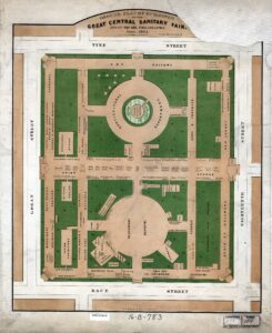
Ground Plan, Great Central Sanitary Fair, Philadelphia
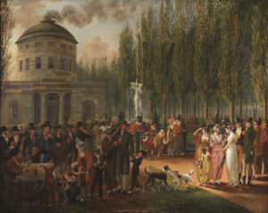
Fourth of July, Centre Square, ca. 1812

Second Bank of Pennsylvania, South Second Street, Philadelphia
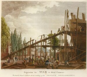
Preparation for War to Defend Commerce

Bank of Pennsylvania, South Second Street, Philadelphia
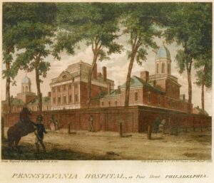
Pennsylvania Hospital in Pine Street

Goal (jail) in Walnut Street, Philadelphia, 1800

State House Garden, Philadelphia, 1800

Back of the State House, Philadelphia, 1800
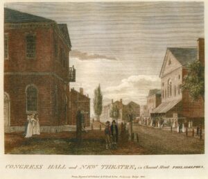
Congress Hall and New Theatre in Chestnut Street, Philadelphia
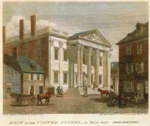
Bank of the United States, in Third Street, Philadelphia

New Market, in South Second Street, Philadelphia, 1800

Second Street North from Market St. with Christ Church, Philadelphia

South East Corner of Third and Market Streets, Philadelphia, 1800

Arch Street, with the Second Presbyterian Church, 1800

Arch Street Ferry, Philadelphia
Plan of the City of Philadelphia and Adjoining Districts, 1830
Map of Philadelphia showing Population in year 1920
By a draft of Foxhall & Morris purchase : [Philadelphia] April 1, 1802

Map of the County of Philadelphia from Actual Survey, 1843
“Philadelphie,” Bird’s Eye View, 1855
Benezet House, Clarke’s Hall, and Chestnut St. Bridge (Watson’s Annals)