The Manayunk Expressway
Northeast Philadelphia history, one page at a time: The Holmesburg Library Scrapbook Collection
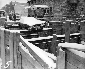
Dauphin and Sydenham car crash, Jan. 17, 1978
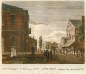
Congress Hall and New Theatre in Chestnut Street, Philadelphia

High Street from Ninth Street, Philadelphia

High Street, with the First Presbyterian Church, Philadelphia, 1800
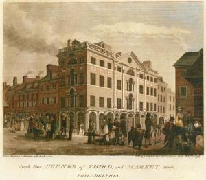
South East Corner of Third and Market Streets, Philadelphia, 1800

Arch Street, with the Second Presbyterian Church, 1800
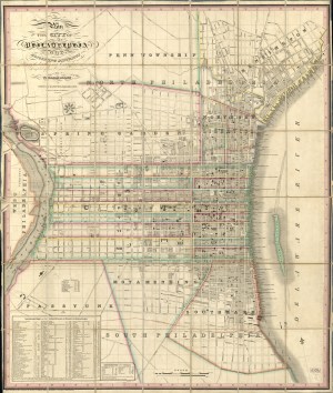
Plan of the City of Philadelphia and Adjoining Districts, 1830
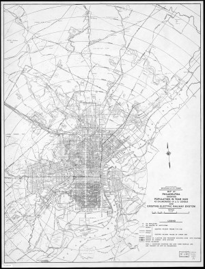
Map of Philadelphia showing Population in year 1920