An idea now filed under the heading:
“Aren’t we glad they never built this?”
In 1955, the Philadelphia consulting engineering firm of Albright and Friel, at the request of the city’s Department of Streets, produced a preliminary report on a new highway in Manayunk that suggested filling in the Manayunk Canal and building the roadway in the canal’s right-of-way.
“The proposed highway would serve the purpose of relieving congestion on Ridge Avenue in Roxborough and on Main Street in Manayunk,” the report stated. “It would permit rapid movement of commuter traffic to and from the Central City area as well as expediting truck traffic to and from the industrial areas of the City….Speed of traffic on Ridge Avenue is extremely slow, so that the new highway would result in large benefits from savings in time and from more economical operation of vehicles.”
The report included the two following maps:
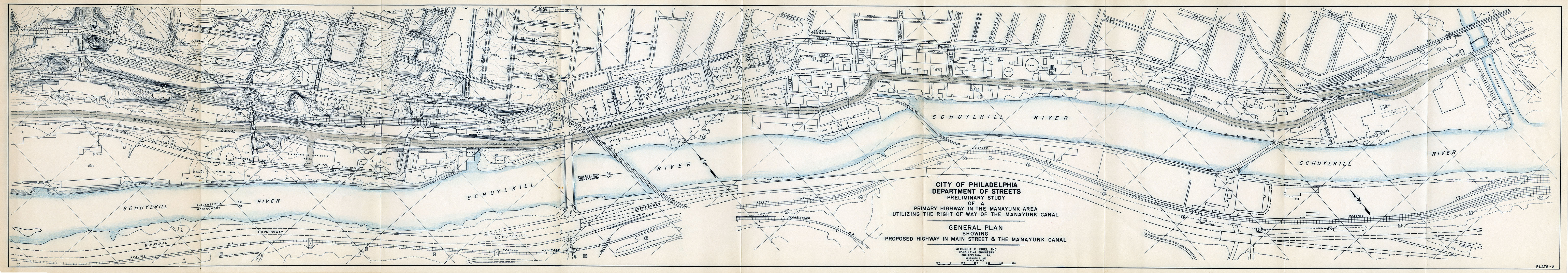
Albright & Friel Inc. Consulting Engineers. 1955

Albright & Friel Inc. Consulting Engineers. 1955
This 1955 plan was to be the first section of what state highway planners eventually called the Manayunk Expressway. Beyond relieving local congestion, the expanded vision for this highway touted it as an east-side alternative to the Schuylkill Expressway, which runs from Montgomery County into Philadelphia on the west side of the river and was clogged almost from the day it opened in 1959.
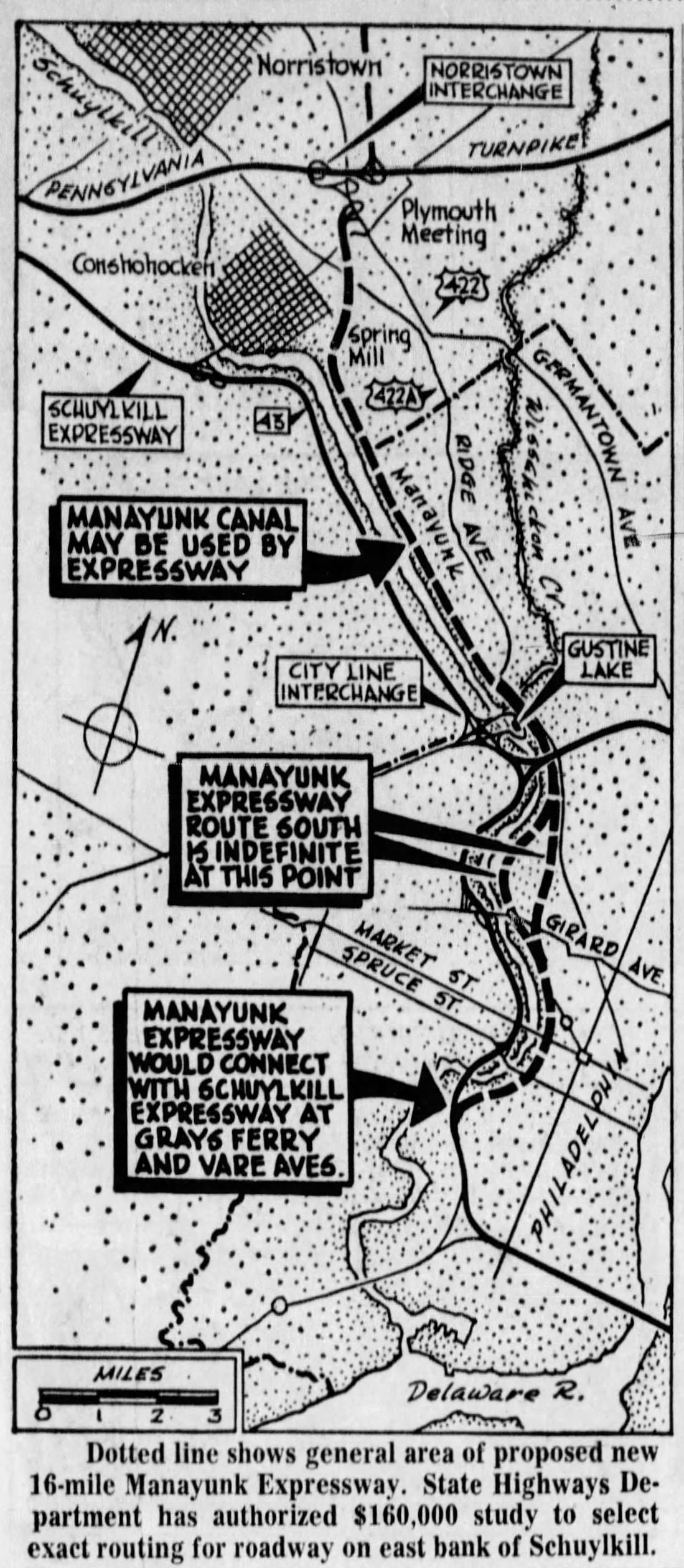
The 16-mile-long, 4-lane-wide, limited-access Manayunk Expressway was to connect the Pennsylvania Turnpike at Plymouth Meeting with the Schuylkill Expressway near Grays Ferry Avenue in South Philadelphia. Besides obliterating the Manayunk Canal, and creating a noisy 4-lane barrier between the river and the Roxborough and Manayunk neighborhoods, one plan had the highway replacing East River (now Kelly) Drive through Fairmount Park. When Mayor James Tate and Streets Commissioner David Smallwood objected to this route, an alternative was proposed to carry the highway down Ridge Avenue to North 33rd Street. It was never clear how either of these routes would have crossed Center City to Grays Ferry Avenue without destroying hundreds of buildings. Somewhere it would have had to go either over or under the Benjamin Franklin Parkway, which had itself been constructed by destroying hundreds of buildings in its path.
But as I said at the top of the page, this highway was never built, so all we can say is that if it had been, parts of the city would have been drastically different. Whether worse or better would have depended on your point of view – or maybe I should say, your point of departure. If you were using the new highway to zip home to the suburbs after work in the city, you probably would have loved it. You might have felt differently if you had lived in one of the city neighborhoods whose heart had been ripped out by this road, you probably would have felt a little differently.
MORE INFORMATION For a full history of this expressway, and many other built and unbuilt roads in the Philadelphia area, see this Facebook page and its accompanying website, phillyroads.com. The site takes a while to load, but it is worth the wait.