![Thomas Mill Covered Bridge on the Wissahickon](https://waterhistoryphl.org/wp-content/uploads/Wissahickon_CoveredBr_PictAm_AEL-scaled.jpg?w=300)
![](https://waterhistoryphl.org/wp-content/uploads/mount-moriah-RCP-210403-8947-crop.jpg?w=300)
Mount Moriah Historic Cemetery and Arboretum
![](https://waterhistoryphl.org/wp-content/uploads/Frank-EcologyCenterCity-image.jpg?w=300)
The ecology of Center City, Philadelphia (in case you didn’t know there was any)
![Color image of a grassy field with trees and buildings surrounding it and white lines drawn on the grass mimicking the path of a creek.](https://waterhistoryphl.org/wp-content/uploads/Lutz-dock-creek-snip.jpg?w=300)
Drawing Dock Creek
![](https://waterhistoryphl.org/wp-content/uploads/smith-windmill-islands-20040210178-Cas2075-FLPPPC.jpg?w=300)
Smith and Windmill Islands
![Black-and-white photograph depicts a large brick sewer tube lying on a barren landscape](https://waterhistoryphl.org/wp-content/uploads/everett-street-sewer-1917.jpg?w=300)
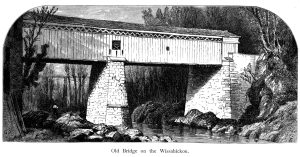
Streams, islands, and ferries of early Philadelphia
![Fairmount Gardens, with the Schuylkill Bridge. This 1839 engraving, published in London, shows a view of the South Garden from the walkways that brought visitors up the cliffside to the overlooks at the height of the reservoirs. The fountain used the pressure of the reservoirs and was a a delightful refreshment in hot weather, and a wonder at all times. One anachronistic element of this engraving is the Upper Ferry Bridge, which burned the year before the print was published. Harding’s Hotel, a popular resort, is at the western end of the bridge.](https://waterhistoryphl.org/wp-content/uploads/05_southgarden_750w.jpg?w=300)
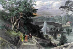
Fairmount Gardens with the Schuylkill Bridge, 1839
![Birkinbine Schuylkill Hydrographical Survey 1861-66](https://waterhistoryphl.org/wp-content/uploads/2008.001.0053_Hydrographical-Schuylkill-1866-2-reduced.jpg?w=300)
Schuylkill River Hydrographical Survey 1861-66 by H. P. M. Birkinbine
View of Fairmount Water Works, ca. 1827
![Lemon Hill and Sedgley Park, Graff Jr., 1851 (Graff05.21)](https://waterhistoryphl.org/wp-content/uploads/graff05.21-scaled.jpg?w=300)
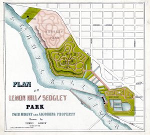
Plan of Lemon Hill and Sedgley Park, Fairmount and Adjoining Property, 1851
![Penn's Treaty with the Lenape](https://waterhistoryphl.org/wp-content/uploads/Penn_Treaty_WAnnals_frontspce_v2_AEL.jpg?w=300)
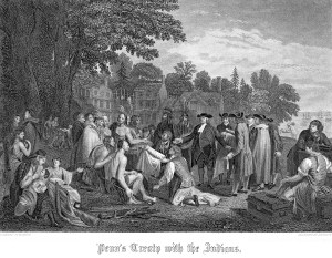
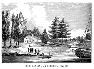
Penn’s Treaty with the Indians (Watson’s Annals)
![Penn landing at Chester](https://waterhistoryphl.org/wp-content/uploads/Penn_Chester_WAnnals_127v1_AEL.jpg?w=300)