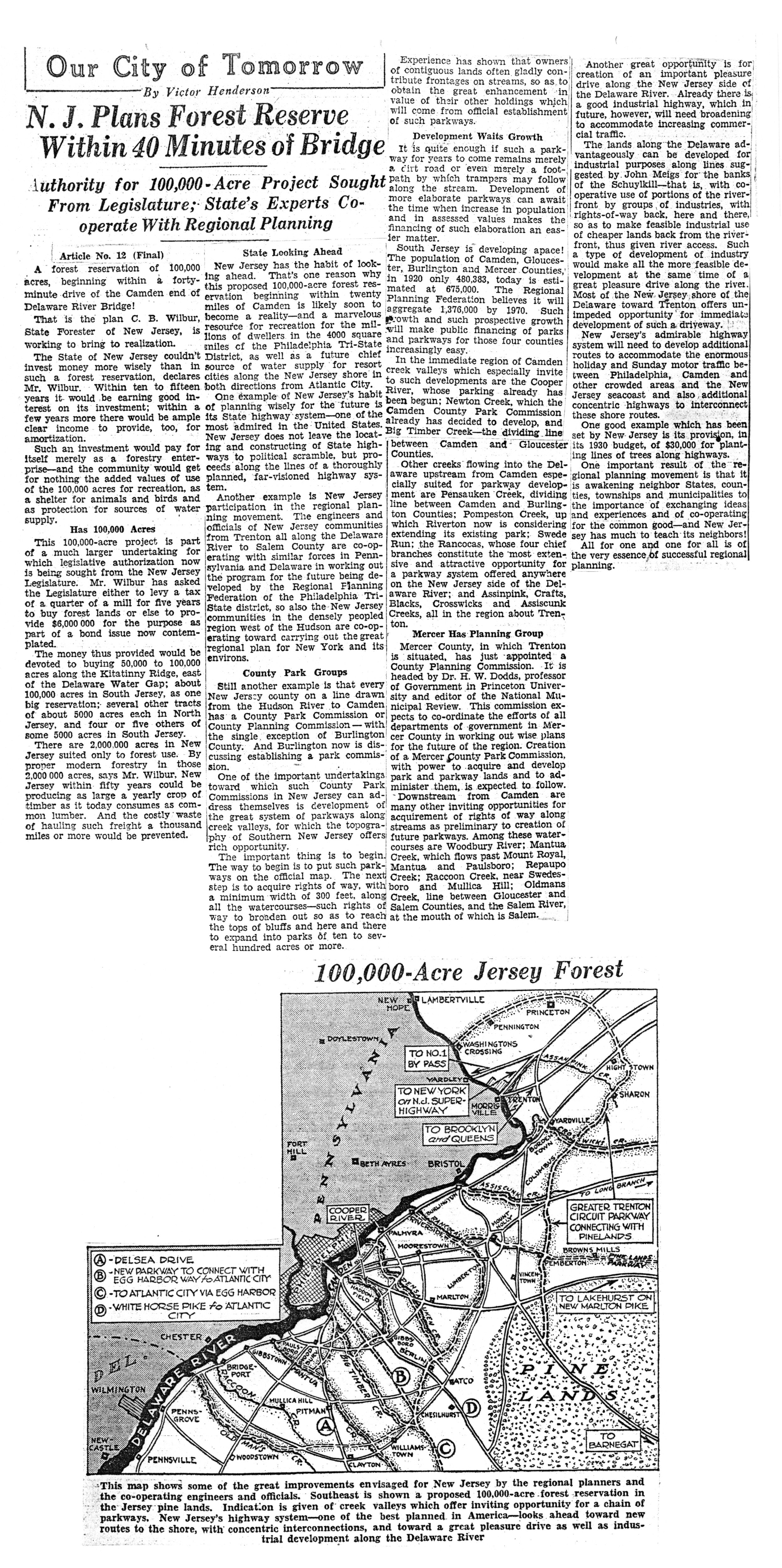
A series of “informative articles on the proposed development of the metropolitan area of Philadelphia and its effect on every taxpayer and property owner in the district.”
This 12-part series of articles, written by Philadelphia Public Ledger reporter Victor Henderson, ran in the newspaper from March 17 to March 29, 1930. I am always fascinated by plans that cities and their larger metropolitan areas come up with to better themselves. Most of the ambitious ideas in these stories, imagined as the country was heading into the worst economic depression in its history, were probably doomed from the start, or at best, their time frame was stretched out far longer than originally thought. Yes, we finally got a bypass highway (in Interstate 476, the Blue Route), but not until the 1990s. Riverfront parks (both on the Delaware and the Schuylkill) were finally undertaken, but only as industries along those riverfronts died and made room for them, and they are still being slowly extended. Instead of a series of small airports we now have one huge regional jetport straddling the Philadelphia-Delaware County border. We got a 40-foot channel in the Delaware River, but only recently reached 45-feet, which means the port of Philadelphia lags behind better situated cities where deeper harbors are easier to maintain.
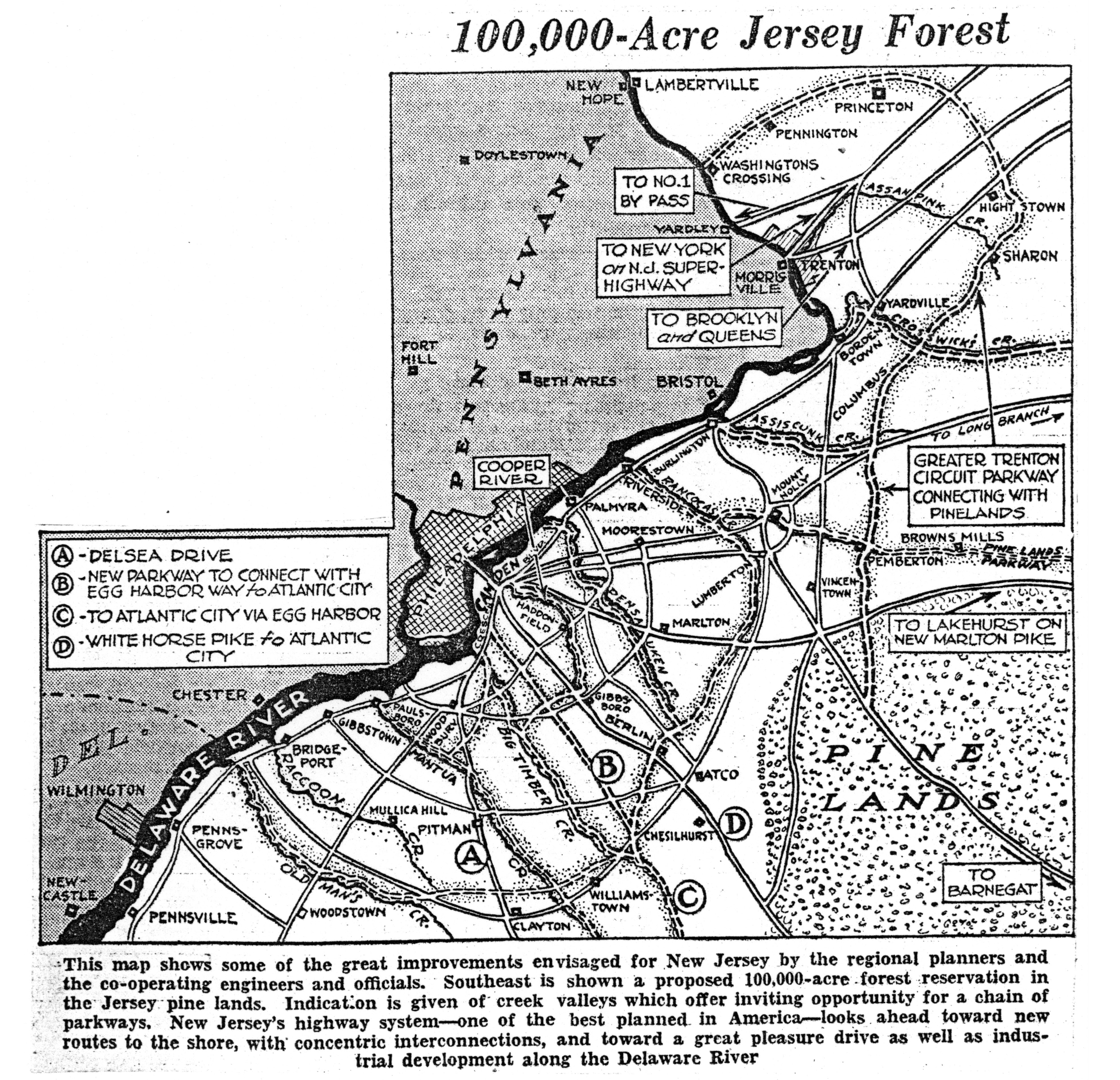
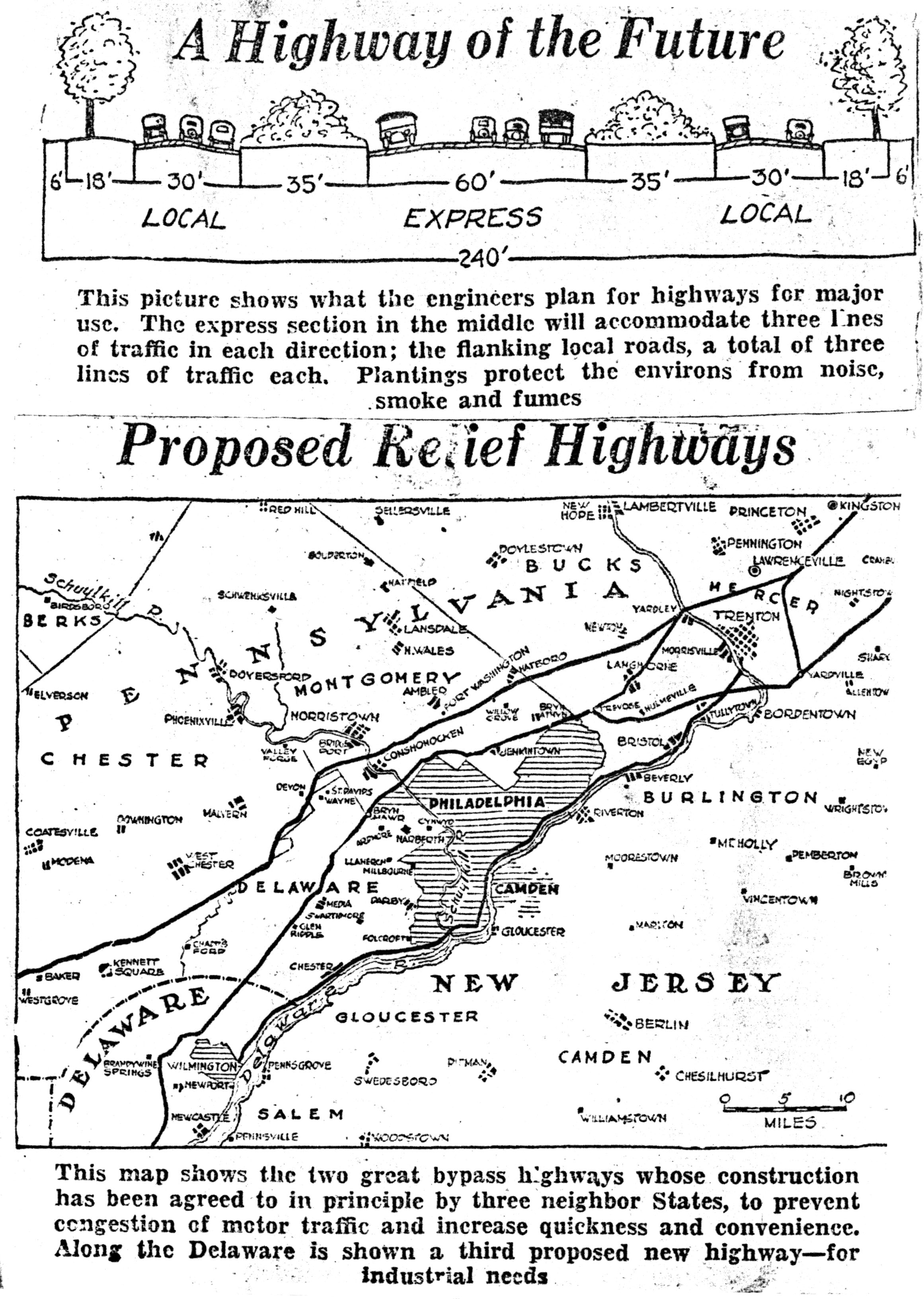
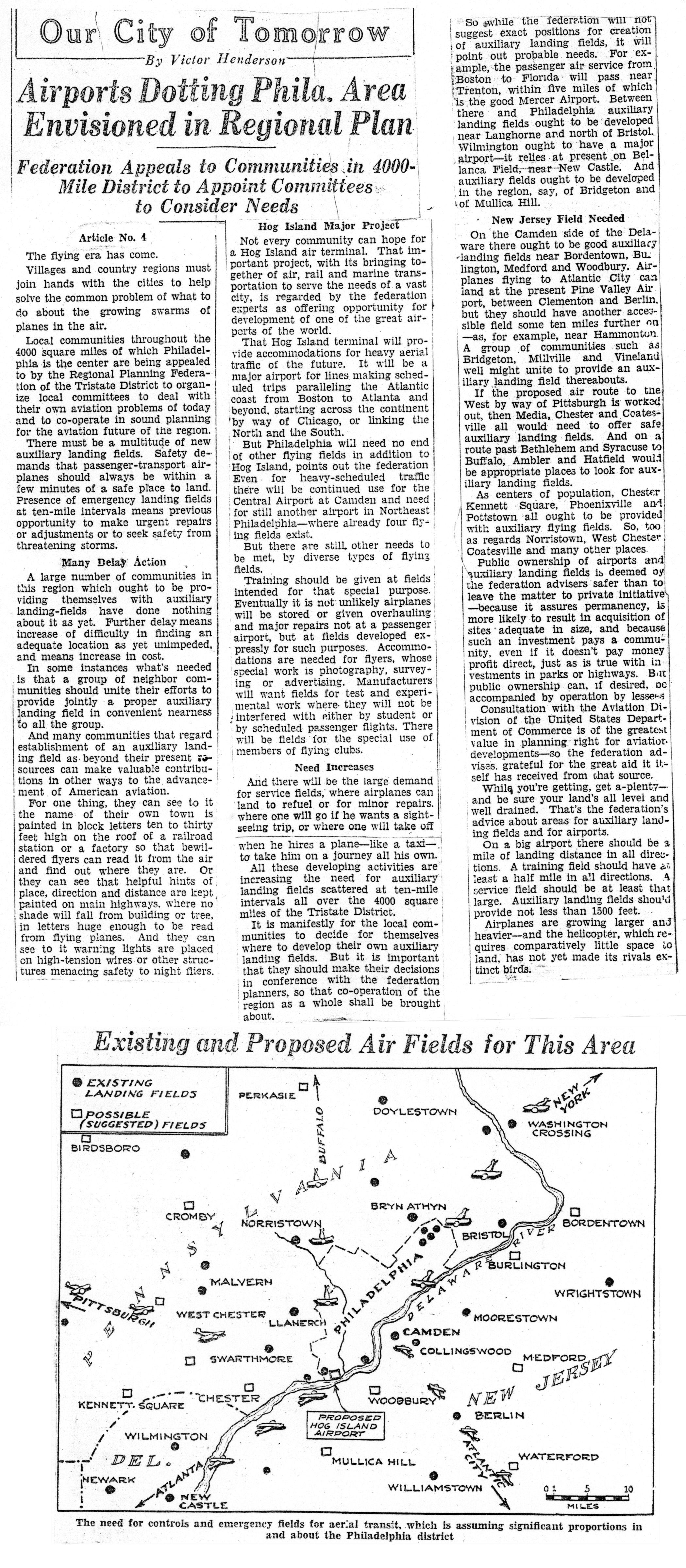
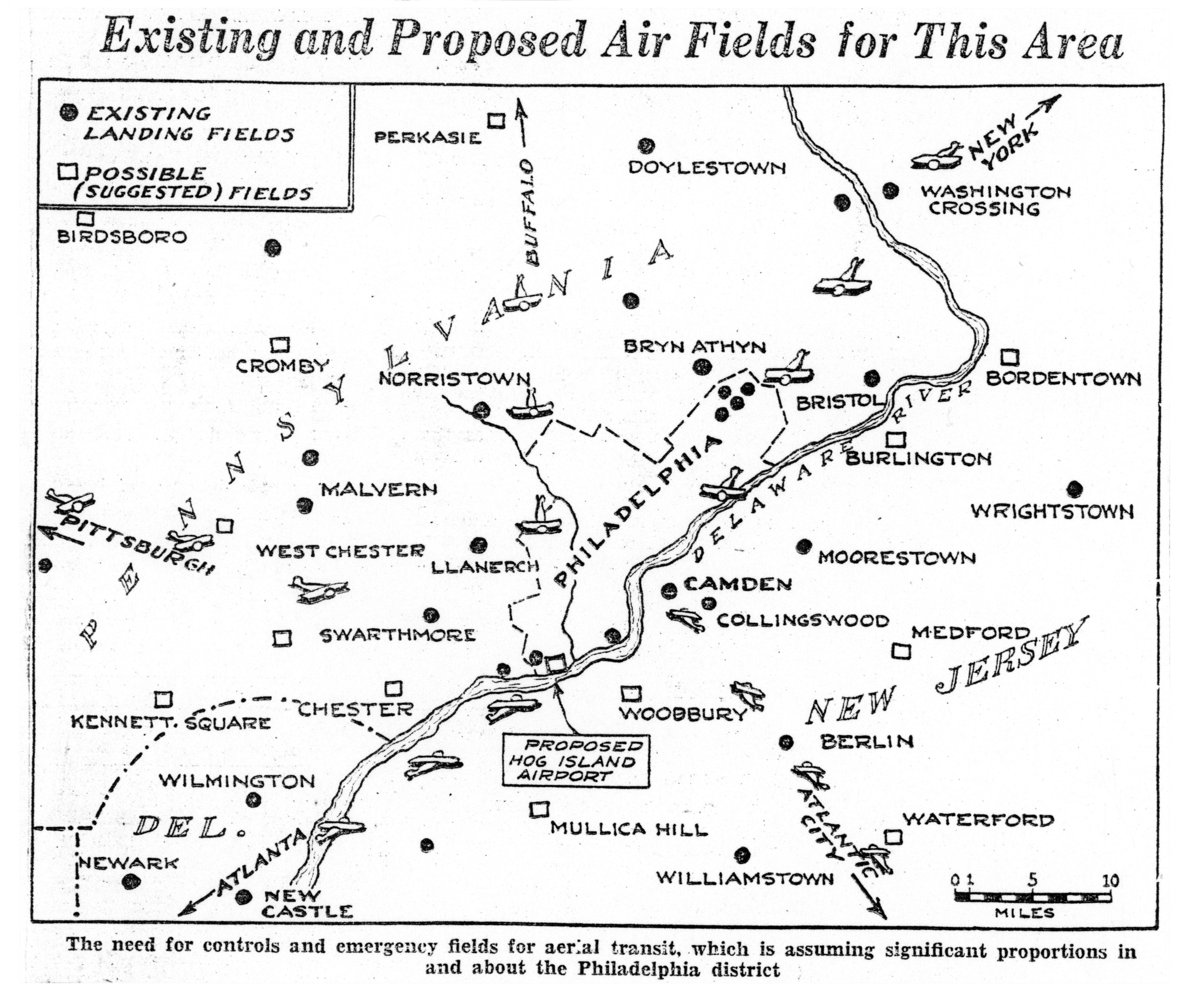
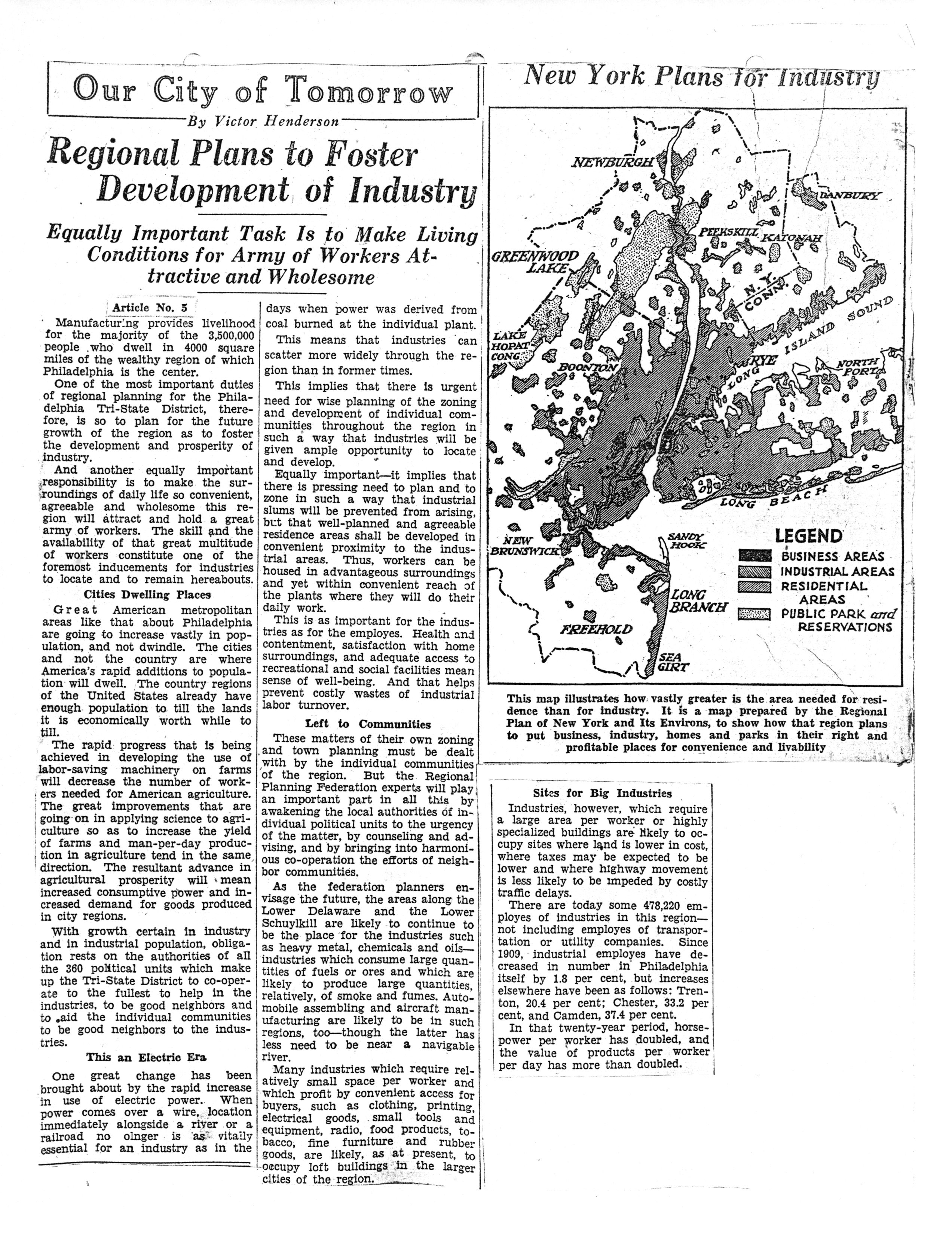
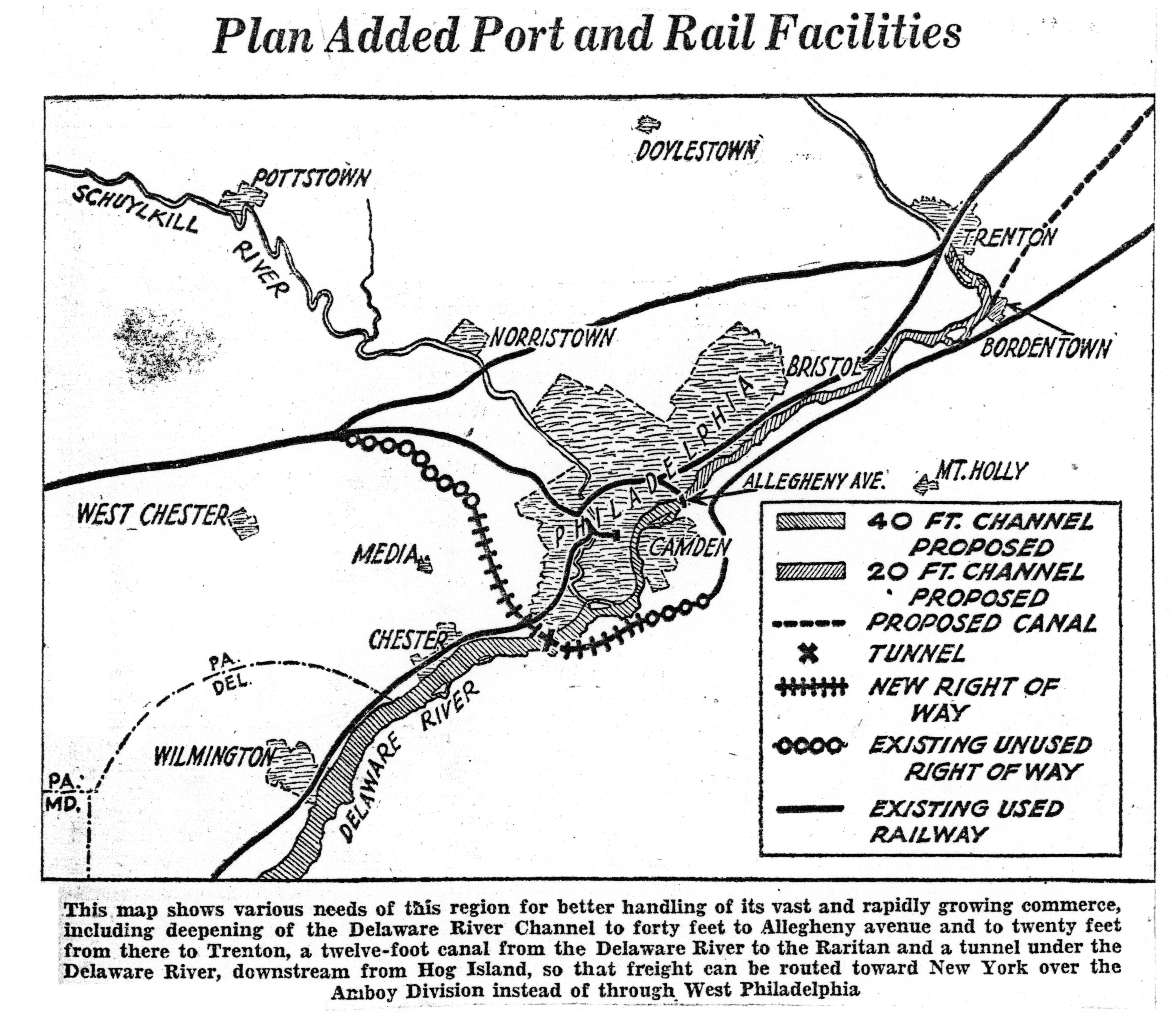
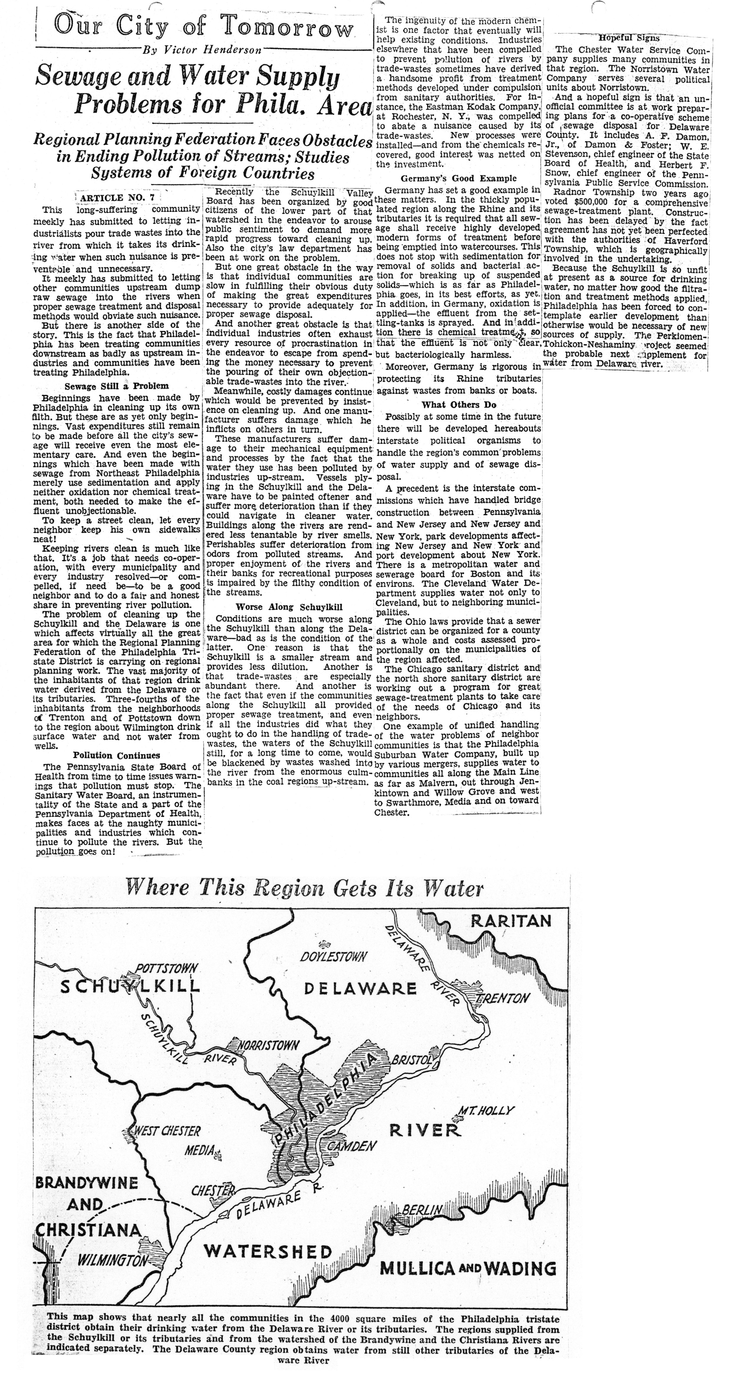
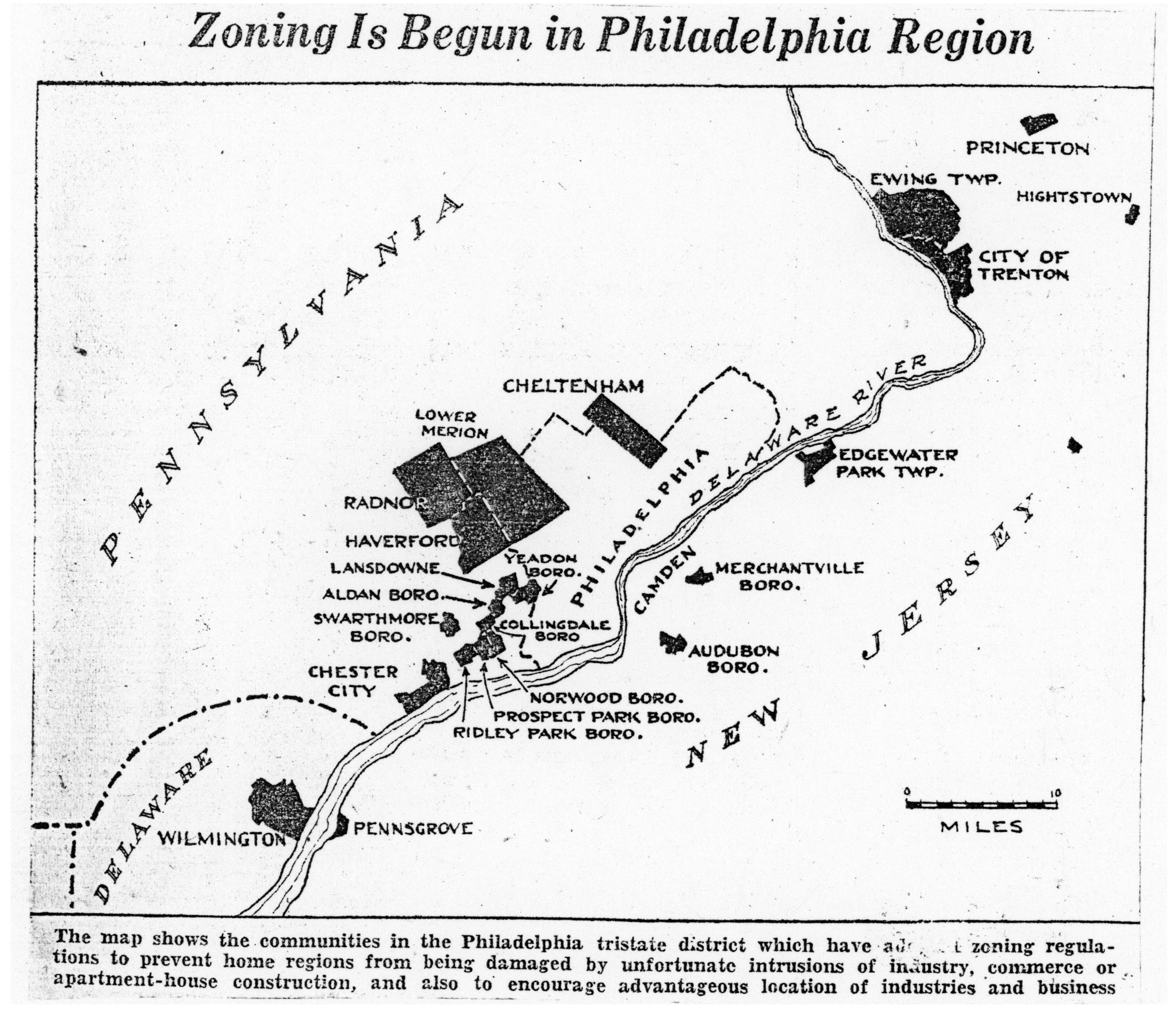
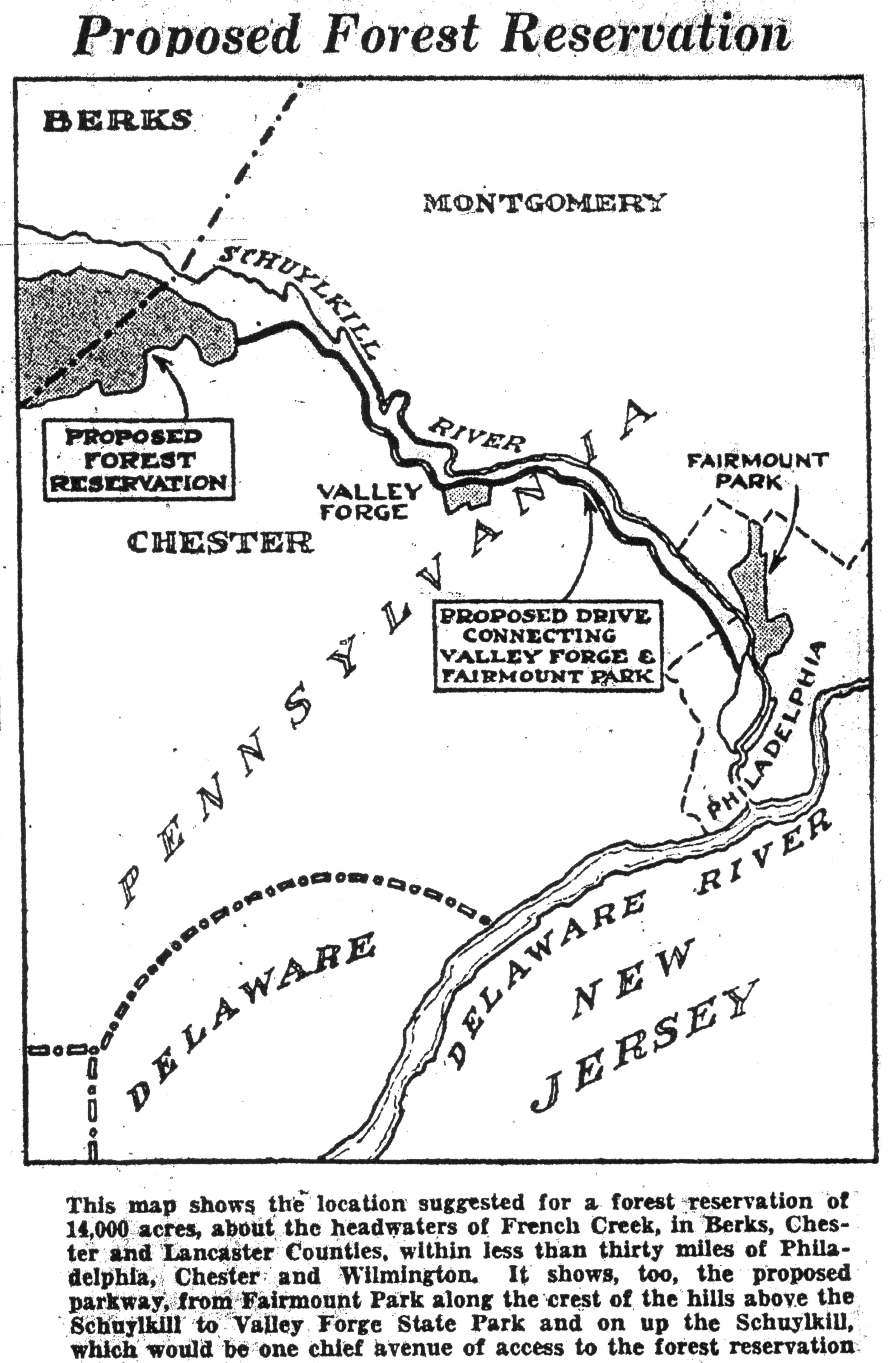
Each of the articles includes a simple map showing the features that were being proposed at the time, which is why I gave this post a “map lover” theme. I have pulled out the maps as illustrations; clicking on the date for each article will open a jpg of the entire article. To download a PDF that includes all 12 articles, click here.
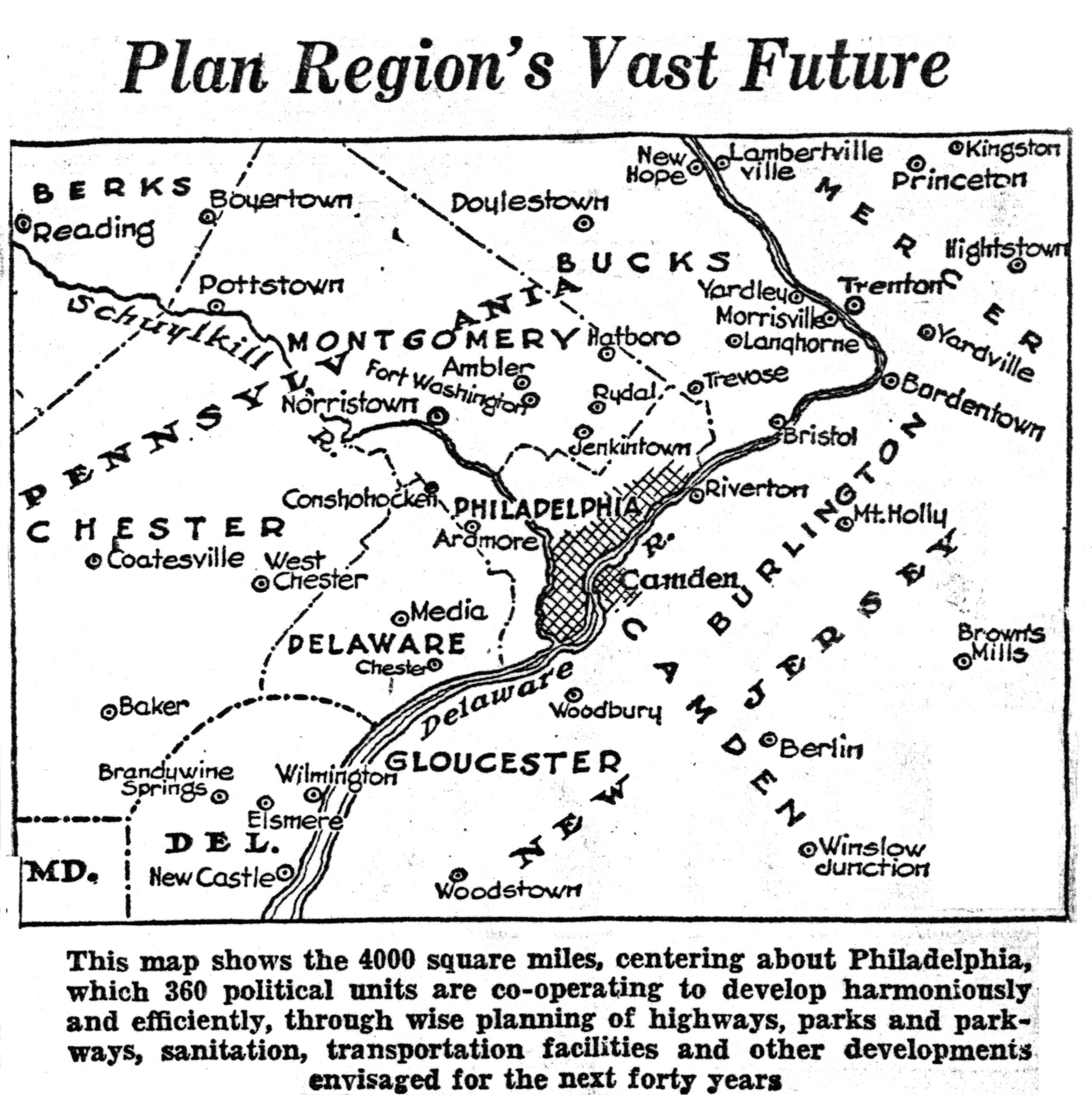
1. Huge Philadelphia Area to Grow In Orderly Way by Planning; Parklike Development of Wealthy Metropolitan District Aim of Engineers; Three States Represented in Effort.
March 17, 1930
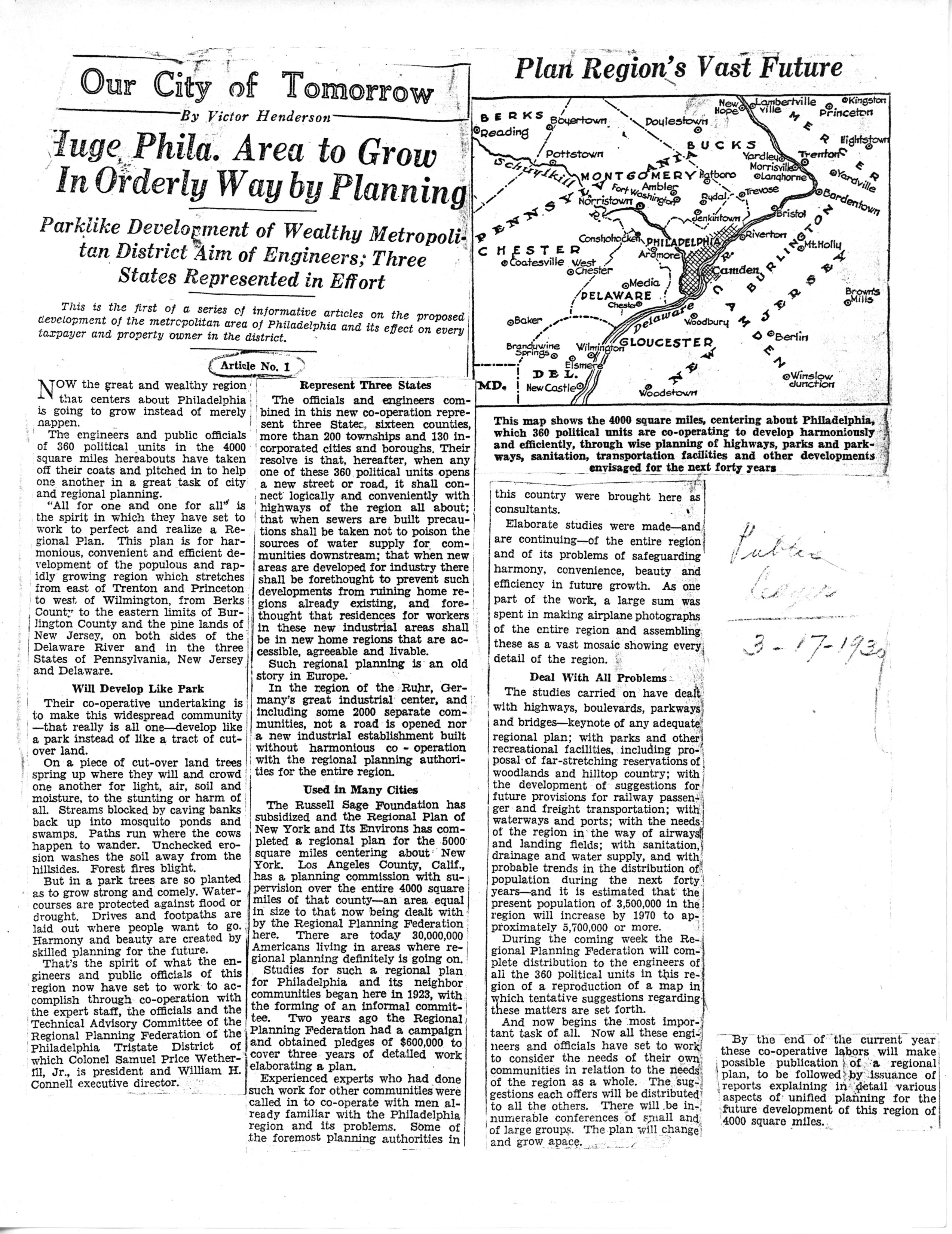
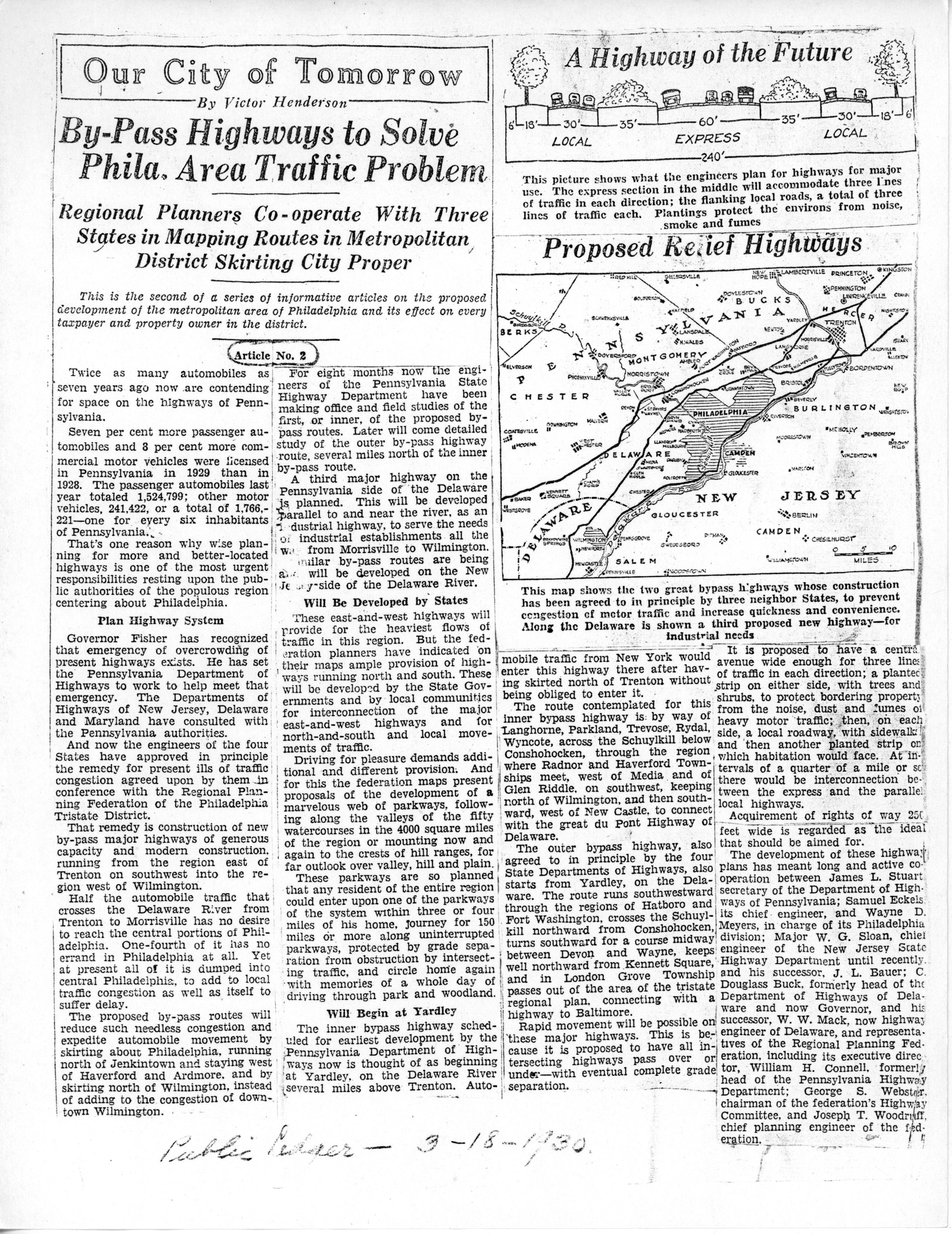
2. By-Pass Highways to Solve Philadelphia Area Traffic Problem; Regional Planners Cooperate With Three States in Mapping Routes in Metropolitan District Skirting City Proper.
March 18, 1930
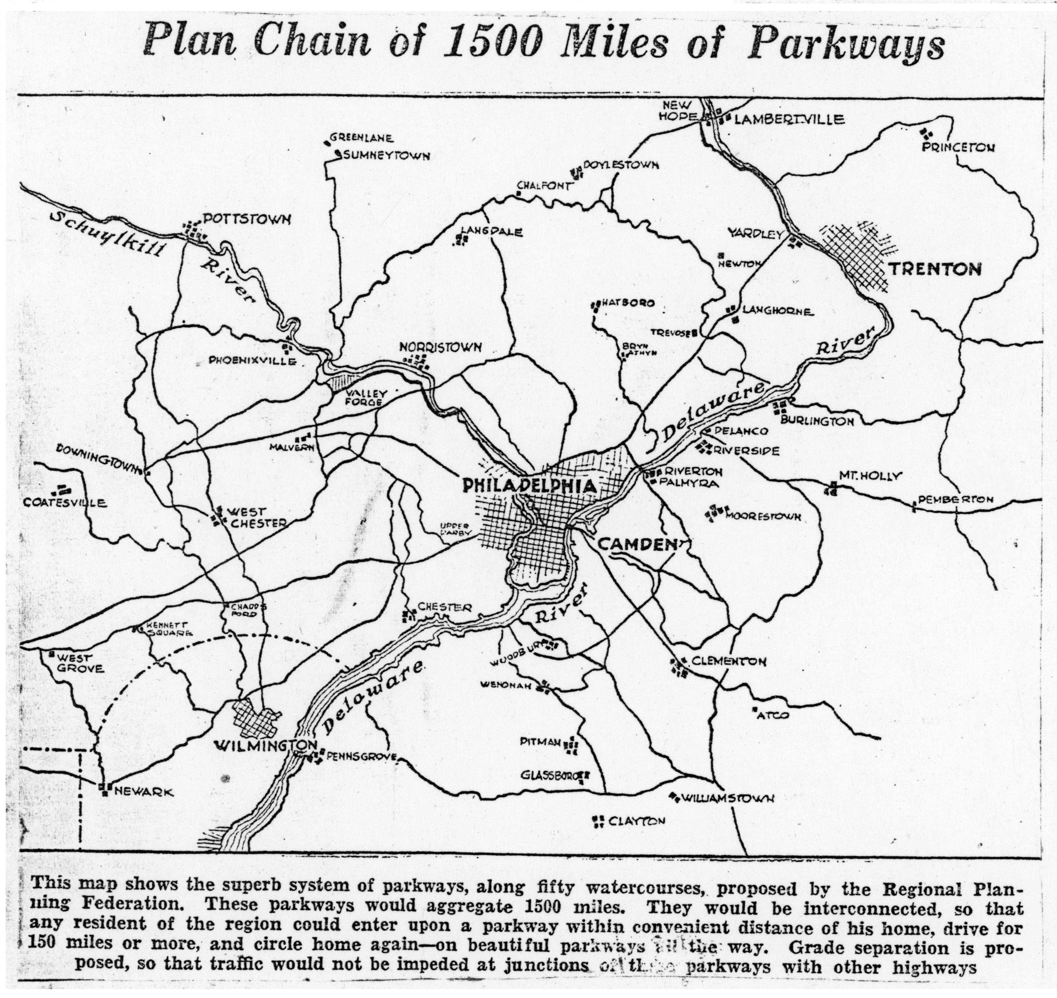
3. Regional Maps Safeguard Beauty Spots in Philadelphia Area; Natural Blessings of 50 Creek Valleys Will Be Rescued From Ruin; Chain of Parkways Embraced in Plans.
March 19, 1930
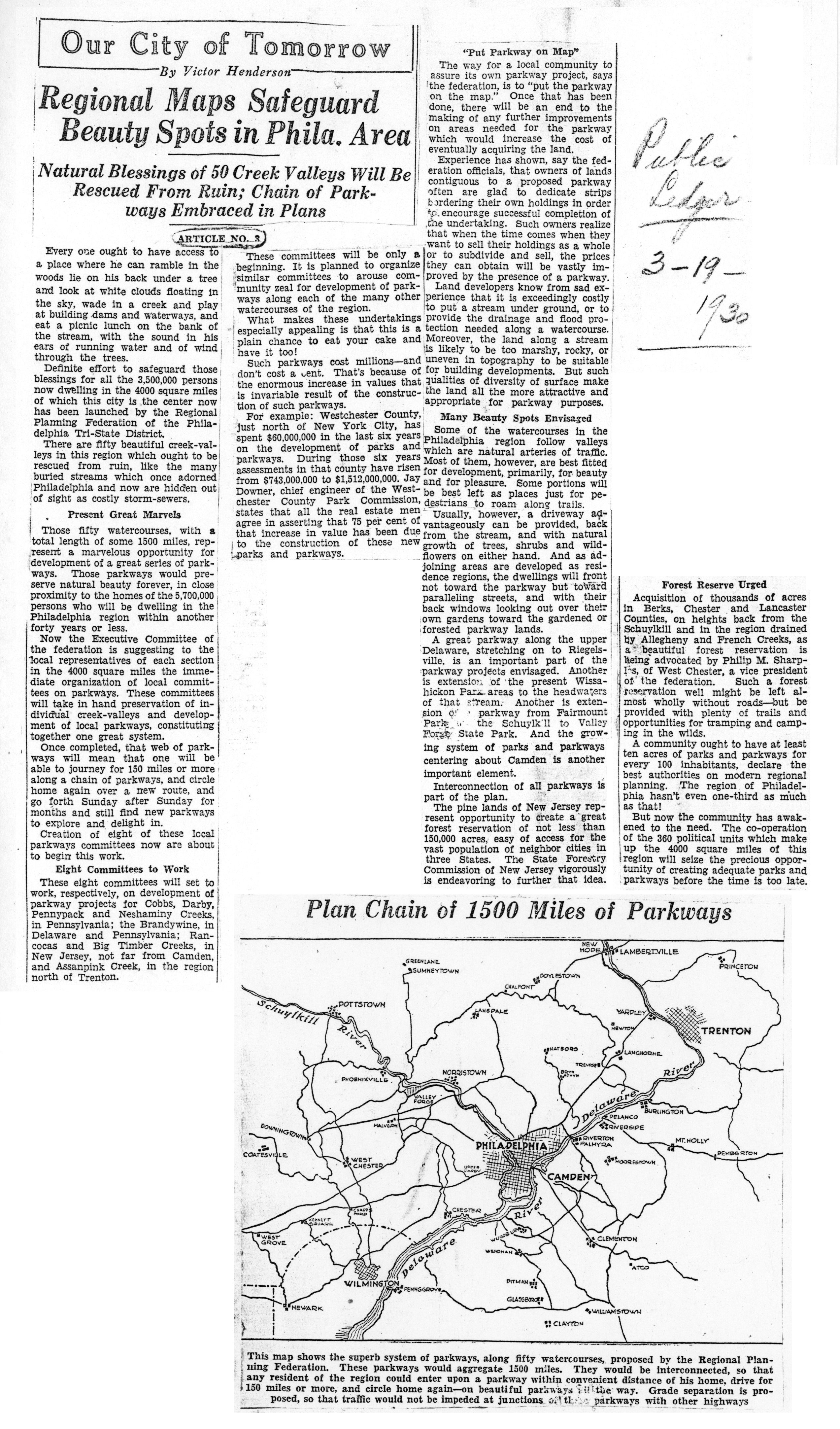
4. Airports Dotting Philadelphia Area Envisioned in Regional Plan; Federation Appeals to Communities in 4000 [sq.] Mile District to Appoint Committees to Consider Needs.
March 20, 1930
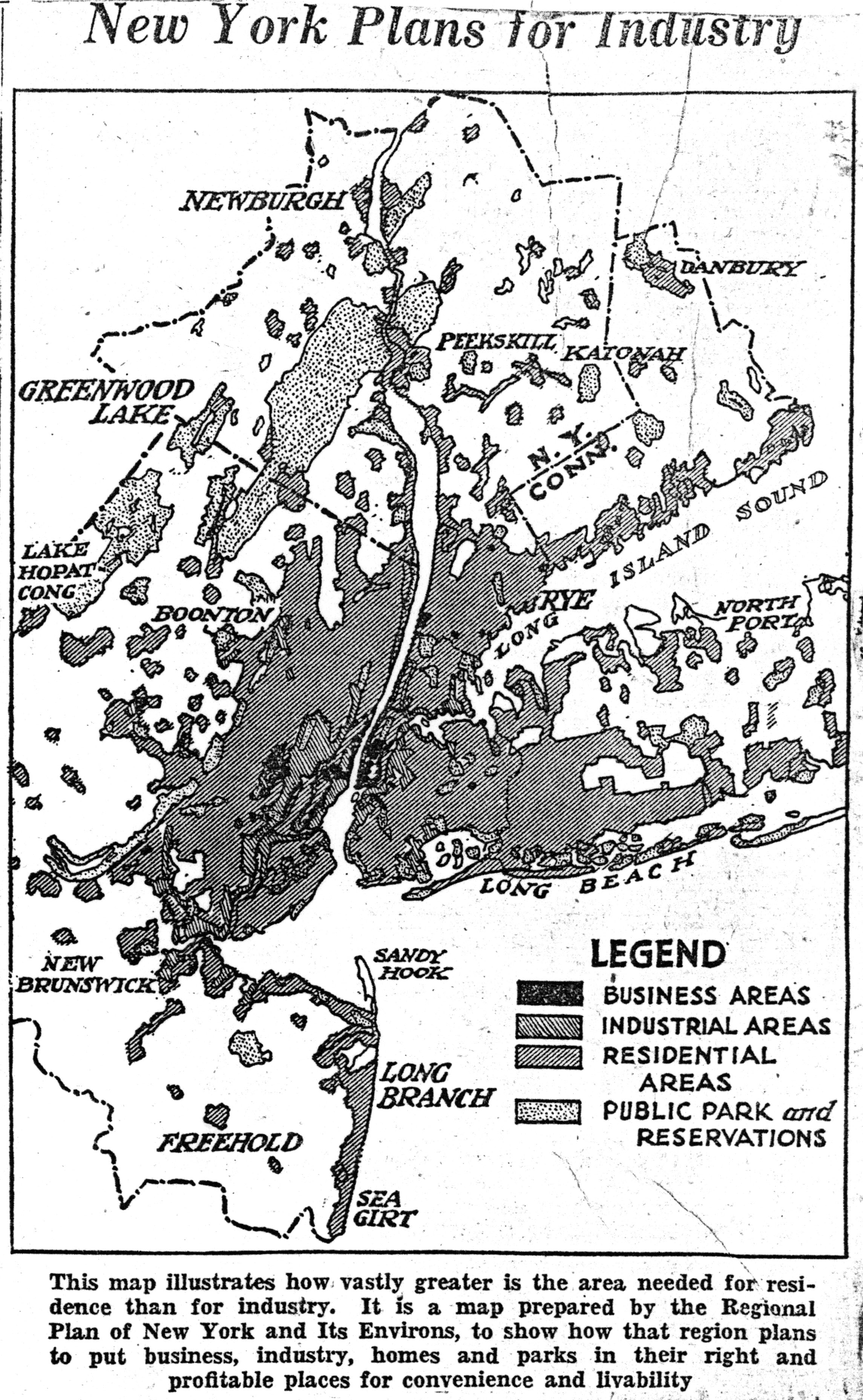
5. Regional Plans to Foster Development of Industry; Equally Important Task Is to Make Living Conditions for Army of Workers Attractive and Wholesome.
March 21, 1930
6. Forty-Foot Channel to Sea On Program for Philadelphia Area; Extension of Shipway to Trenton and Canal From the Delaware to the Raritan Developments for Near Future.
March 22, 1930
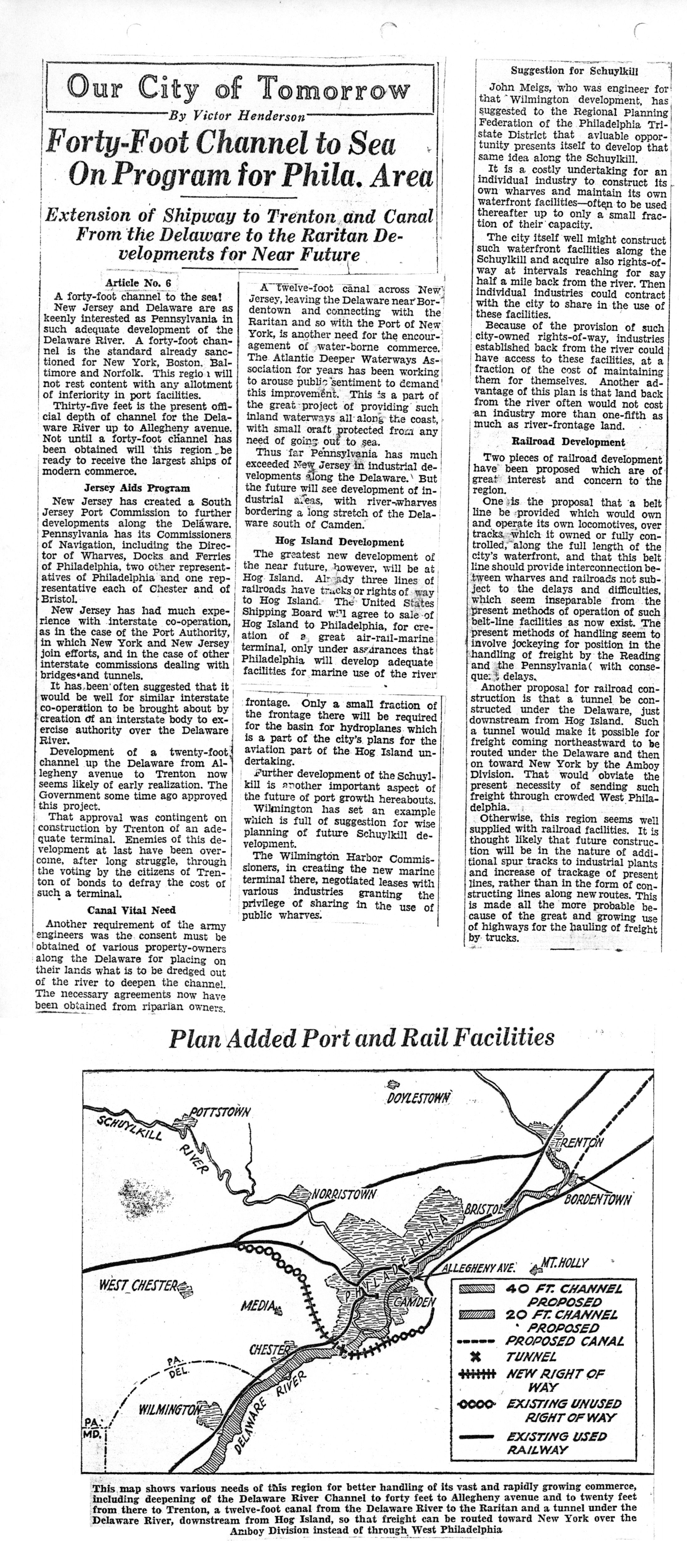
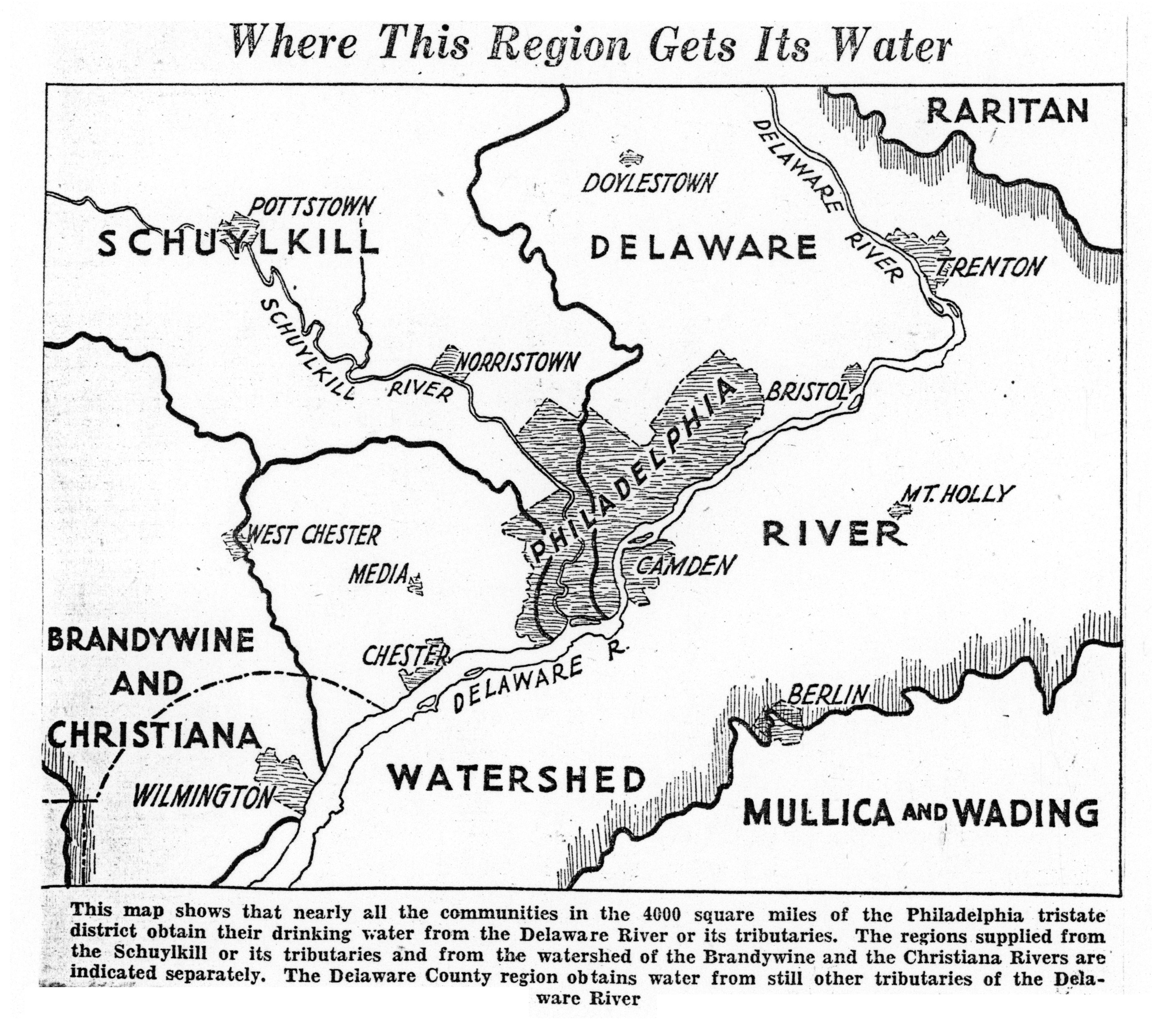
7. Sewage and Water Supply Problems for Philadelphia area; Regional Planning Federation Faces Obstacles in Ending Pollution of Streams; Studies Systems of Foreign Countries.
March 24, 1930
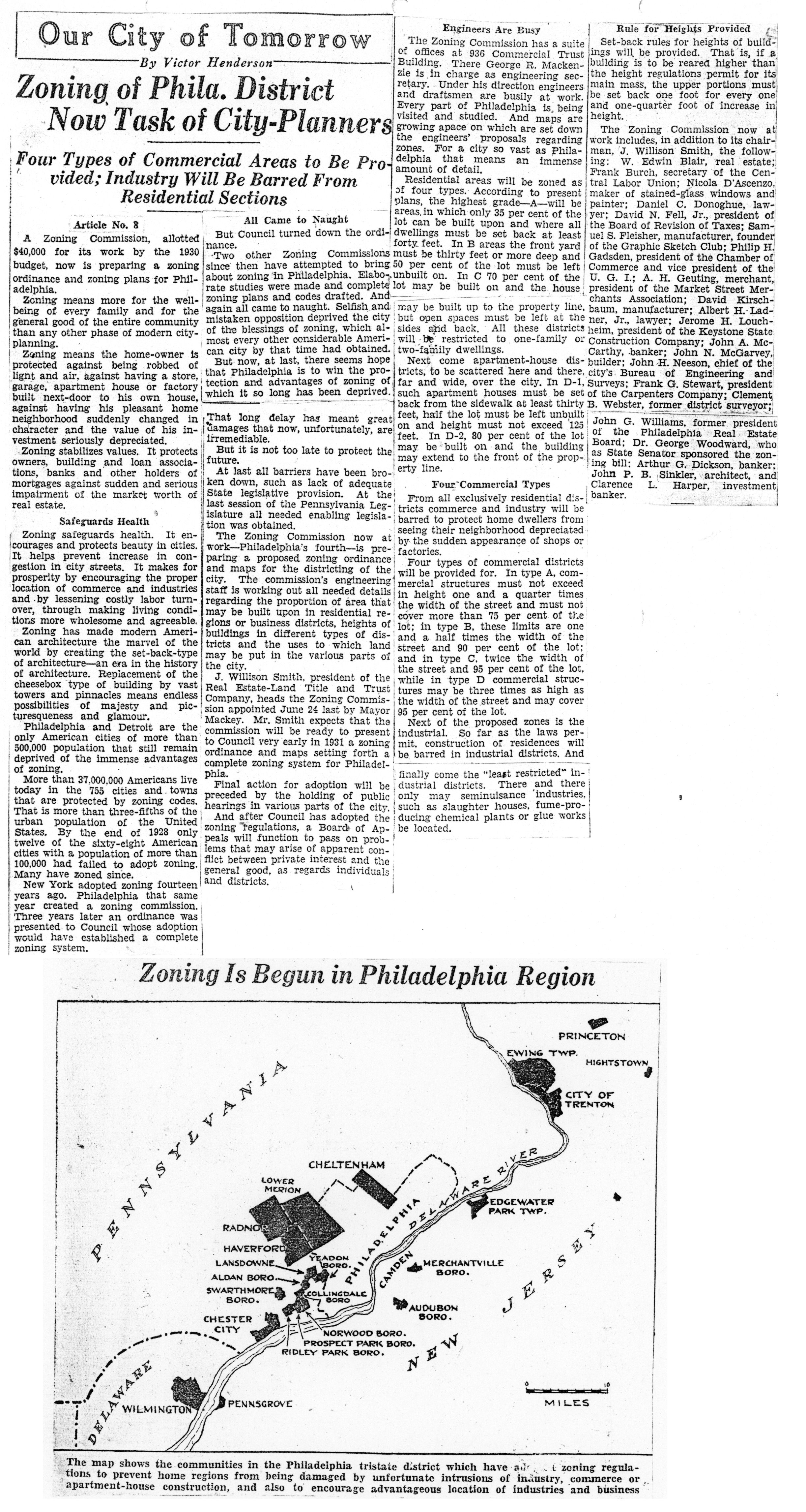
8. Zoning of Philadelphia District Now Task of City-Planners; Four Types of Commercial Areas to Be Provided; Industry Will Be Barred From Residential Sections.
March 25, 1930
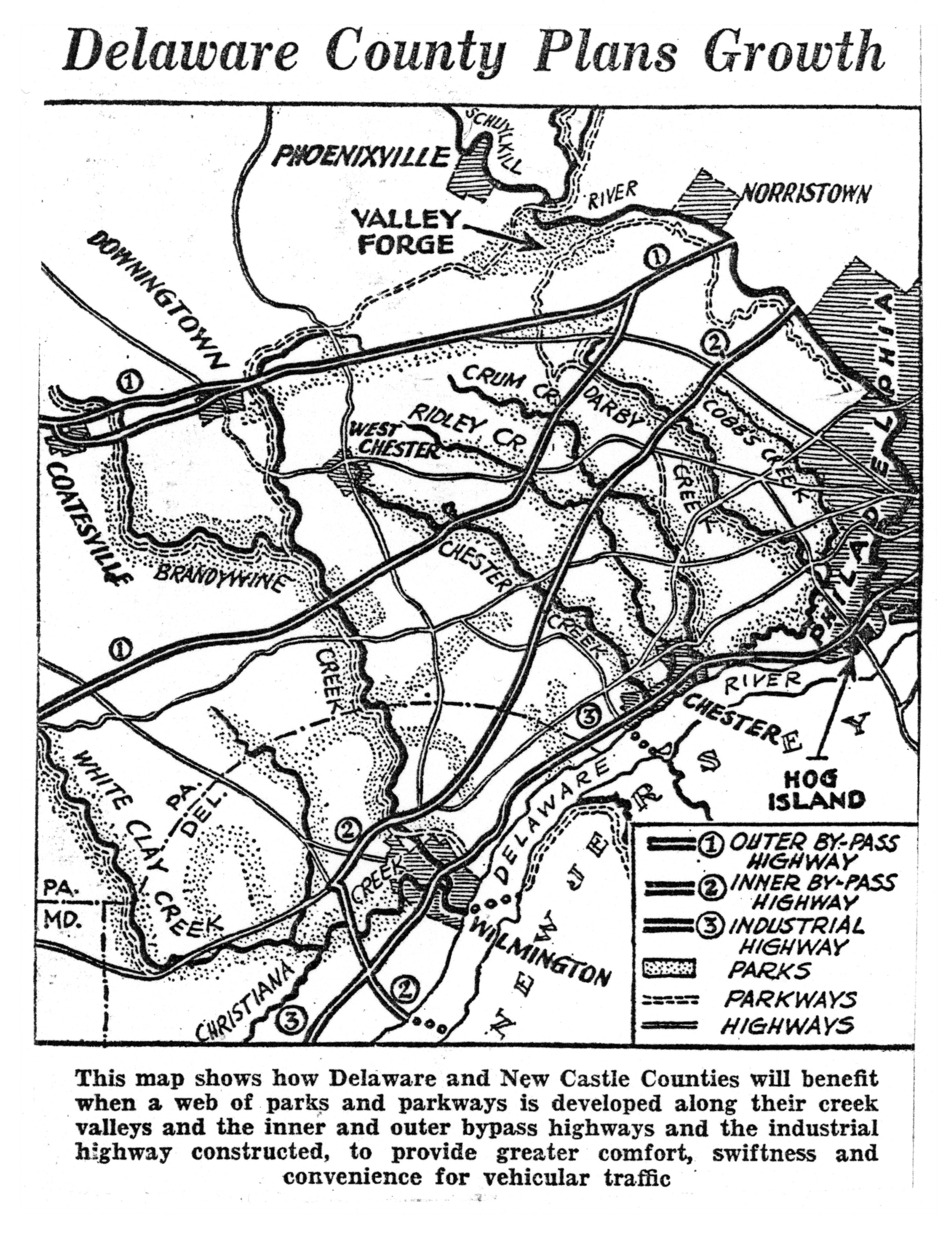
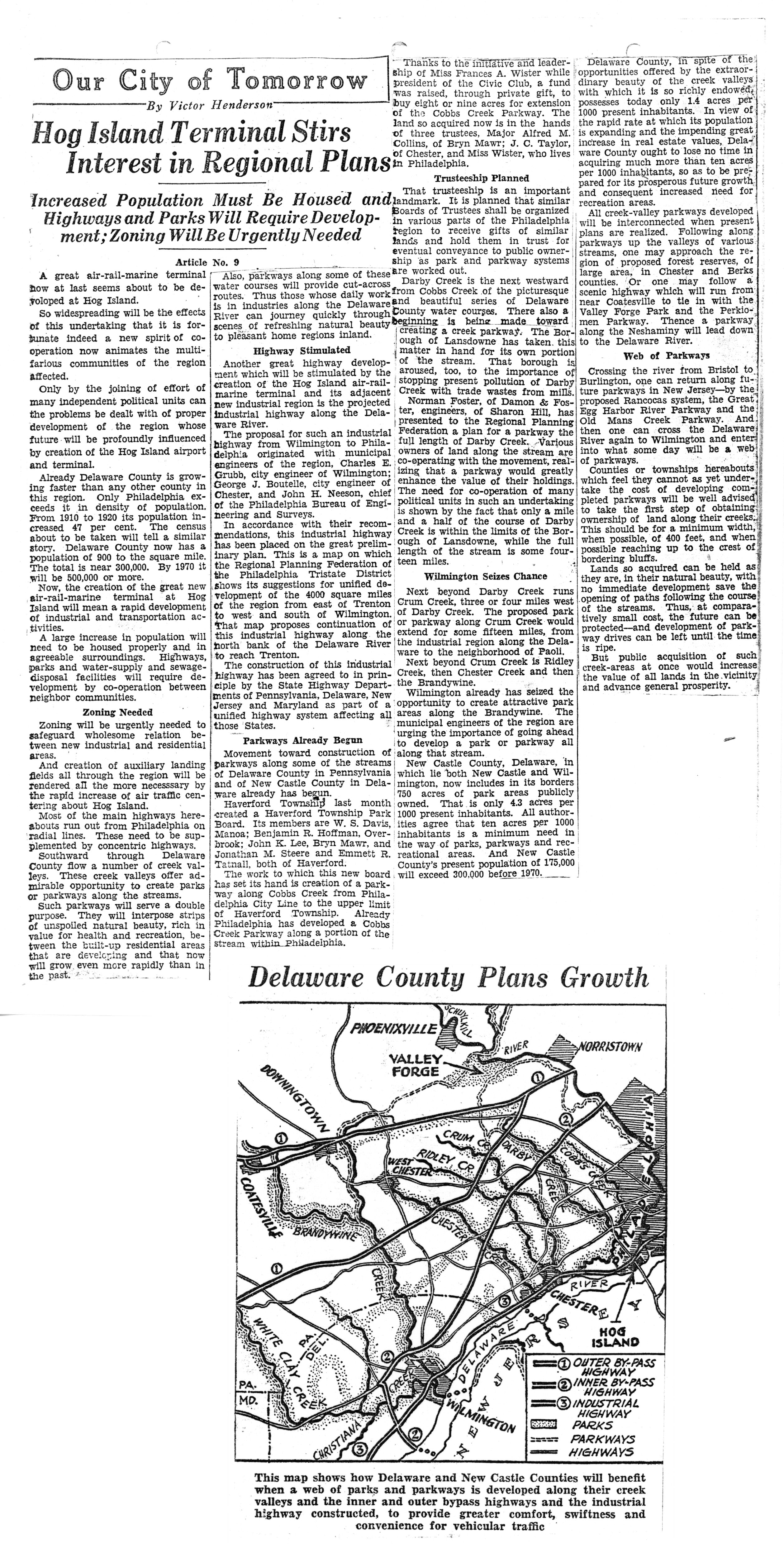
9. Hog Island Terminal Stirs Interest in Regional Plans; Increased Population Must Be Housed and Highways and Parks Will Require Development; Zoning Will Be Urgently Needed.
March 26, 1930
10. Forest Preserve Is Possible Within Philadelphia Tri-State Area; Ideal Site Seen in French Creek Region; Will Serve Recreation Needs of Rapidly Growing Population. March 27, 1930
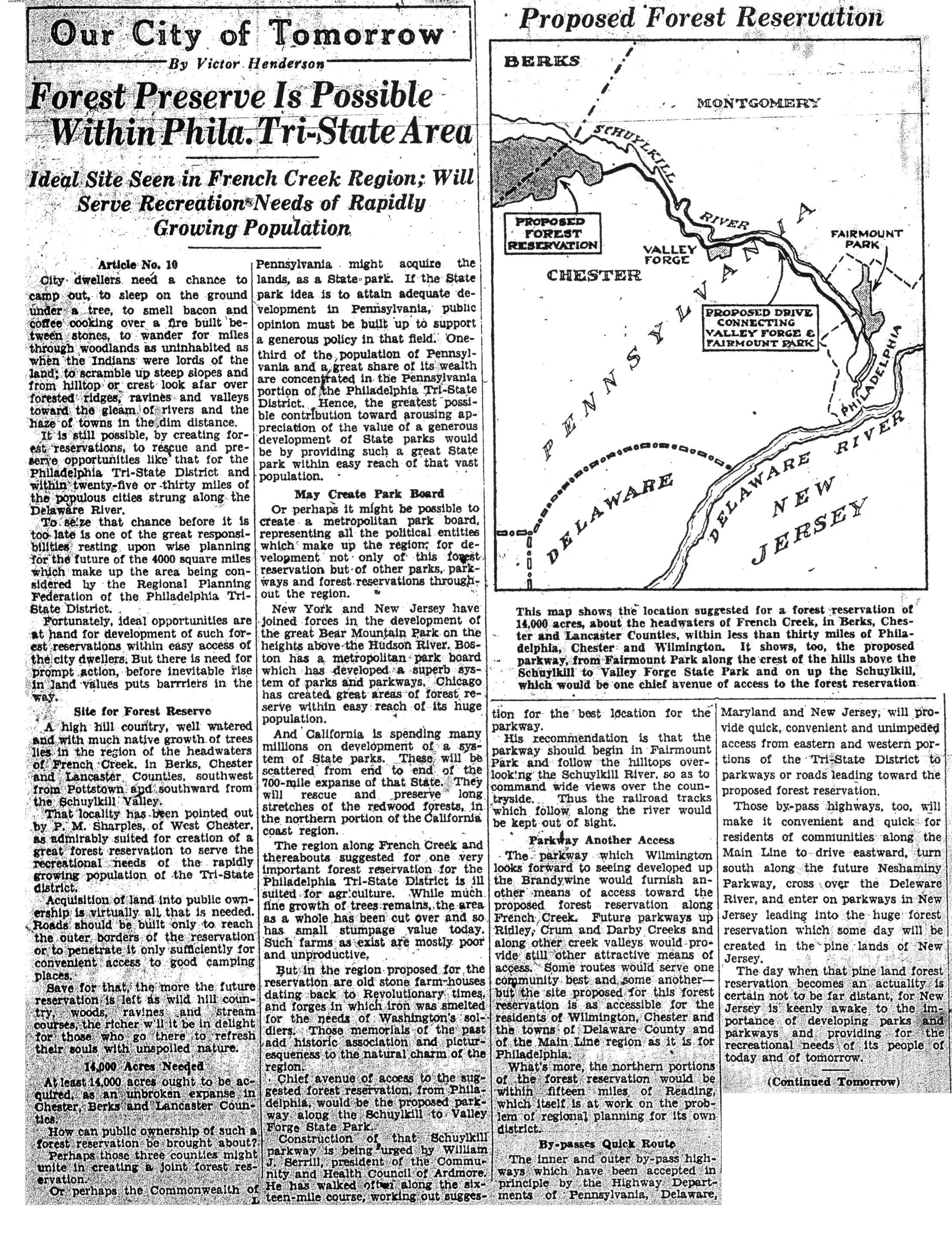
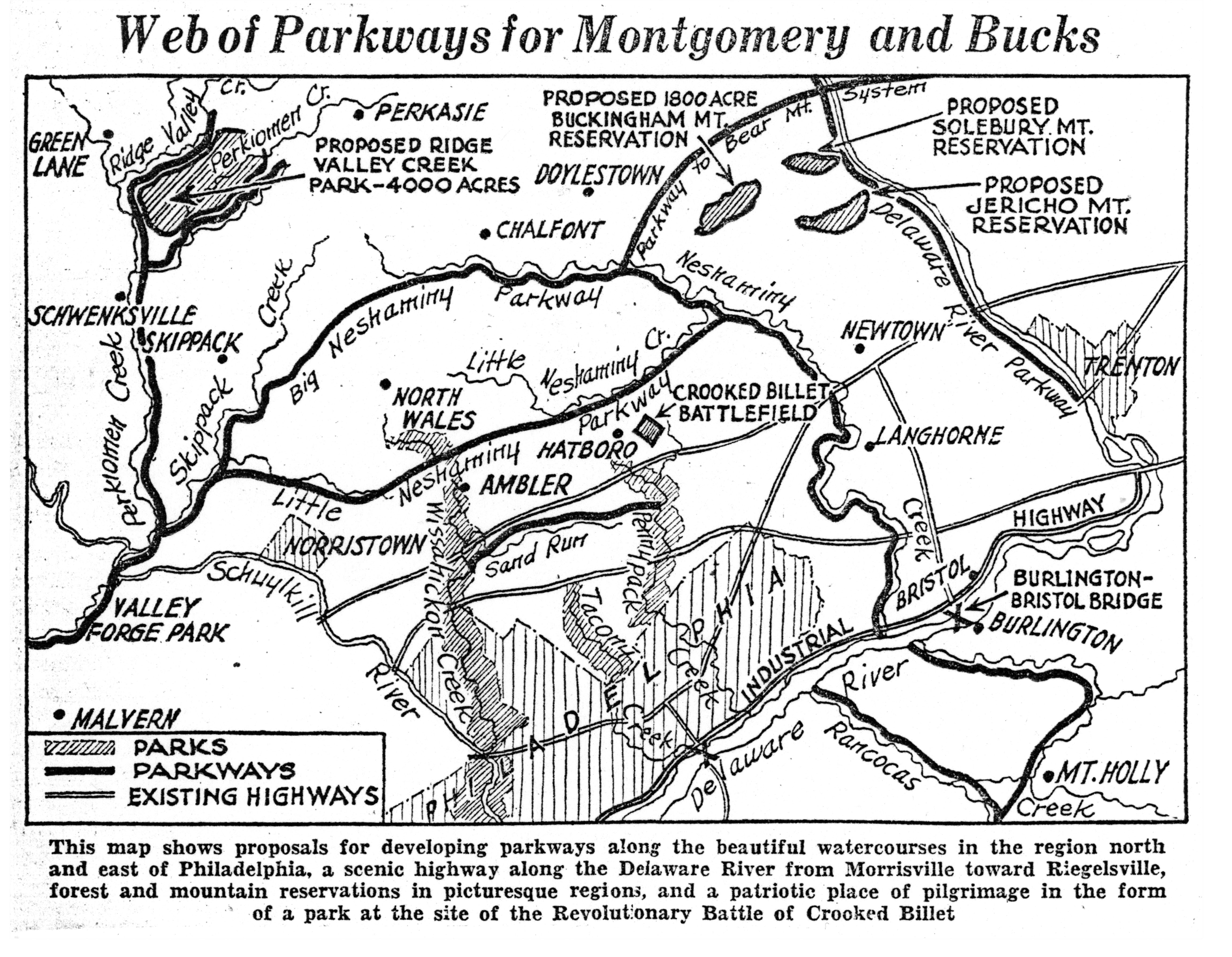
11. Beautifying Rivers of Area On Philadelphia Regional Program; Opportunities for Scenic Highways Along Delaware and Schuylkill Visioned; Lessons Learned From Foreign Cities.
March 28, 1930
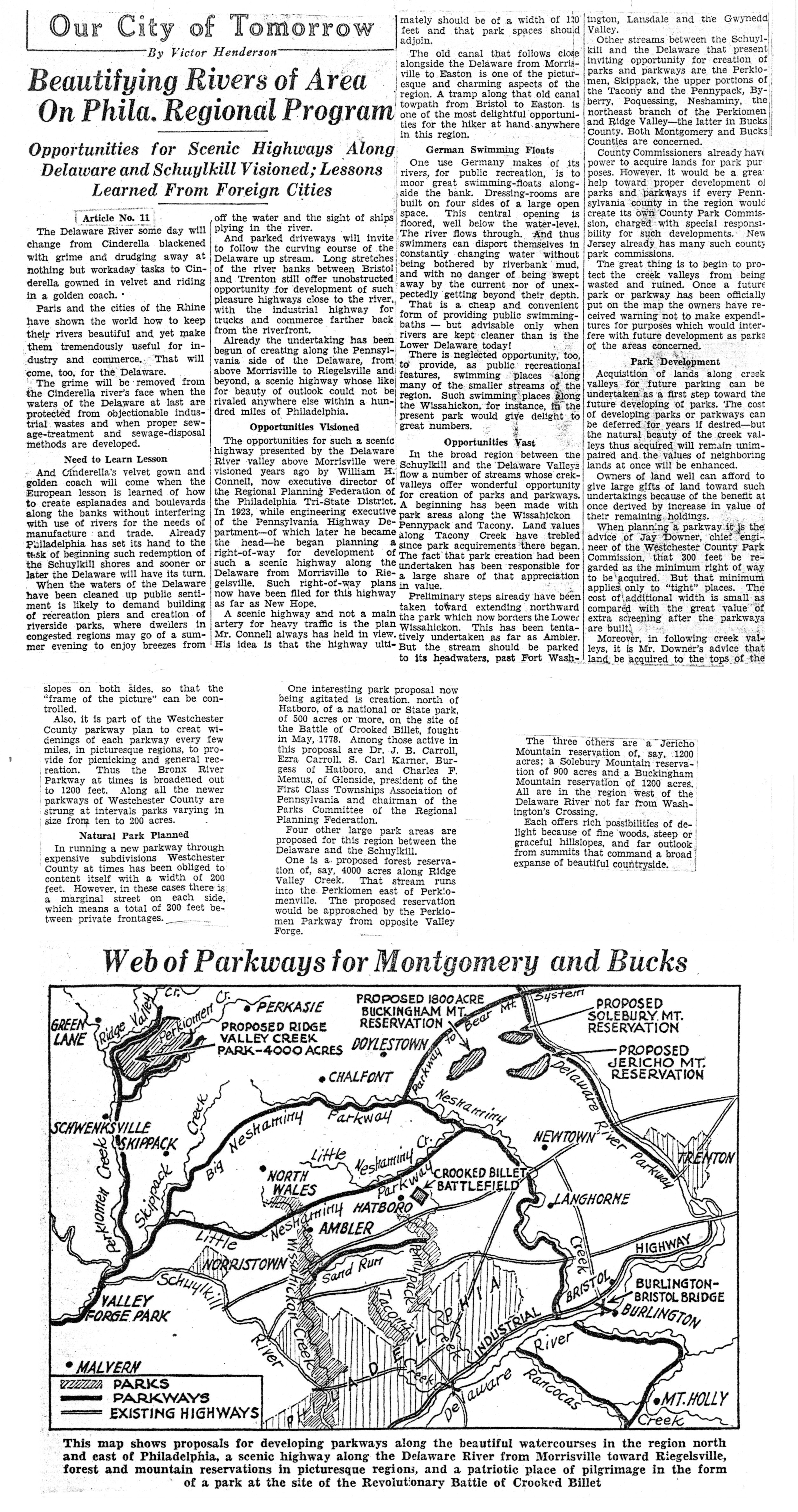
12. New Jersey Plans Forest Reserve Within 40 Minutes of Bridge; Authority for 100,000-Acre Project Sought from Legislature; State’s Experts Cooperate With Regional Planning.
March 29, 1930