2025 is the 200th anniversary of the completion of Pennsylvania’s pioneering slackwater-canal system

One of the bumper stickers, with real canal boat names, that was created for the 200th Anniversary. Find out more about the project, and more about the individual boats that once plied the Navigation, at this link.
PAST EVENTS
June 26, 2025: Grand Reopening of the Manayunk Canal at Flat Rock.
“The Philadelphia Water Department is excited to announce the Manayunk Canal Reopening Community Event, celebrating the completion of the Flat Rock Dam Betterment Project. Join us to celebrate this major infrastructure improvement for Philadelphia waterways and the re-introduction of fresh water flow into the Manayunk Canal. Attendees can learn about water quality improvements, speak with local partners, and watch a mussel presentation.”
May 18: At the Confluence of Navigation History, an All-Day History & Environment Symposium. Slide presentations, discussions, displays, and self-guided tours. Events held at C. Howard Hiester Canal Center at the Berks County Heritage Center. CLICK HERE to view the program. Links to recordings of talks to come.
April 5: All-Day Canal-Rail Excursion, with Reading Blue Mountain & Northern Railroad, a fundraiser for the American Canal Society, exploring the upper third of the Schuylkill Navigation. Click here to view the homepage created for the tour.
May 17: Free open houses and events were held at individual historical societies and parks, listed from the top of the Navigation to the bottom: Schuylkill County Historical Society, Pottsville; Leesport Lock House, Locks 36-37; Laurel Locks Farm, Pottstown; Frick’s Locks Village, Pottstown; Spring-Ford Area Historical Society, Royersford; Lock 60 Schuylkill Canal Park, Mont Clare; and Fairmount Water Works Philadelphia.
May 19: Driving/walking tour of Hamburg Canal sites in Berks County. Stops included: (1) Etchberger Trail on the Towpath below Lock 30. (2) Five Locks rewatered canal and lock tender’s house (3) Lock 33 and lock tender’s house Shoemakersville (4) Ontelaunee Wetlands Preserve at Mohrsville canal section and small aqueduct (5) Leesport Lock House and Locks 36-37 and (6) walk to Herbines Lock 38.
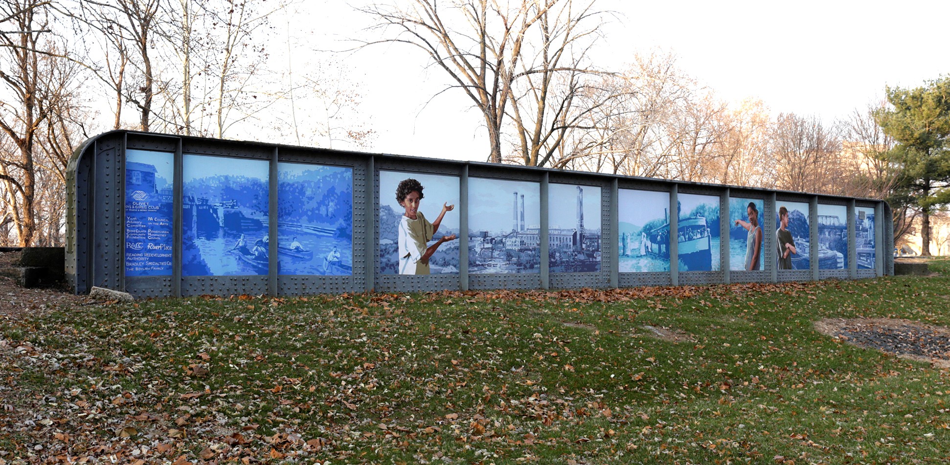
May 20: Flat Rock Betterment Insider’s Tour at Lock 68, Manayunk Canal. Forty people saw the new restored flow to the canal and learned its environmental purpose. Led by the Philadelphia Water Department Project Manager Ian McKane and Navigation historian Sandy Sorlien. See the upcoming events above for another chance to learn about this project.
April 9: Two talks: Mike Szilagyi provided a different view of the history and mechanical workings of the Schuylkill Navigation, using his skills as a planner and designer to present 3D models of various working parts of the system, to the Oliver Evans Chapter of The Society for Industrial Archeology. Dave Willauer gave a slide talk about the Schuylkill Navigation System and the Vincent Canal, sponsored by the Spring-Ford Area Historical Society.
June 14-20, 2025: Schuylkill Sojourn. The theme of this year’s sojourn, a weeklong paddle down the river from Schuylkill Haven to Philadelphia, was “Canals and Campfires,” with evening educational programs about the history of the Schuylkill Navigation.
TO BE A PART OF THIS HISTORY, OR LEARN MORE
- Join our Schuylkill Navigation Facebook Group.
- This video by Larry Whyte provides an excellent, illustrated overview of the system.
- This article by Stuart Wells explains why we chose May 20, 2025 to celebrate
LEARN MORE ABOUT THE SCHUYLKILL NAVIGATION
TWO CANALS
Philadelphia has two canals:
The Manayunk Canal, still watered with intact lock chambers at both ends.
The Fairmount Canal, with just a few hidden remnants left.
This 12-page booklet by Fairmount Water Works educator Sandy Sorlien tells the story of both our canals, and the legacy of the associated industries, pollution, and cleanup.
Together these Philadelphia canals didn’t even add up to three miles. But they were critical levels of the 108-mile Schuylkill Navigation that brought anthracite coal and other cargo from Schuylkill County all the way to our tide lock at the Fairmount Dam, some boats continuing on New Jersey canals to New York City. The Navigation canals also provided critical water power to mills.
TWENTY-SEVEN CANALS
The Schuylkill Navigation is often called the Schuylkill Canal. But actually the system included 27 canals, each with its own name, along with 32 dams and their slackwater pools. Thus, 200 years ago, the shallow, rocky Schuylkill River was tamed. Boats up to 100 feet long traveled in and out of the river pools and canals. They brought cargo from coal country to tidewater, and went back up. There were scores of hand-built stone locks to handle the elevation change, totaling 618 feet of “lift”, and aqueducts to carry the canals over streams. The Navigation ceased operation by the 1930s, but many structures survive: some standing in the woods, some buried under fill. One even survives underwater.
The private Schuylkill Navigation Company, based in Philadelphia, chartered their system in 1815. Construction began in 1816, a year before the Erie Canal started their construction. The upper and lower sections of the Schuylkill Navigation were built simultaneously with individual canals operating as early as 1818 or 1819, including the one in Manayunk. The two long sections finally connected through Reading on May 20, 1825.
VIDEO PRESENTATIONS
Larry Whyte, The Schuylkill Navigation: A Journey on the Historic Nineteenth Century Waterway. This video presentation, written and narrated by Whyte, provides an excellent overview of the history of the system.
“Shadow River: Recovering the Schuylkill Navigation Ruins” a documentary film by Addison Geary
HISTORIC MAPS & DRAWINGS
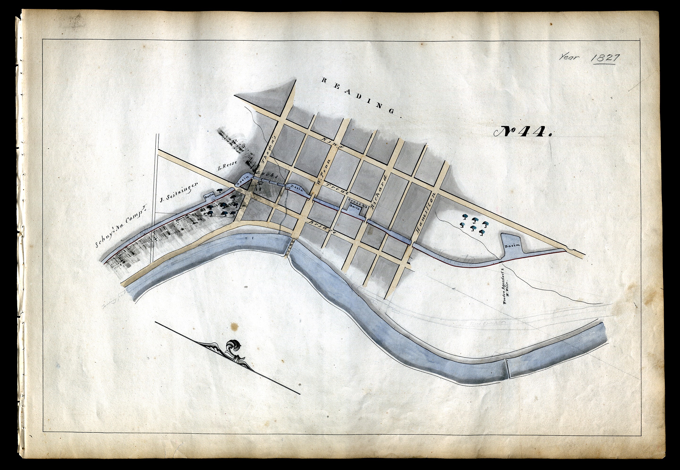
- 1827: Maps of the Schuylkill Navigation by T. H. Gill
- 1913: Schuylkill River, Wissahickon Creek, Phila., PA. to Norristown, PA. 18 sheets.
- 1891: The water supply of the City of Philadelphia by a proposed aqueduct from Norristown Dam, and the acquisition of the works of the Schuylkill Navigation Company. Collection of 16 oversized plates, folded and bound between boards
- 2022: Download this new Schuylkill River map created by Morgan Pfaelzer for Sandy Sorlien’s book Inland: The Abandoned Canals of the Schuylkill Navigation, showing the 27 Canals and 71 Locks of the Schuylkill Navigation system, plus selected parks and trailheads of the Schuylkill River Trail.
- Reading Area Community College: Schuylkill Navigation Collection
- City Plans Collection: Streets Department of Philadelphia
BOOKS AND ARTICLES
- Stuart William Wells, The Schuylkill Navigation and the Girard Canal
- Edward S. Gibbons, The Building of the Schuylkill Navigation System 1815-1828
- Walter S. Sanderlin, The Expanding Horizons of the Schuylkill Navigation Company 1815-1870
- Sandy Sorlien, Inland: The Abandoned Canals of the Schuylkill Navigation (2022)
- Chari Towne, A River Again: The Story of the Schuylkill River Project
PRIMARY SOURCE DOCUMENTS
Acts of the Legislature of Pennsylvania relative to the Schuylkill Navigation Company. Philadelphia: Joseph and William Kite, 1838
More Resources on the Schuylkill Navigation Facebook Page
The shadow image at the top of the page is a detail from an 1847 map of the Manayunk Canal by John Levering, from the collection of the City Plans Unit, Streets Department of Philadelphia. This tracing of the original was made by H. H. Platt, probably in the late 19th century. You can view the full map here.