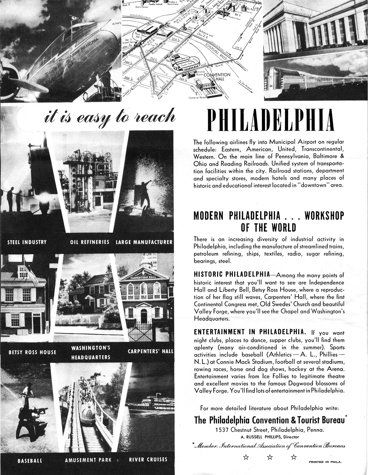
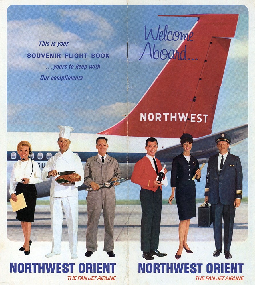
Around 1990 I did gardening work for an 80-some-year old woman who lived in a big white house on a two-acre lot near the Merion Railroad Station, just outside Philadelphia. Mrs. English, as I knew her – calling her Ruth, her given name, was out of the question – was a well-bred, well-to-do woman from the white-glove era who taught decoupage at a local art center. She was born just a year after the Wright Brothers’ first flight, and had witnessed the entire evolution of air travel in her lifetime. I’ll never forget her complaint one day after she had returned from an airplane trip to a family event: “People just don’t dress up to fly anymore! It used to be something special!”
Yes, Mrs. English, flying in the 1990s, or today, is not the luxury it must have been when you first walked up the gangway onto a Tran World Airlines DC-4, greeted by stewardesses (not flight attendants, and never men) who served real meals on real china with real cutlery. But more has changed than the way people dress to fly, or the in-flight food we get (when we get any). For journeys over a certain distance, airplanes have become just another form of mass transit.
And airports themselves (which are the real subject of this post) have also changed dramatically in the past 90 years. Those that have the room to expand keep growing to keep up with competition from other cities. In Philadelphia the airport has added new terminals and runways and parking lots and package delivery hubs until only ragged remnants remain of the marshland that all of this was built on.
This post features plans and maps that exemplify early visions of what an airport should be. Several of the items are of local interest, but to start let’s zoom out to this national view of air traffic from 1928.
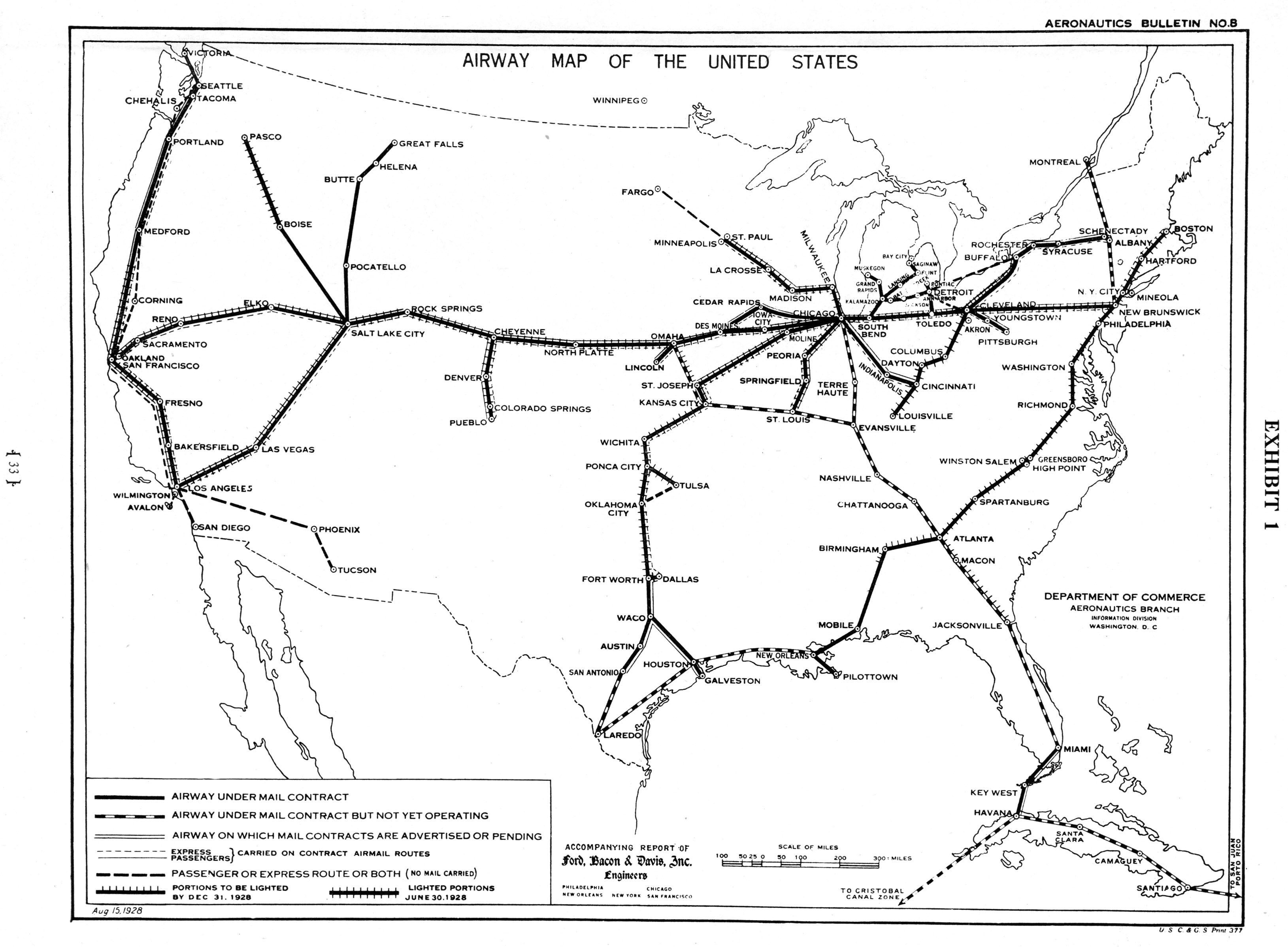
Note how few routes there were, and the ground lights that were used as navigational aids in the pre-radar era. Most of the air traffic in those days was for mail delivery; commercial passenger flights were just in their infancy.
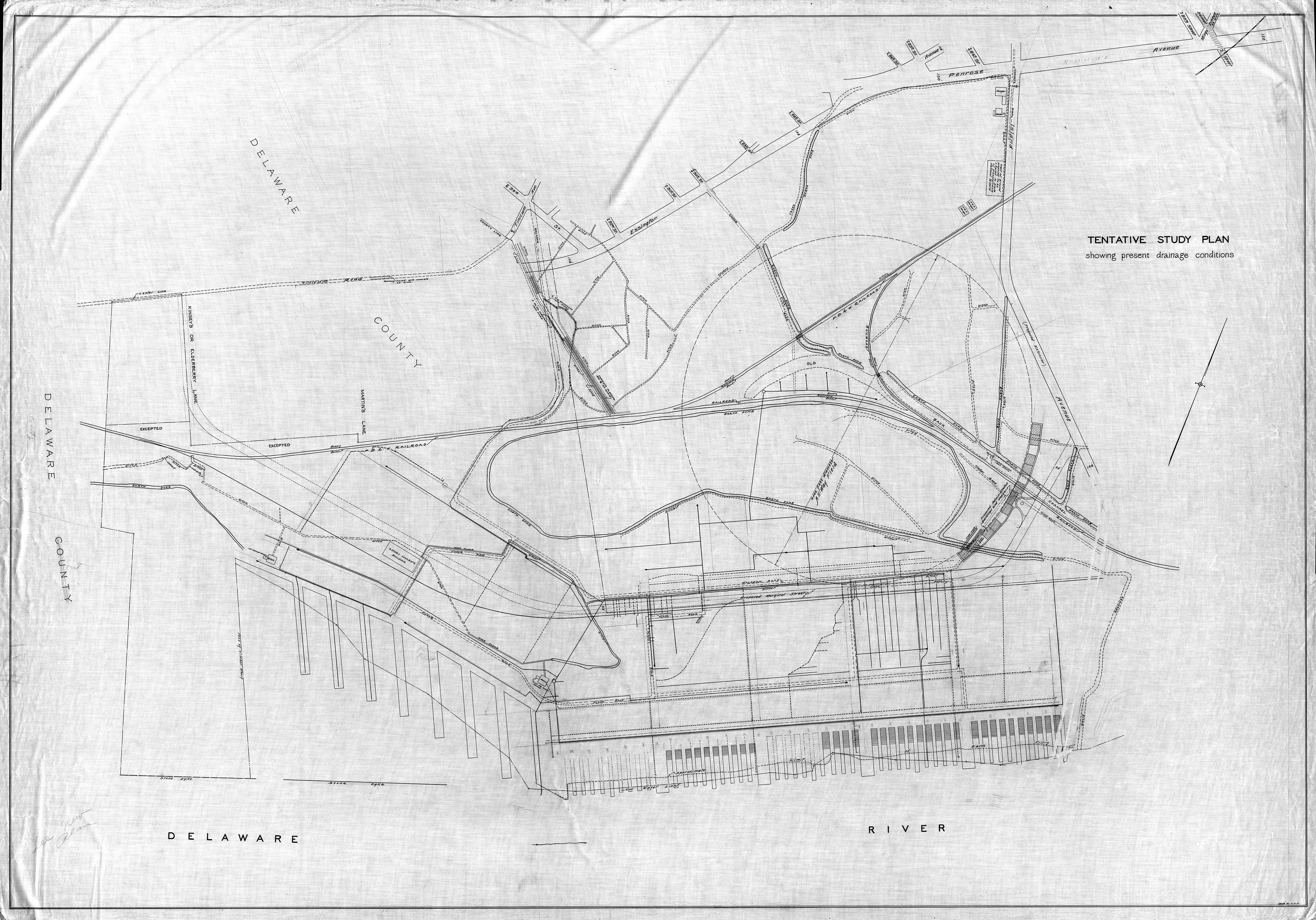
The next trio of maps, created by the Philadelphia Department of Public Works, show the many amenities planned for the city’s airport in 1931. These include a railroad station and a bus terminal, parking for cars, a seaplane basin, a mast for mooring dirgibles – no form of transportation seems to be left out. Grandstands are provided for the public to watch the all the comings and goings, and the adjacent Pennsylvania National Guard Reservation is provided with a “turf training field,” presumably for its pilots to practice on.
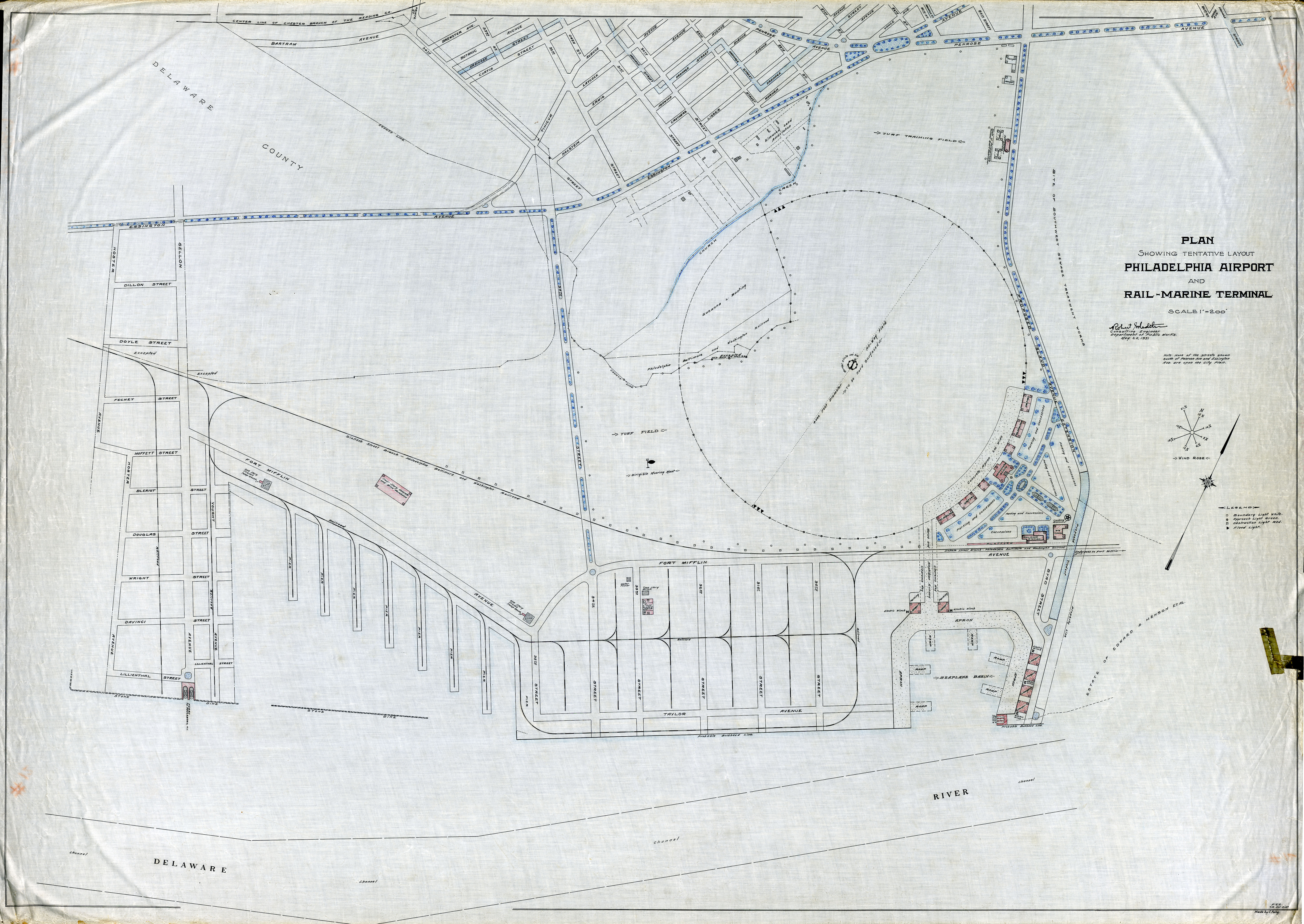
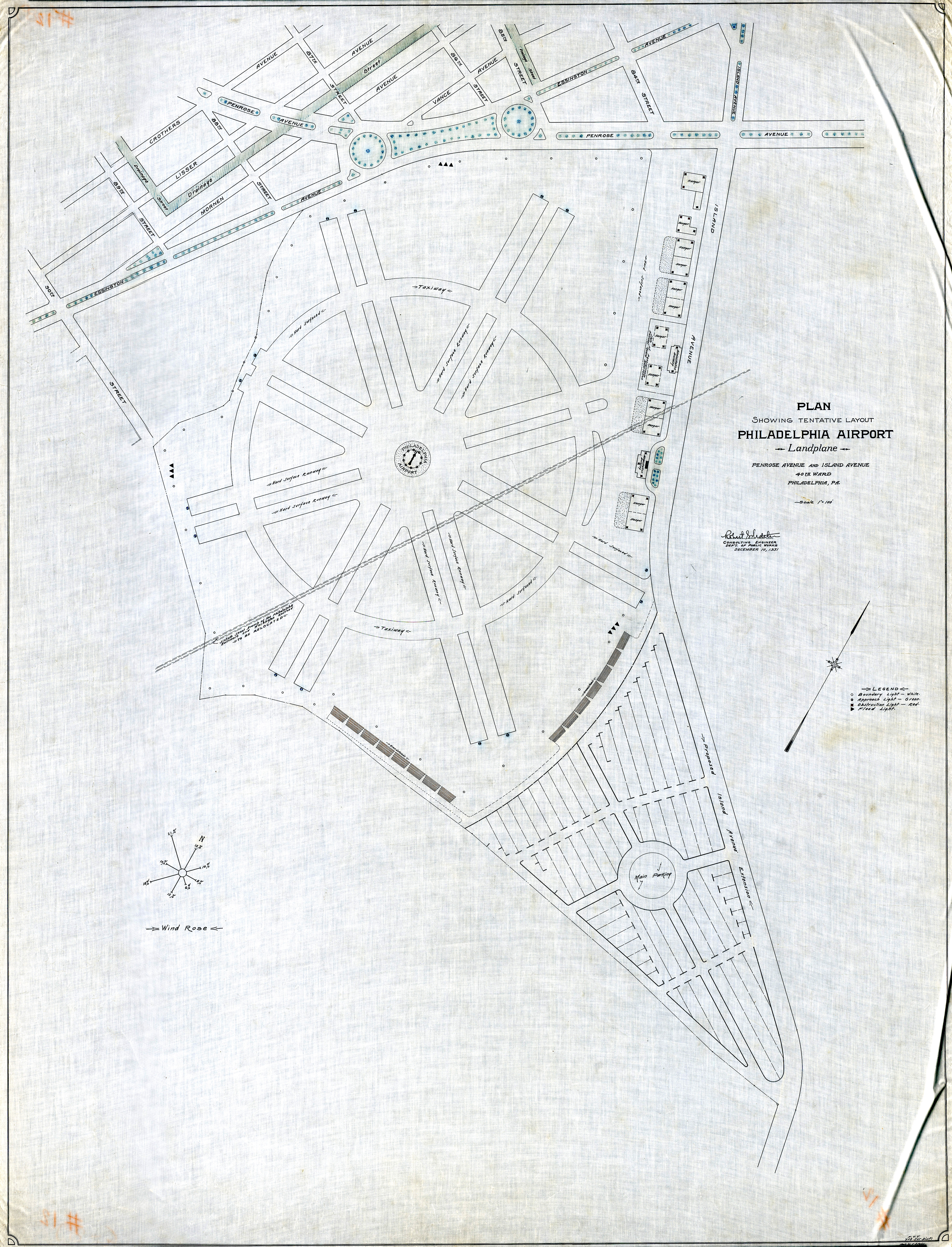
The most interesting feature of these maps are the provisions for landings and takeoffs. The plan at the top shows a giant 4000-foot-diameter “all-ways” landing field, the entirety of which was “to be hard surfaced.” This aeronautic free-for-all, with planes coming and going willy-nilly, was abandoned within the year; on the second plan the delineated areas for runways and taxiways begin to resemble the configuration the airport eventually adopted.
The third plan shows the actual conditions on which the airport was to be built, a patchwork of marshland, interlaced with tidal creeks (bordered by earthen dikes) and with a railroad cutting through the proposed landing area. As unlikely a setting for an airport as this may seem to be, eventually the marsh was filled in, the railroad was moved, and the vision – if not exactly following these plans – was fulfilled.
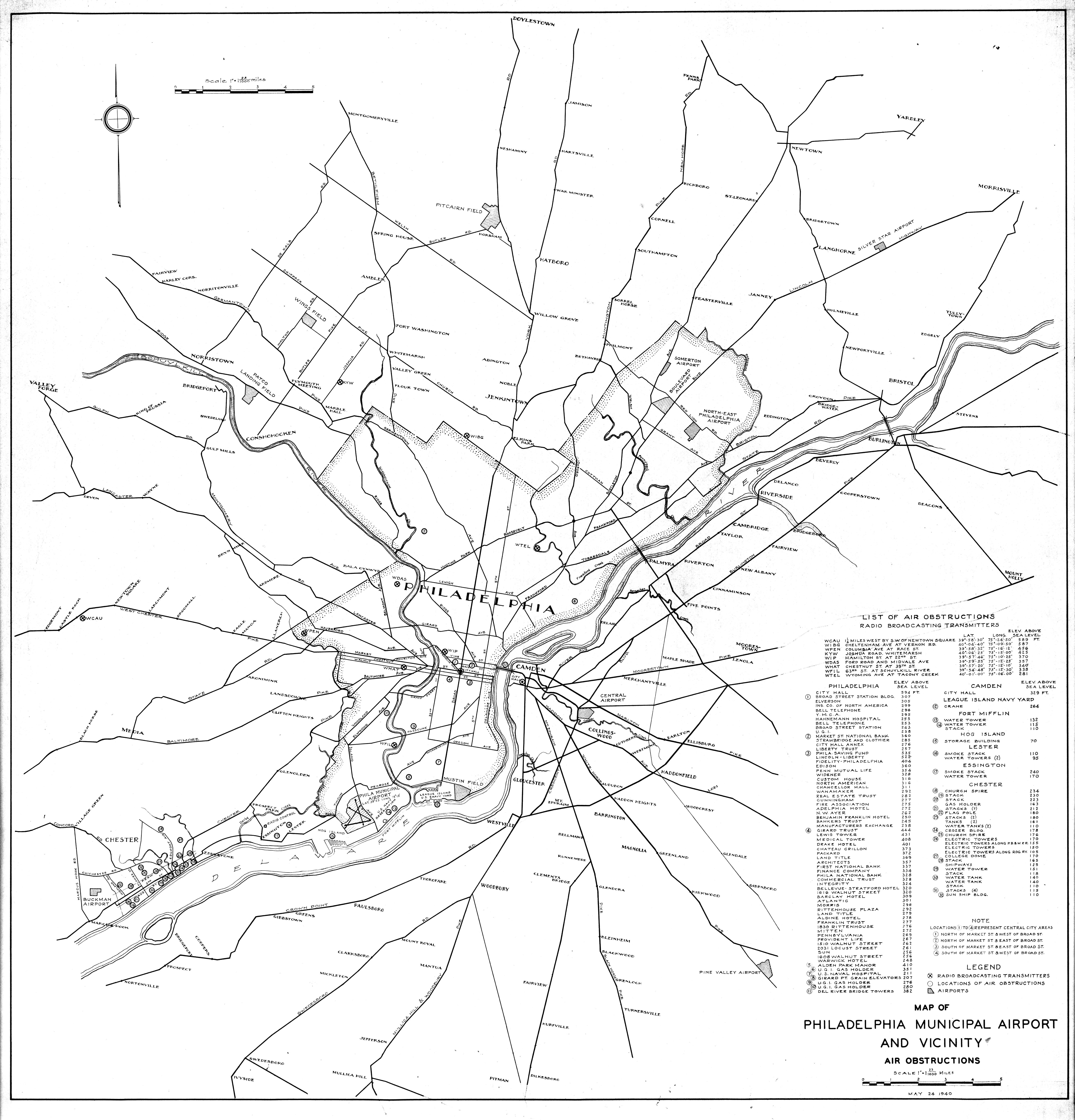
This next pair of maps may seem unrelated at first. Above is a 1928 map from a report which recommended that the main airport for the Philadelphia region be located in Springfield Township, Delaware County. Below is a map showing air obstructions in 1940, which is most interesting to me for its list of the tallest buildings, towers, smokestacks, and other hazards in the area at that time.
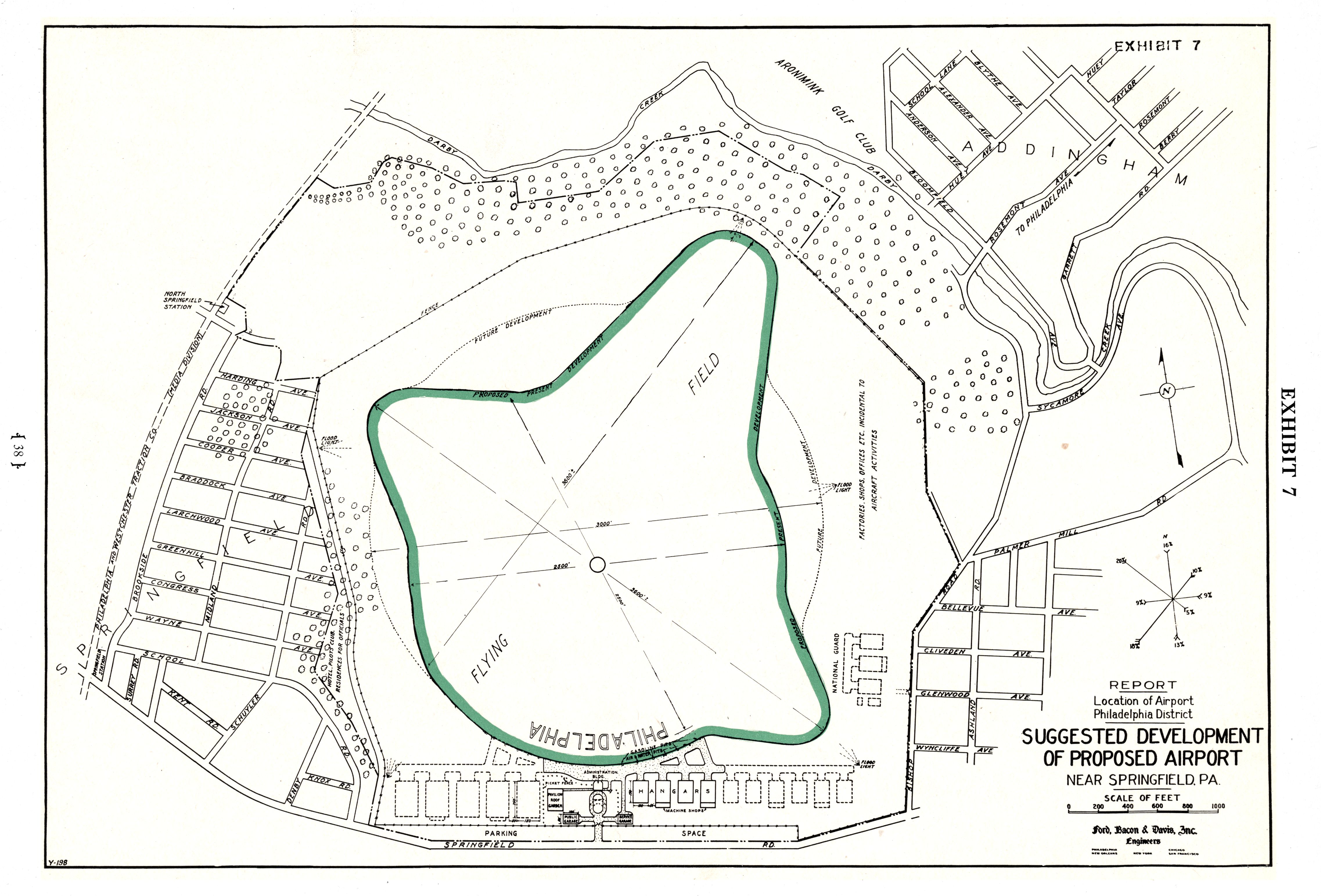
The connection between these two is that Springfield was recommended in part because of the site’s relatively high elevation compared to riverfront locations: “On account of its elevation and remoteness from large water or wet land areas, the prevalence of fog and ground mist is reduced to the minimum for the district. Its elevation above all surrounding property renders it least liable to irregular wind currents. Its position to the west of Philadelphia and northerly from Chester protects it from smoke from Philadelphia or from Chester except with southerly to easterly winds, which are infrequent, the prevailing winds being westerly. It is surrounded by farming and residential districts at lower elevations, leaving it free from obstacles and other hazards in the air approaches.”
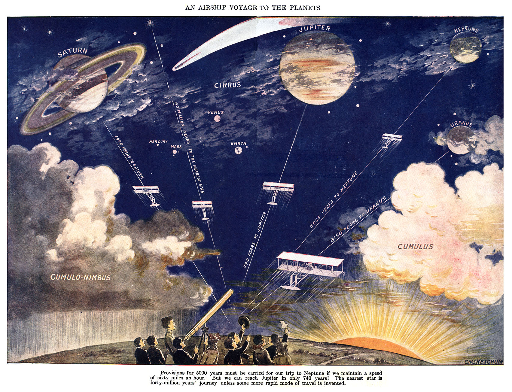
And finally, because the subject is airports and air travel, I can’t resist posting this futurisitic “map” from 1924, about the possibility of both interplanetary and interstellar air travel. Artist Charles Ketchum, basing his calculations on the 60 mile per hour flight speed of a gasoline-powered biplane, notes that a trip to Neptune would take 5,000 years, and that “the nearest star is forty-million years’ journey, unless some more rapid mode of travel is invented.”
More information about the Springfield airport location, and other airports in the region at the beginning of commercial aviation, can be found in the Report with supplements [on the] location of airport, Philadelphia, PA. District, submitted to the city in December 1928 by Ford, Bacon & Davis, Inc., Engineers. More maps and plans of the Philadelphia Airport and its buildings can be found at this link on the Greater Philadelphia Geohistory Network, a website created and maintained by The Athenaeum of Philadelphia. Plug the keyword “airport” into the search box, and enjoy!