![Black-and-white diagram showing streets and the Little Tacony Creek](https://waterhistoryphl.org/wp-content/uploads/plan-of-private-sewer-dyre-street.jpg?w=300)
![](https://waterhistoryphl.org/wp-content/uploads/Frankford-creek-1934-2004.097.0034-crop.jpg?w=300)
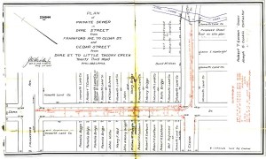
Frankford Creek Watershed Historical Timeline
![Black-and-white aerial photo of a creek bend with industrial buildings surrounding it](https://waterhistoryphl.org/wp-content/uploads/Frankford-Creek-removal-of-bend-above-Bridge-Street-1934.jpg?w=300)
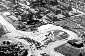
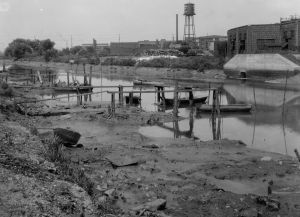
Filling valleys and other lowlands, cutting down high ground, piping streams into sewers, filling marshland, dredging and damming streams and rivers, and any other activities or infrastructure designed to alter the original topography of the city to more readily accommodate real estate development.