Map of Philadelphia Harbor, Delaware and Schuylkill, 1912
Chart showing Harbor of Philadelphia, Delaware and Schuylkill Rivers, and points of interest. Prepared under the direction of Joseph S. Hasskarl, Director, Department of Wharves, Docks & Ferries, Philadelphia.
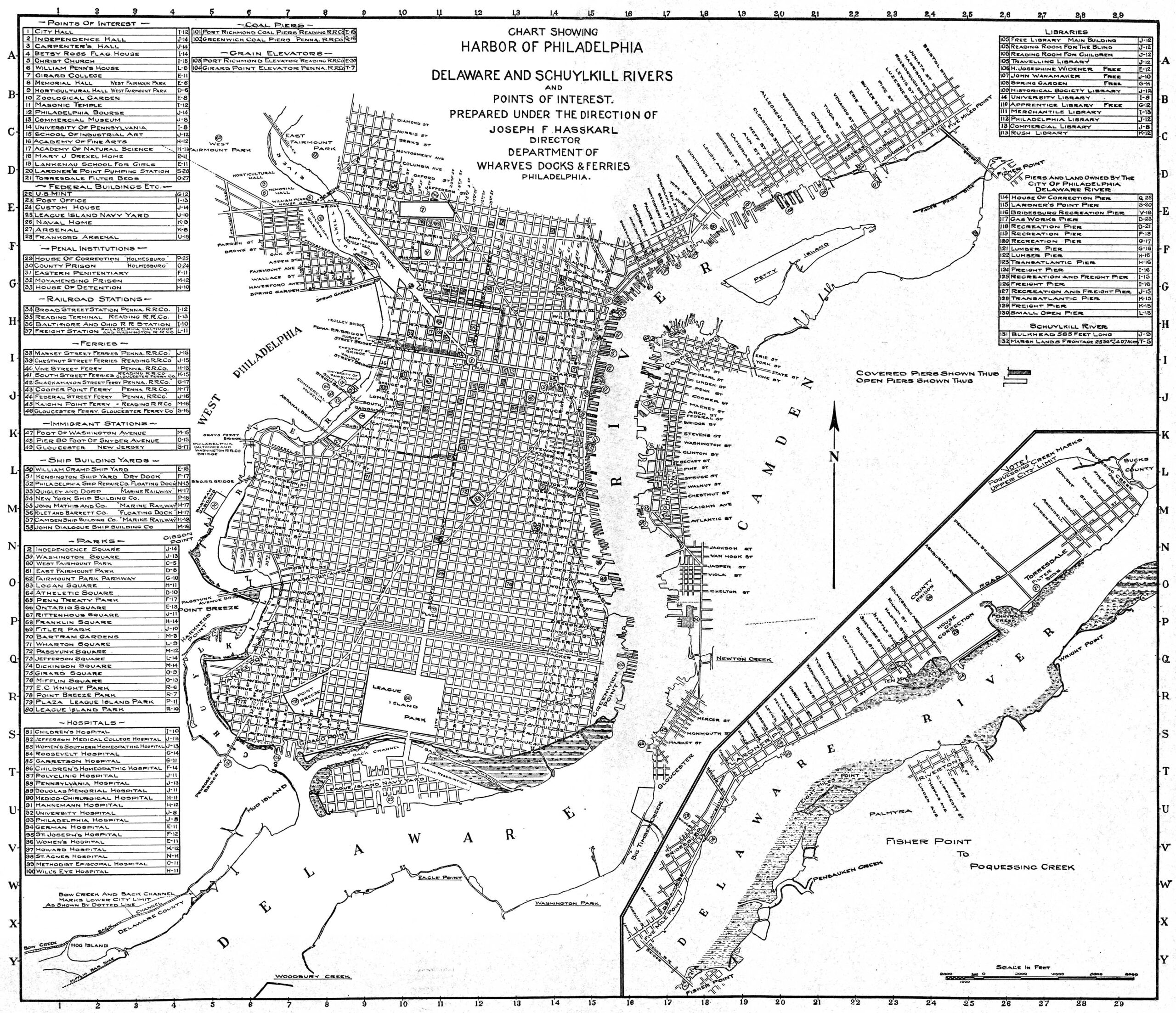
This map was bound into a hardbound souvenir book: The Port and City of Philadelphia. Prepared by Frank H. Taylor and Wilfred Schoff for the 12th International Congress of Navigation. Representatives of 16 countries attended the congress, which was opened on May 23, 1912 by U.S. President William Howard Taft. To see a front page article from the Philadelphia Inquirer about this event, click here.
As was common for maps of Philadelphia at this time, many of the street lines were so-called "paper streets," that existed only on city plans. For a more honest view of one part of South Philadelphia, compare this 1916 plan, "showing the location of pools of water, creeks, ditches & marsh lands, in area bounded by Broad St. on the east, the Schuylkill River on the west, Reed St. on the north and Government and Schuylkill Aves. on the South." Clearly a lot of landfilling remained to be done before these areas could be fully developed.