About 45 years ago a group of Philadelphia Water Department staff rescued a trove of books and files from the attic of an unused PWD building which had a hole in the roof. The items underneath or close to the hole had disintegrated into pulp after repeated exposure to the weather, and many of the survivors had water and mold stains. Pigeons had taken shelter in the space, and bird poop coated the covers of many of the documents.
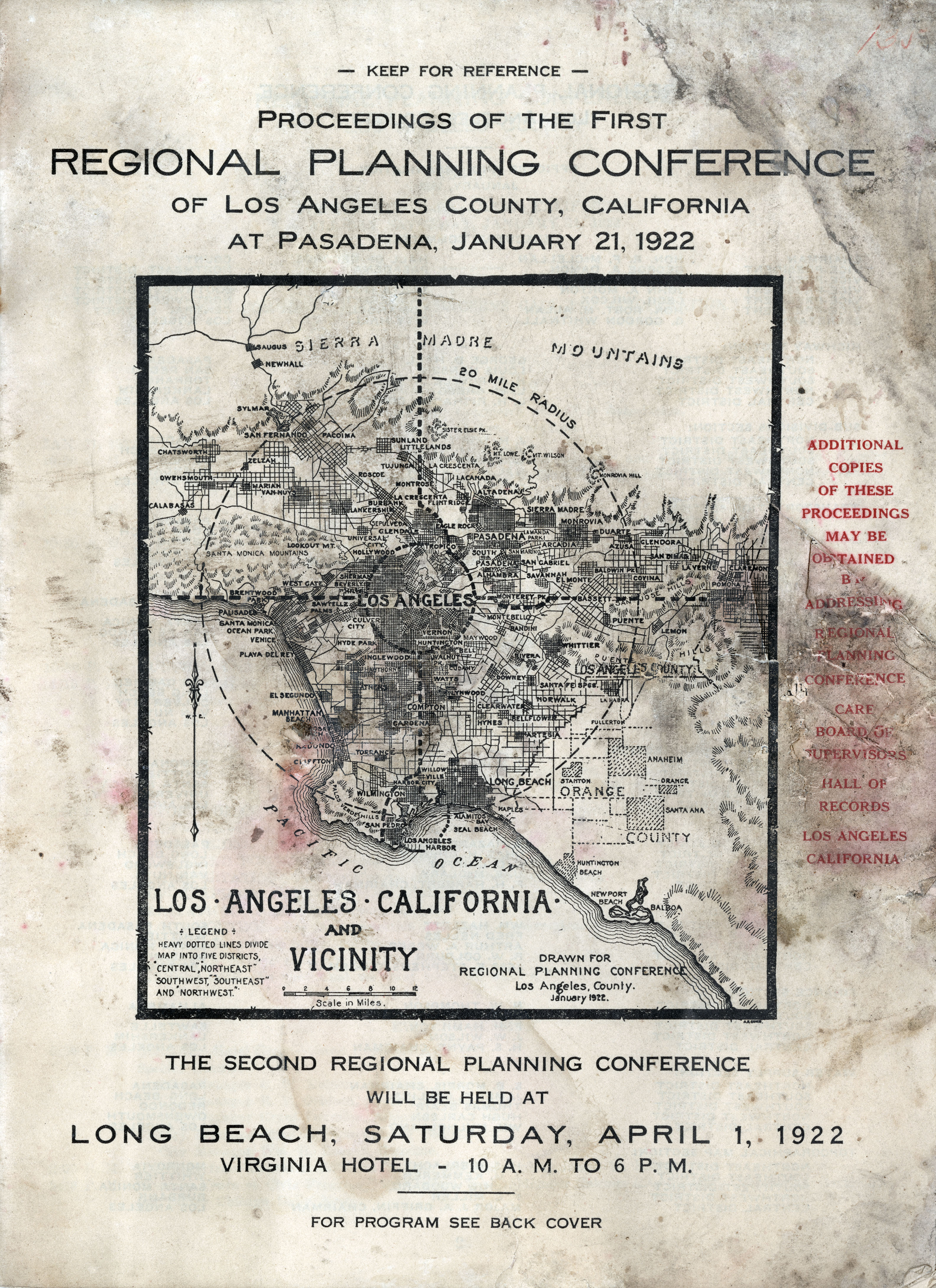
Among the items saved were early 20th century files from the Bureau of Surveys of the Department of Public. One folder, documenting city planning efforts in Philadelphia and elsewhere, included this brochure for the first Regional Planning Conference in Los Angeles County, California, in 1922. Considering the recent devastating wildfires that ravaged the city in January, I thought resurrecting this item and posting it here might be timely.
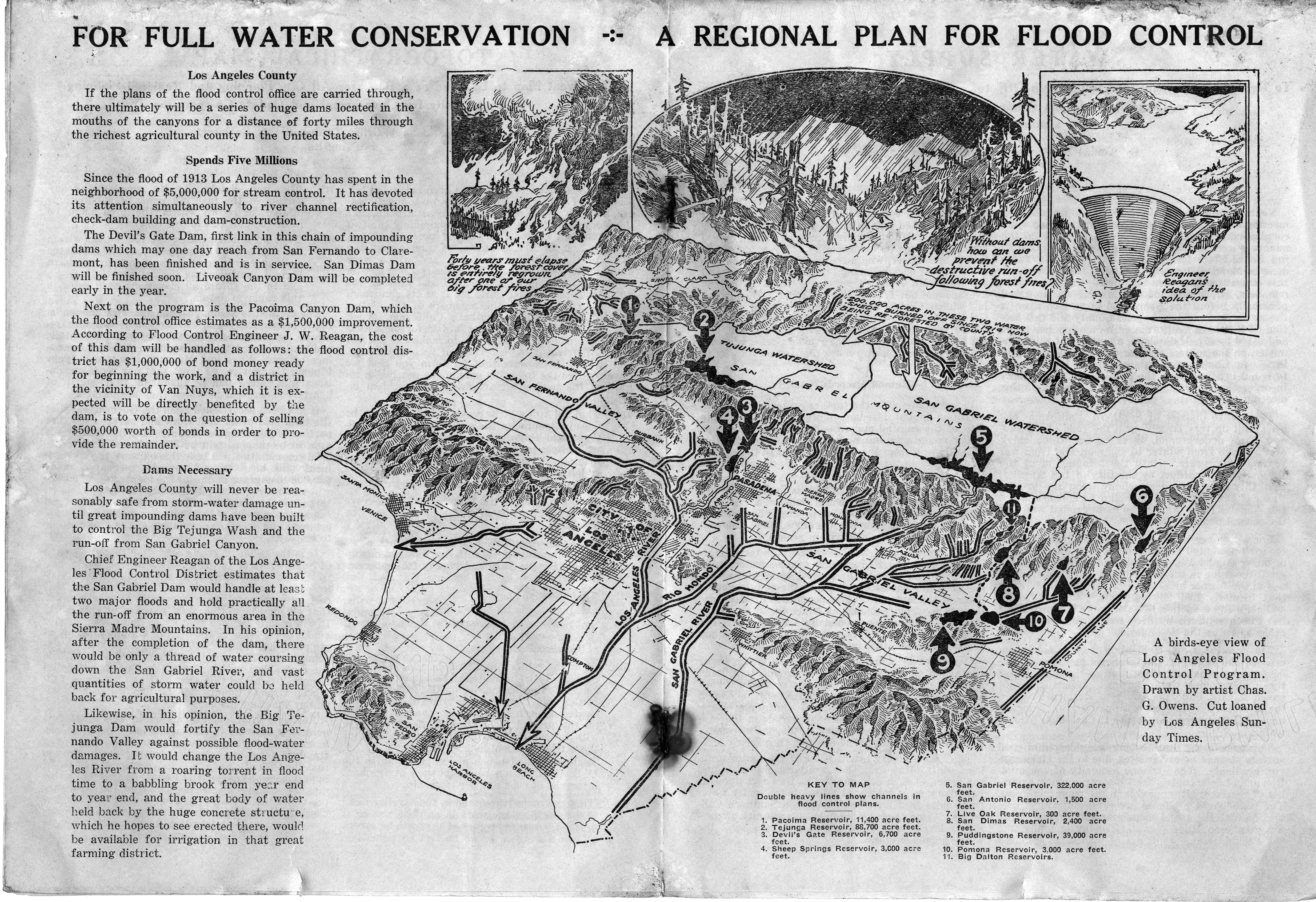
This publication includes two depictions of Los Angeles: a conventional map and a topographical illustration, both of which clearly show how closely juxtaposed that city’s built up areas are to its forested, mountainous areas. My thoughts go out to those whose lives have been upended by the fires; perhaps this brochure will provide inspiration as rebuilding efforts begin.