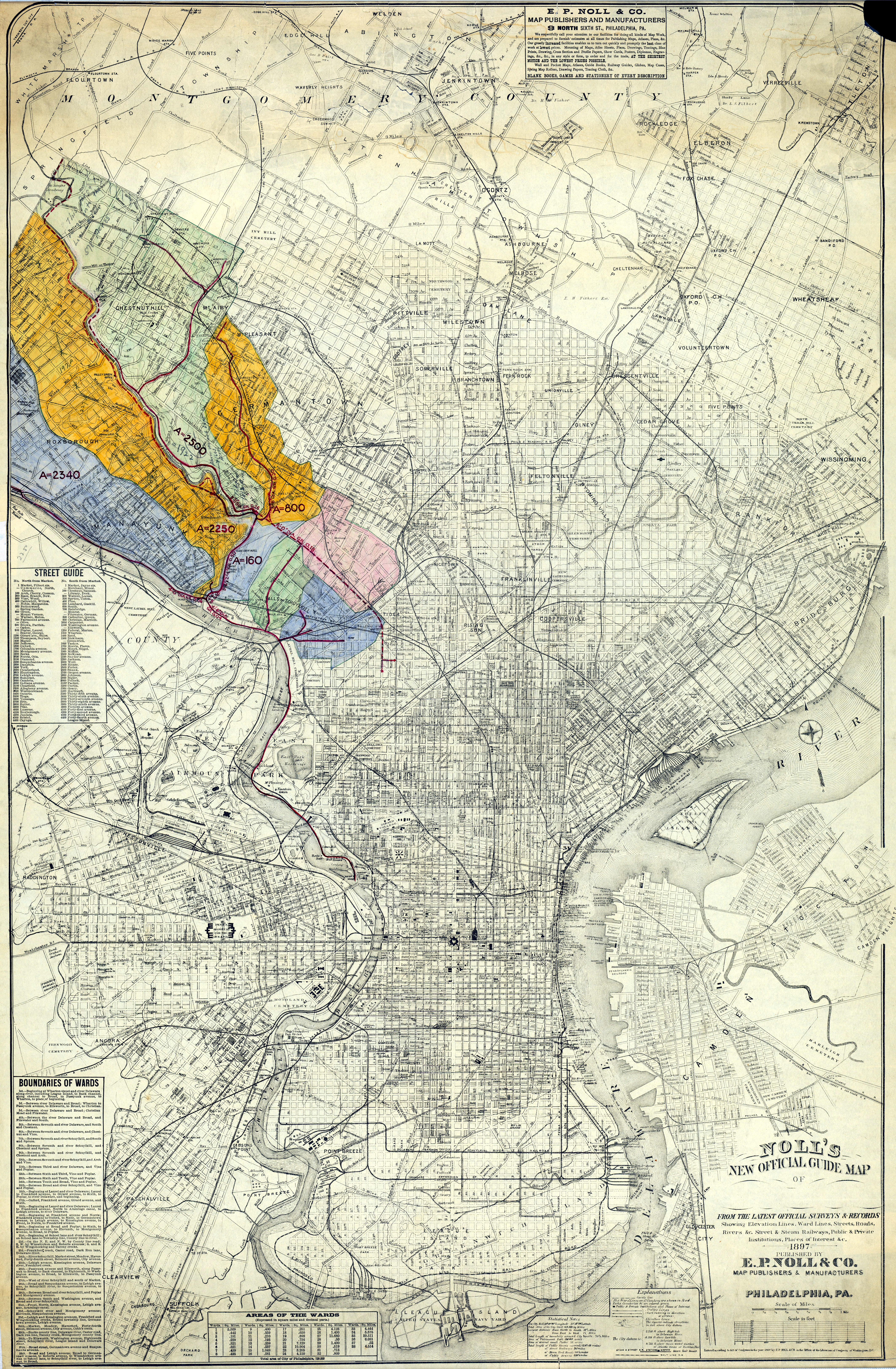
FULL TITLE Noll’s new official guide map of [Philadelphia] from the latest official surveys & records, showing elevation lines, ward lines, streets, roads, rivers, &c., street and steam railways, public and private institutions, places of interest, &c. Published by E. P. Noll & Co., map publishers & manufacturers, Philadelphia, PA.
DATE 1897, with colored annotations added circa 1897-1910
SIZE 45 inches x 30 inches. The file linked to the above thumbnail is half the size of the original scan. Click here to download a higher resolution PDF of this map.
DESCRIPTION The colored areas in the northwest section of the city indicate drainage areas to the Schuylkill Intercepting Sewer, which ran along the east bank of the river to collect sewage that would have otherwise flowed into the river and polluted the water supply above the Roxborough, Queen Lane, Belmont, Spring Garden, and Fairmount Water Works pumping station intakes. The numbers probably indicate the area in acres of each drainage area.