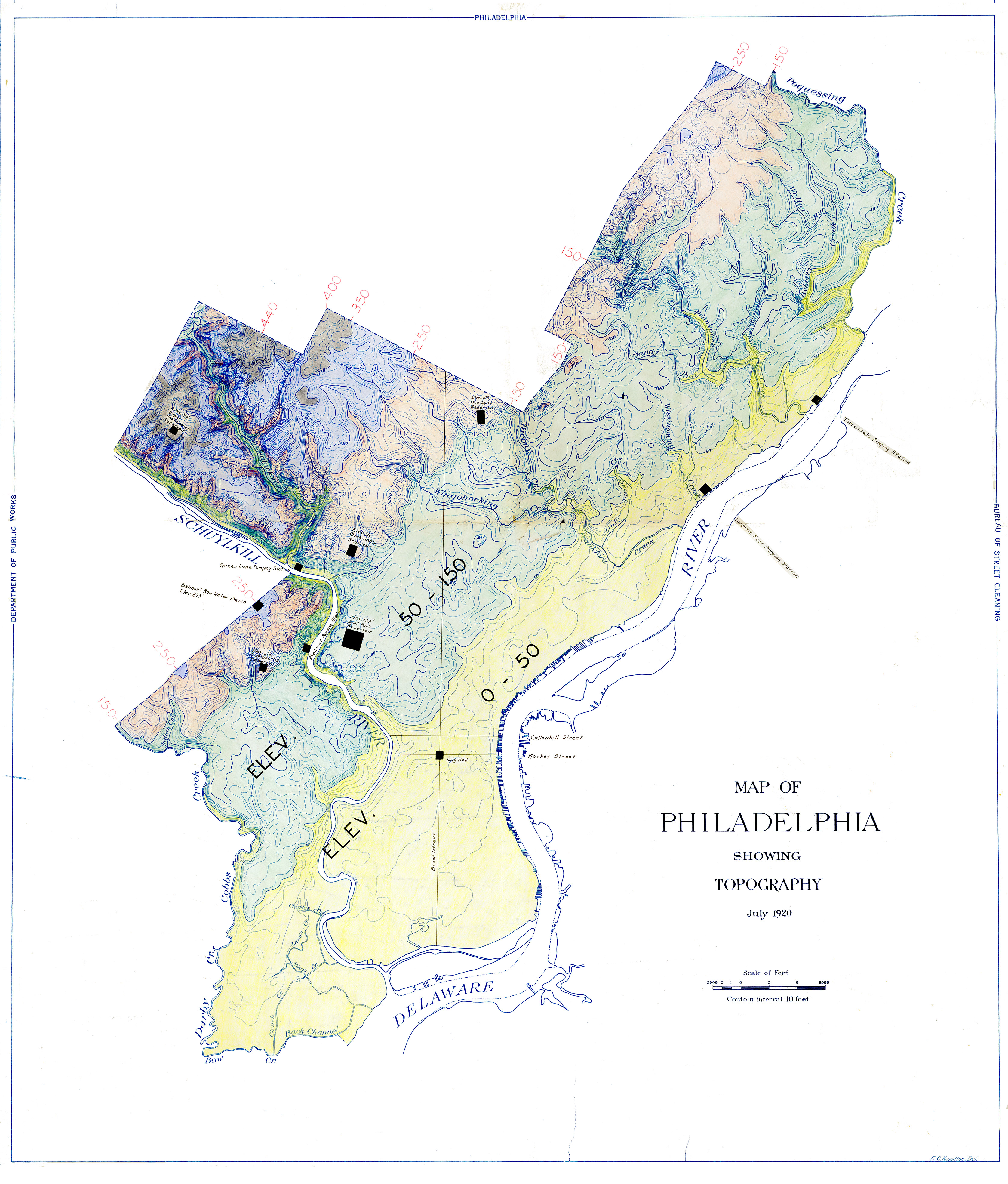
FULL TITLE Map of Philadelphia showing Topography. July 1920. Department of Public Works, Bureau of Street Cleaning. E.C. Hamilton, delineator. (Blueprint, overdrawn with ink, colored pencil, and colored marker or watercolor; scan digitally edited)
DATE 1920
SIZE 36 x 47 inches
SOURCE Philadelphia Water Department Historical Collection
WHY DO I LIKE THIS MAP? The city’s topography has long ben an interest of mine, and this map clearly shows the different topographical regions, with color coding raging from yellow for the lowlands to violet for the highest points. Though the original drawing was done for the Bureau of Street Cleaning, the overdrawn information on this blueprint was clearly done for Water Department use. This includes elevations of all the reservoirs and standpipes in the distribution and storage system, and the location of several pumping stations. The hand coloring indicating the various elevations may also have been done by PWD staff.
One important note: these elevations indicate the level of the ground in 1920, and in developed areas of the city do not account for all the alterations undertaken to provide proper drainage of the streets, which included cutting down high ground, filling up low ground, and burying a hundred or more miles of streams in pipes and then filling up the former valleys. See this page on WHPHL for more details on this process.
MORE INFORMATION The original scan was 772 mb, and while the .jpg file presented here is several magnitudes smaller, I think I can say that the information is as clearly readable as in the original. The version presented here was edited in Adobe Photoshop to remove the distracting brown background, and adjusted to brighten the colors of the original scan. I like to do this to make a map more readable, but also as a challenge to myself to see how pretty I could make what was otherwise an old and dirty map. I can sit for hours sometimes working these maps over, removing only the distractions while altering none of the essential information.
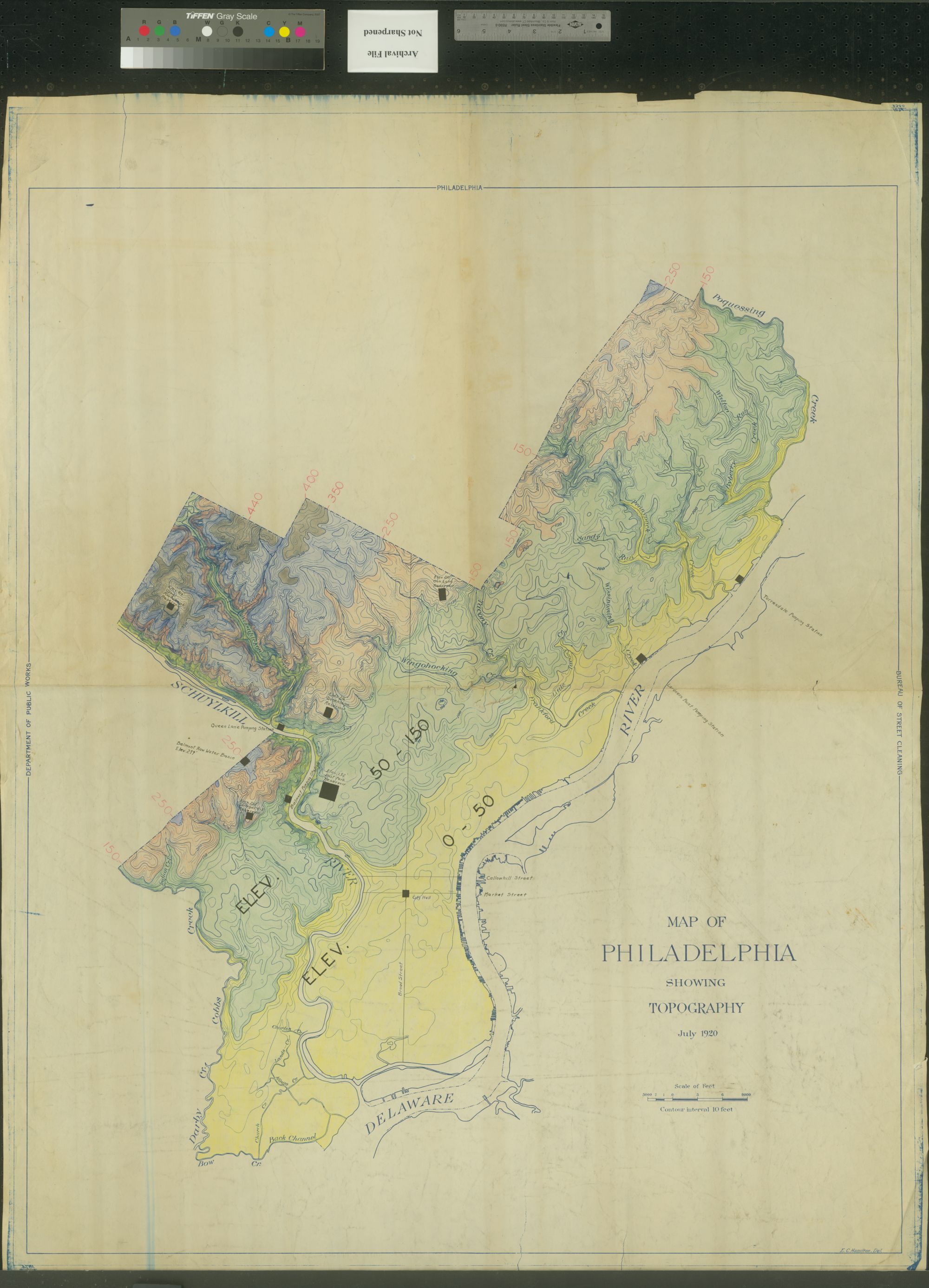
In this way I am like a painting conservator, who by removing a layer of varnish or soot reveals the brilliant colors hidden beneath. I don’t necessarily consider my restored map more authentic than the original, but to my eye it is easier to read, and certainly closer to what the creator intended. For any archival purists who believe that what comes off the scanner is what must be presented to the public, I can assure you that I always preserve the original scan. A thumbnail of the original of this map is below, and I will let you judge if my late night, obsessive Photoshopping of this map was worth the effort.
I found this map sitting on top of a filing cabinet with a jumble of other historic material, including late 19th century topographical maps of the city. These things had clearly been abandoned by whoever had once possessed them, and I brough them up to the PWD Archives for safekeeping. So many things that could end up as cherished items in archives get tossed into wastebaskets, and I didn’t want these things to go down that path to oblivion. They were once cherished–well, if not cherished, at least considered useful and important by whoever created and used them–and now they can be cherished again.
SIMILAR MAPS Historic topographic maps produced by the US Geological Survey and dating back to the 1890s are also available. To find your map, type a place name in the search box, click on the dropped pin on the map, and then click VIEW to access downloadable PDF files. These USGS maps use 10 or even 20 foot contours. For a more detailed series of topographic maps showing specific areas of Philadelphia, you can visit this trove of city plans (which I excavated from the Streets Department files and cataloged and arranged to have scanned) at the Greater Philadelphia Geohistory Network of the Athenaeum of Philadelphia. Put the word “topography” in the search box and you’ll get hundreds of results. The Geohistory site also has other topographic maps in its general resources, including this remarkably detailed topographic plan of Fairmount Park, created in 1938 by the Federal Works Progress Administration.