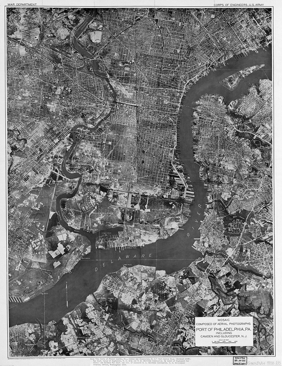
Aerial photography of the port of Philadelphia, Camden, and Gloucester in 1938

FULL TITLE Mosaic composed of aerial photographs, port of Philadelphia, Pa. : including Camden and Gloucester, N.J.
SOURCE Library of Congress
DATE 1938
WHY I LOVE THIS PHOTO/MAP? This item combines my two favorite types of historical items – photographs and maps – into one remarkably detailed snapshot of parts of Philadelphia and adjacent New Jersey communities on the eve of World War II. You can zoom in and see a myriad of landscape features – factories, houses, stadiums, streams, marshland, etc. – that no longer exist. (Be aware that because this is a compilation of a number of photographs, some sections do not align perfectly.)
MORE INFORMATION The photomap was part of a larger publication titled: “The Ports of Philadelphia, PA., Camden and Gloucester, NJ. Port Series No. 4 (revised 1938.) War Department Corps of Engineers, U.S. Army and U.S. Maritime Commission. By Board of Engineers for Rivers and Harbors War Dept. and Div. of Research, U.S. Maritime Division. U.S. Government Printing Office, Washington, DC, 1939.” The Library of Congress notes that it was “Reproduced by permission of the Regional Planning Federation of the Philadelphia Tri-State District, makers and copyright owners.”
MODERN VERSIONS If you want to compare this 1938 view with modern aerial photography (also called orthophotography), Google Maps has a very detailed layer, which has the advantage of being easily searchable by address. If you want to download images of the Philadelphia region from various years, visit this page at the Penn State digital library. It is a little hard to figure out, but basically you can click on the map tiles and download huge files of particular areas. For older orthophotography, the Delaware Valley Regional Planning Commission coverage from 1965 to 1995 (which I have used elsewhere on WaterHistoryPHL) is also available for download from Penn State. To decide which tiles you want to download, you can first consult the index maps at the DVRPC website. And if all of this seems confusing, feel free to contact me at the link below.