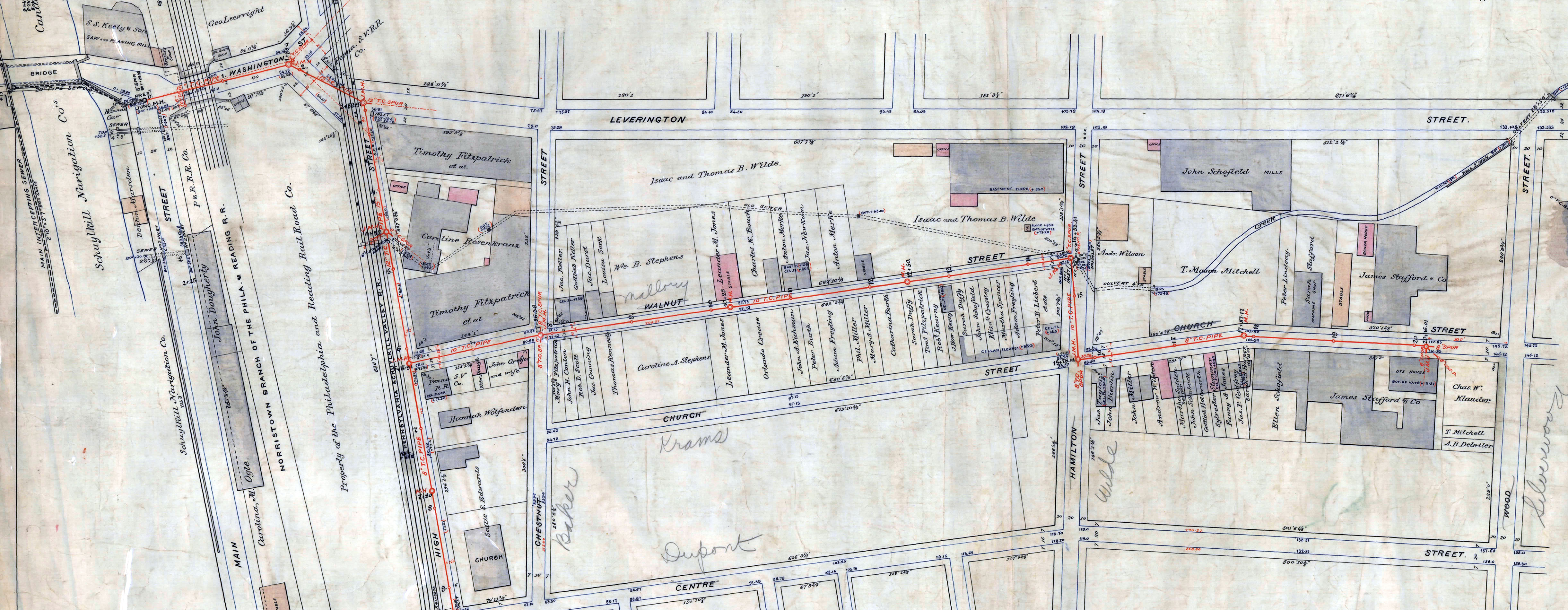
When I wrote about the Leverington Avenue stormwater sewer in 2006, I knew that the sewer captured one of a number of small streams that flowed down the steep slope between Ridge Avenue and the Schuylkill river. But since that article was focused on the broader historical issues related to the development of sewers for Manayunk, I didn’t think to look for more information on the stream itself. I focused only on the plan below, found in the records database of the Philadelphia Water Department, which showed an unnamed stream flowing into what was labeled an “old sewer.”
This was also long before the wealth of online resources made research in old books, maps, photographs and other images far simpler than searching these items out in the city’s dozens of historical collections. Since 2006 I have also found new plans that have added many details to my understanding of the growth of the city’s neighborhoods and infrastructure. Many of these plans are part of the City Plans collection of the Philadelphia Streets Department, such as the 1848 Dripps map of Roxborough and Manayunk, a piece of which is shown below.
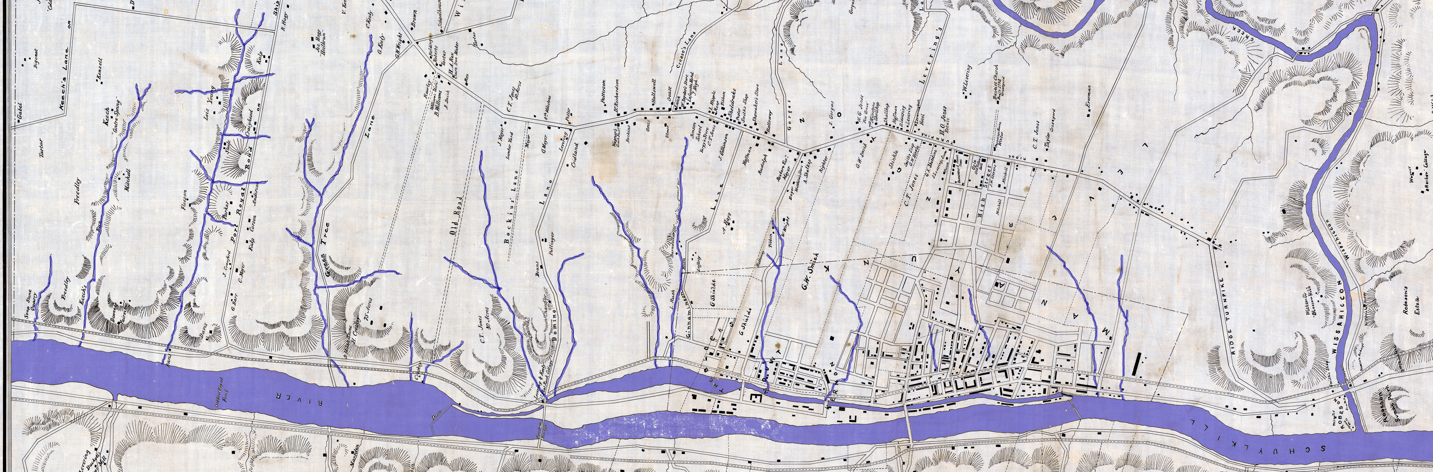
Like the PWD plan, the Dripps map does not name the stream that wound around what is now Leverington Avenue. But if I had thought to look for it on Plate 22 of the Smedley Atlas from 1862, I would have learned that it was called Still House Run. This name probably refers to a still building that was once located somewhere along the stream but, even by Smedley’s time, seems to have been forgotten.
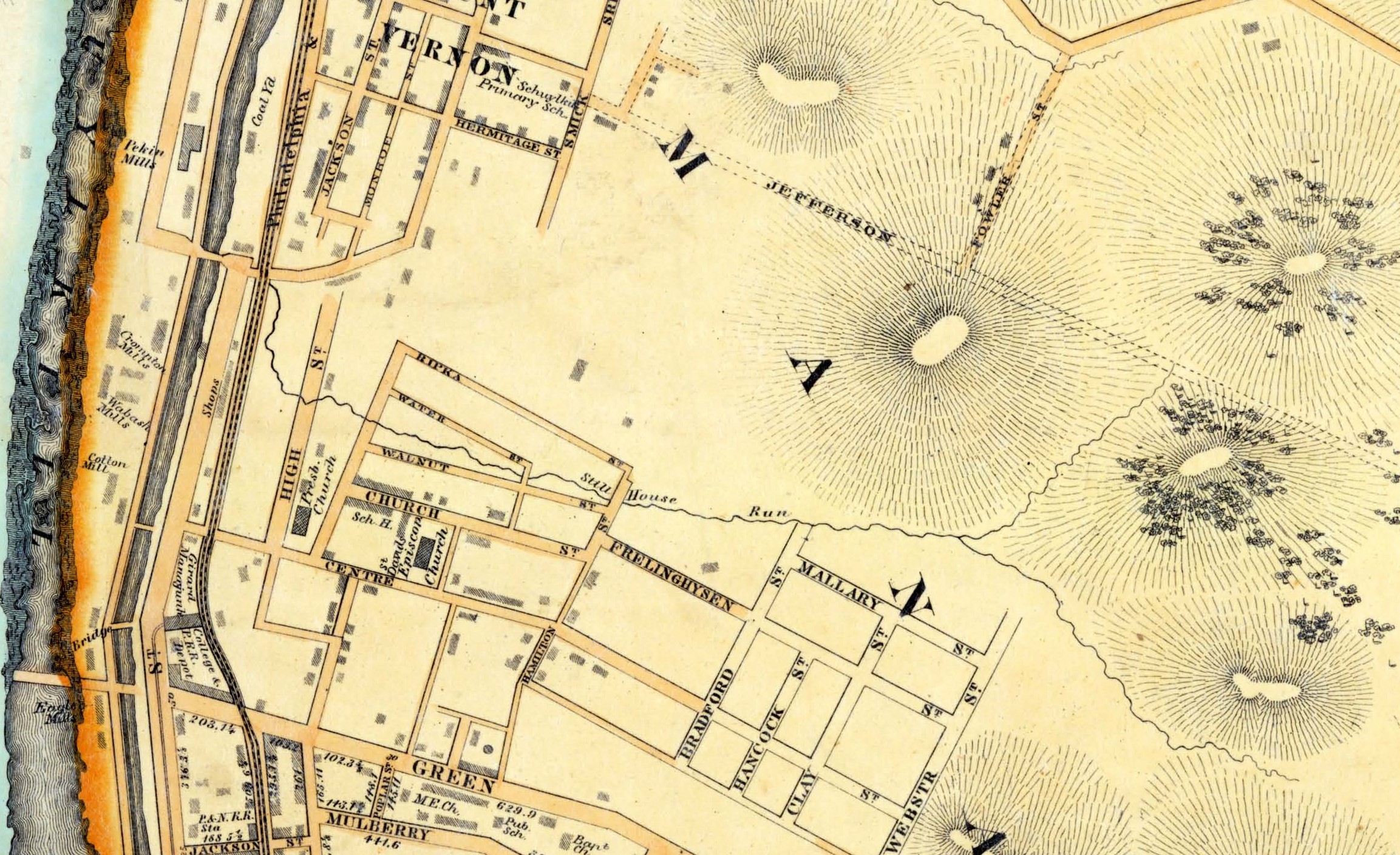
As indicated by the PWD plan, and in perusing later maps, I would have seen that the stream must have had enough flow to provide water for several factories that were built around it. The 1875 Hopkins Atlas of the 21st and 28th Wards, on plates A and D, shows a couple of ponds in the upstream part of this small watershed, and the several factories near Leverington Avenue and further downstream. More factories existed by 1895, as shown below, although by then the stream had been mostly encapsulated in a pipe.

Seeing this cluster of industry made me think I might glean more information about the stream from the high-resolution scans and excellent index of the Hexamer General Surveys, online via The Athenaeum of Philadelphia’s Greater Philadelphia Geohistory Network website. Searching the index for “Manayunk” I found plans for several of those factories. These confirmed my guess, in the original article, that the water from Still House Run was used for various industrial processes, and was polluted when waste water from the factories was turned back into the stream.

On the 1910 map below, Still House Run – and all the streams adjacent to it – are gone and forgotten, absorbed into the city’s infrastructure, running underground in sewers instead of on the surface.
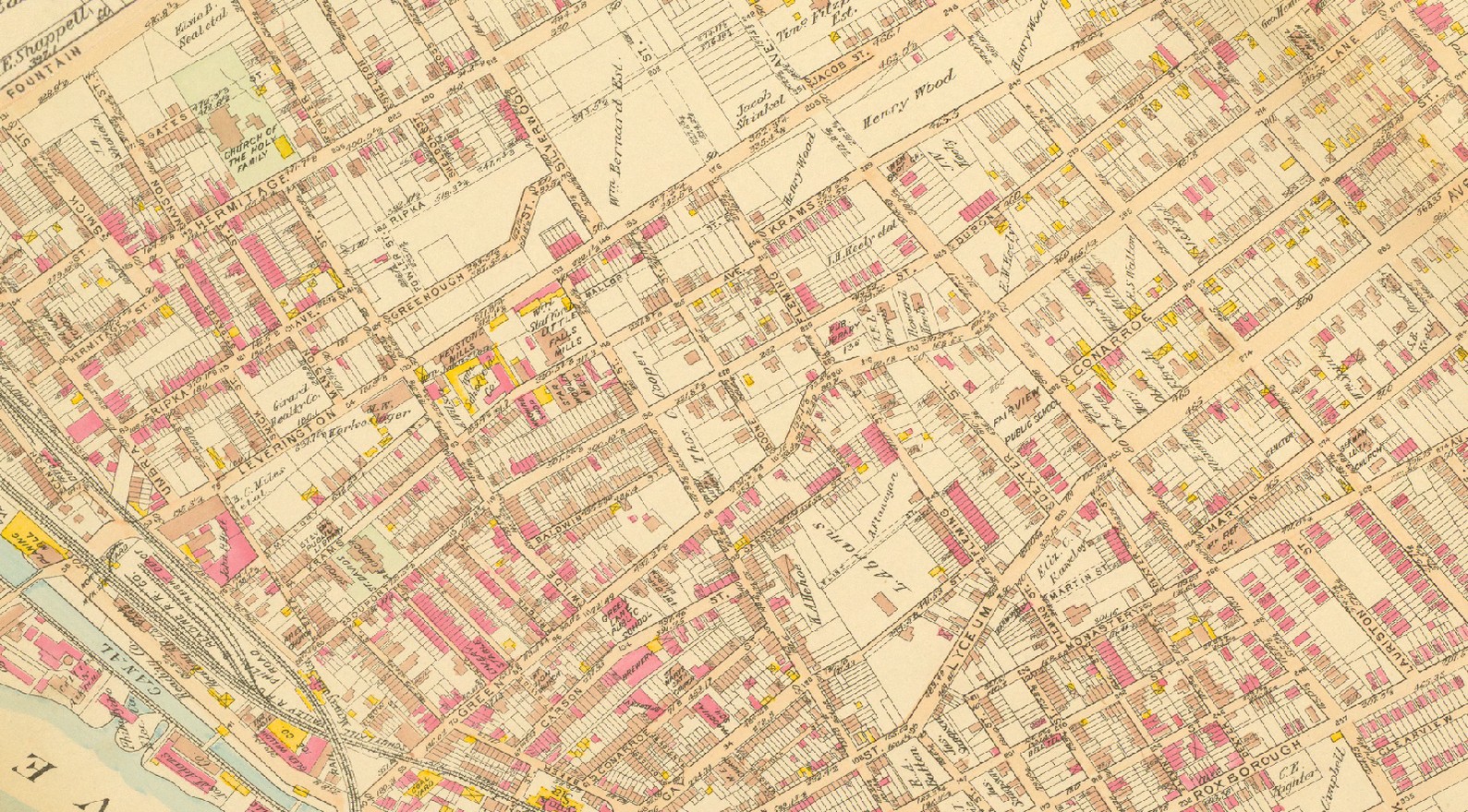
(Apologies to Peter Seeger. Map source: Bromley Atlas of the City of Philadelphia, Plate 33, The Athenaeum of Philadelphia, Greater Philadelphi Geohistory Network)