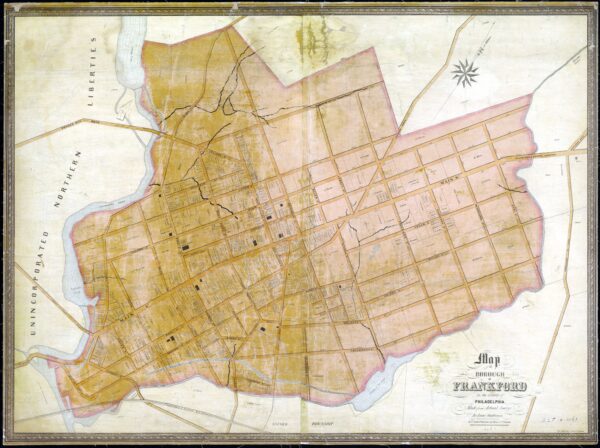
Map of Frankford Borough, 1845
Frankford was one of the municipalities in Philadelphia County that was absorbed into the city with the Act of Consolidation in1854. This map shows property owners, and the main streams that traversed the borough, including Little Tacony Creek, Frankford Creek, and others without names. Also shown are several named ponds, formed behind several dams on those streams, which provided water for the boroughs numerous factories. The full title of the map reads: "Map of the borough of Frankford in the County of Philadelphia made from actual survey by Isaac Shallcross. R. P. Smith, Publisher, 15 Minor St., Philada. [1845]. Thanks to the Historical Society of Frankford for allowing me to post this map here. A less detailed version of the map, which was adopted as the official street plan for the borough in 1847, can be found at the Greater Philadelphia Geohistory Network.
