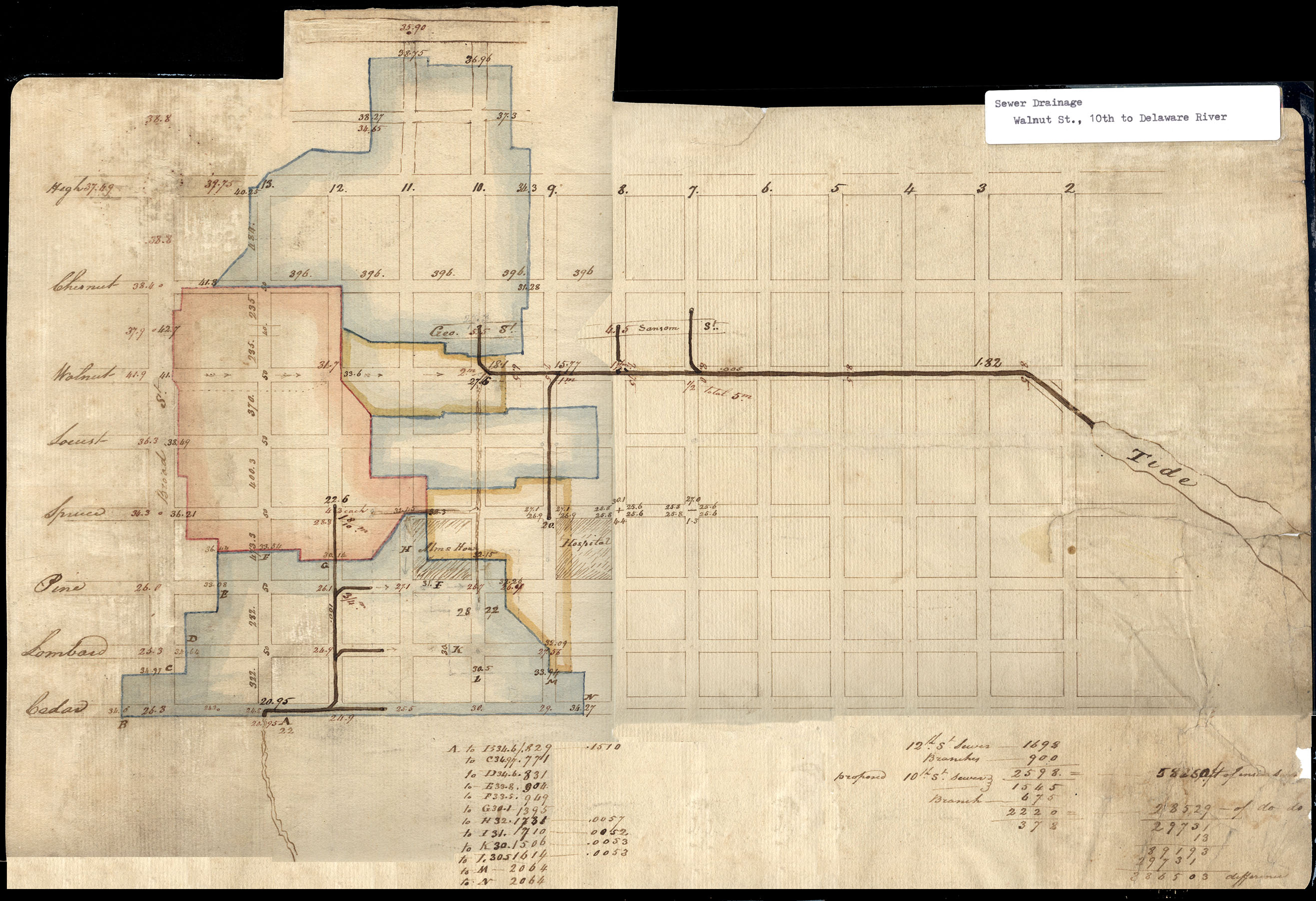
Drainage area plan, early 19th century
Plan of drainage areas leading to various sewer inlets, early 19th century. Each colored area represents a small “watershed.” The numbers at the bottom of the plan are calculations of the various drainage areas, which helped determine how large to make the receiving sewers. The sewers emptied directly into the nearest streams: Dock Creek, on the right, and Chickhausing (or Shackhansing, or Shackhanson) Creek, at the bottom of the plan. At this time sewers carried only storm drainage, but this was highly-tainted with the manure of thousands of horses, as well as household wastes that were deposited in streetside gutters.