![Map of Philadelphia showing Population in year 1920](https://waterhistoryphl.org/wp-content/uploads/ct008336.jpg?w=300)
By a draft of Foxhall & Morris purchase : [Philadelphia] April 1, 1802
![Map of the County of Philadelphia from Actual Survey, 1839 (la000784a)](https://waterhistoryphl.org/wp-content/uploads/la000784a.jpg?w=300)
Map of the County of Philadelphia from Actual Survey, 1843
![Outline Map of the County and City of Philadelphia and Vicinity (wd000516)](https://waterhistoryphl.org/wp-content/uploads/wd000516.jpg?w=300)
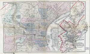
Outline Map of the County and City of Philadelphia and Vicinity, 1883
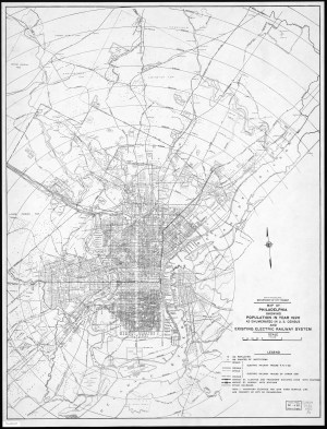
Philadelphia the Manufacturing and Industrial Capital map, 1906
![Upper Ferry Bridge over the Schuylkill (Graff09.03)](https://waterhistoryphl.org/wp-content/uploads/graff09.03-scaled.jpg?w=300)
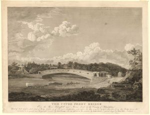
Upper Ferry Bridge, 1820
![Upper Darby map, G.M. Hopkins 1877](https://waterhistoryphl.org/wp-content/uploads/Hopkins1877_UpperDarby_AEL-scaled.jpg?w=300)