Adam Levine’s report on this Wissahickon Creek tributary first appeared on PhillyH2o in 2009, and was updated in 2024.

HISTORICAL OVERVIEW: This small watershed covers about 446 acres in the Roxborough and Andorra neighborhoods on the western flank of the Wissahickon Valley. Until the mid-20th century, the watershed was mostly rural, with scattered homes and estates throughout the area and concentrated residential development in several sections along Ridge Avenue. The post-World War II housing boom, combined with the widening of Henry Avenue in the mid-1950s, opened up the watershed to denser development that today includes numerous high-rise and low-rise apartment complexes, and a sprawling shopping center that sits on top of the stream’s original source.
Historical resources in the watershed (such as dams, spring houses, and nearby ruins of old buildings) are outlined in the “Description of Streams and Features” below. An inventory of all historically significant resources within the watershed was beyond the scope of this report.
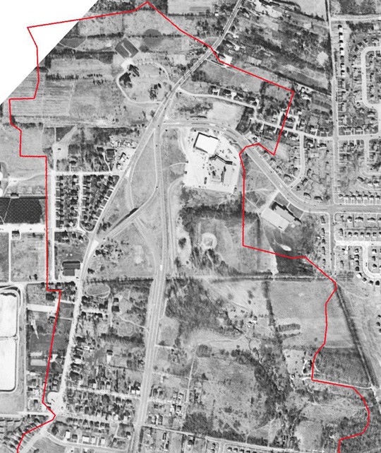
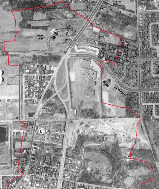
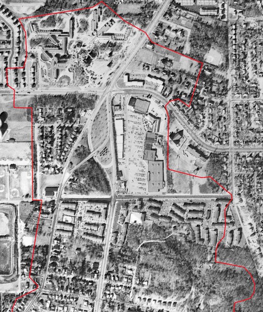
This sequence of maps shows how this small watershed has changed over time.
A NOTE ON STREAM NAMES For several reasons I would propose that the main stream in this 446 acre watershed be called Andorra Run, rather than Wise’s Mill Run as has been previously used. First, the portion along Wise’s Mill Road is the smaller section, with the largest section of the watershed (as well as the historical source of the stream) in the city’s Andorra neighborhood.
Second, if the proposed wetland at the upper end of Wise’s Mill Road is built, the Fairmount Park Commission will likely want to install interpretive signage to describe the project. For that purpose alone, naming both extant tributaries is important. And since it flows in a valley paralleling Wise’s Mill Road, the Wise’s Mill Run designation makes the most sense for the stream emanating from the wetland. Japanese Run might seem a strange name for the smallest tributary, but it is derived from a Japanese garden marked on the Klinge Map of 1929–rev.1945, and the name would be appropriately romantic and intriguing for this remote corner of the park.
Finally, naming all three of these previously anonymous streams will give them an identity, which may help encourage a sense of stewardship among neighborhood residents and park users. In general, if we fail to name various streams and their watersheds and continue to refer to them, on our infrastructure maps, as functional “drainage rights of way,” we cannot be surprised when residents treat the streams with similar disrespect.
Giving anonymous streams names that resonate with their human neighbors might seem presumptuous and trivial, but given the precarious state of stream health in our urban watersheds, anything that may help increase human awareness and lessen human impact should be considered. In some neighborhoods, we could even consider enlisting the neighbors in the process of naming nearby streams, to give them an even greater sense of ownership and involvement.
DESCRIPTION OF STREAMS AND FEATURES
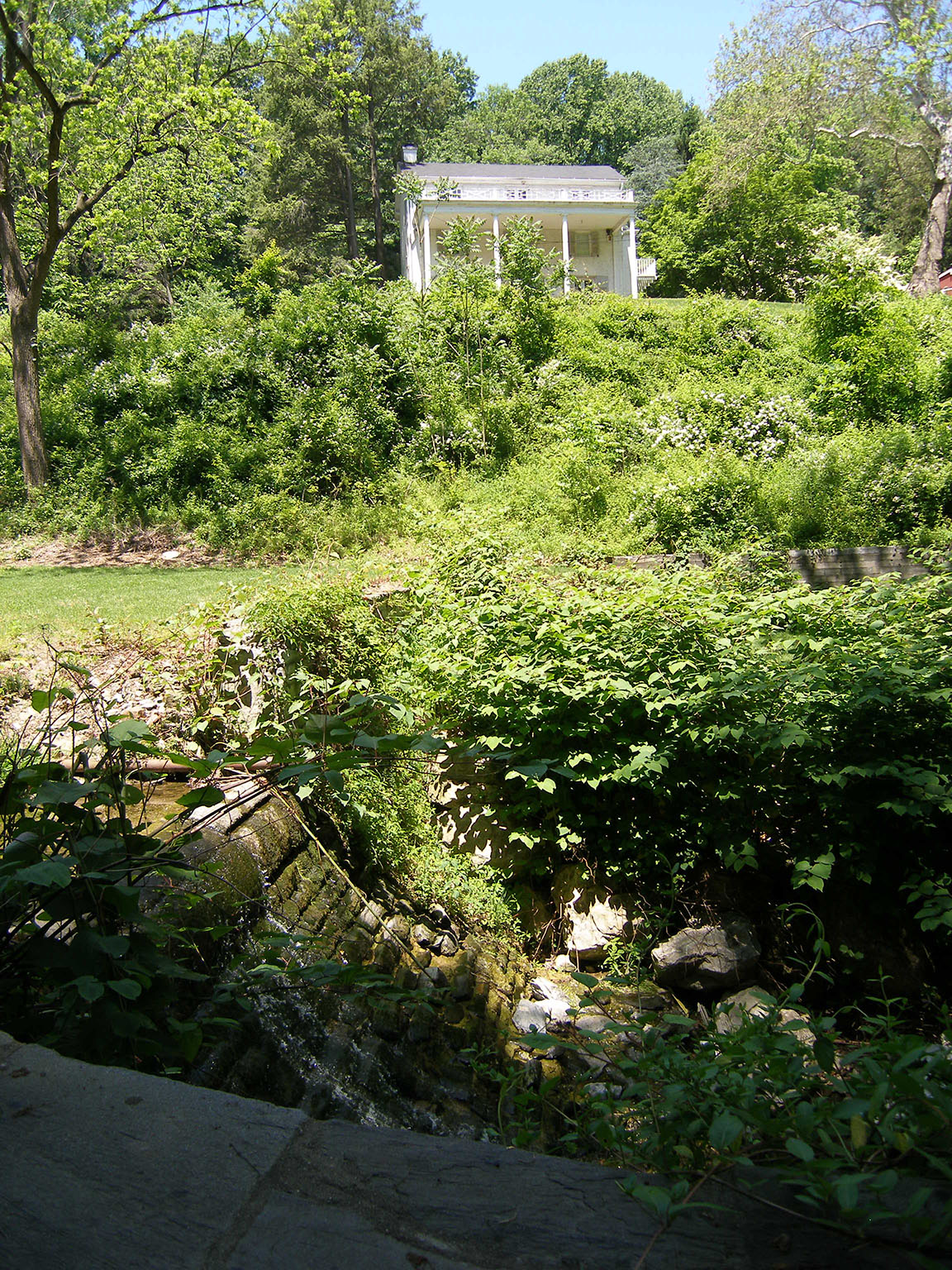
ANDORRA RUN This stream [also called Wise’s Mill Run] empties into Wissahickon Creek north of Valley Green Inn, near where Wise’s Mill Road joins the Forbidden Drive. A short distance upstream from the mouth, just below the point where the stream crosses from the south to the north side of Wise’s Mill Road, is a small dam (see below) that seems to be a remnant of a larger structure.
The valley is almost a gorge here, very narrow, and the road sits almost in the stream bed at some points. The 1884 Hopkins map (see map sequence below)) shows the pond that was once formed behind this dam, and a second pond on the north side of the road just upstream. But this is the only source that shows these ponds, and none of the sources indicated that any industrial facilities were ever associated with them.
The upper pond may have been an ornament to what the Klinge Map of 1929 (rev.1945) calls the “Mill House,” then owned by the Mitten family, who made a fortune running streetcars in Philadelphia in late 19th and 20th centuries. During my tour of the watershed on May 30, 2008, the existing landscape did seem to suggest the prior existence of such a pond.
As it passes underground in front of this house, the stream flows over a step dam into a box culvert. Upstream of the underground section is another dam on the property of 800 Wise’s Mill Road. A cattail-filled depression in front of a spring house looks to be a remnant of a small, perhaps ornamental pond. No sources show any pond at this location, or any industrial or other structures associated with this dam, which may have simply augmented a natural fall of water at this point.
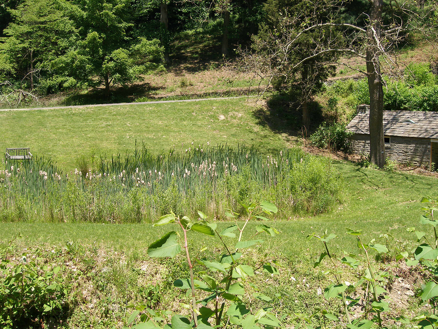
From this point the main stream turns northward into a densely-overgrown valley, very steep in places. I did not explore this valley on foot. Such an examination would certainly be worthwhile and could uncover historic remnants of interest, which may correspond to two features noted on the 1892 map (below). This map indicates what seems to be a small mill race and associated structure downstream from Summit Avenue, and a small dam and pond upstream from Port Royal Avenue. No other maps show these features.
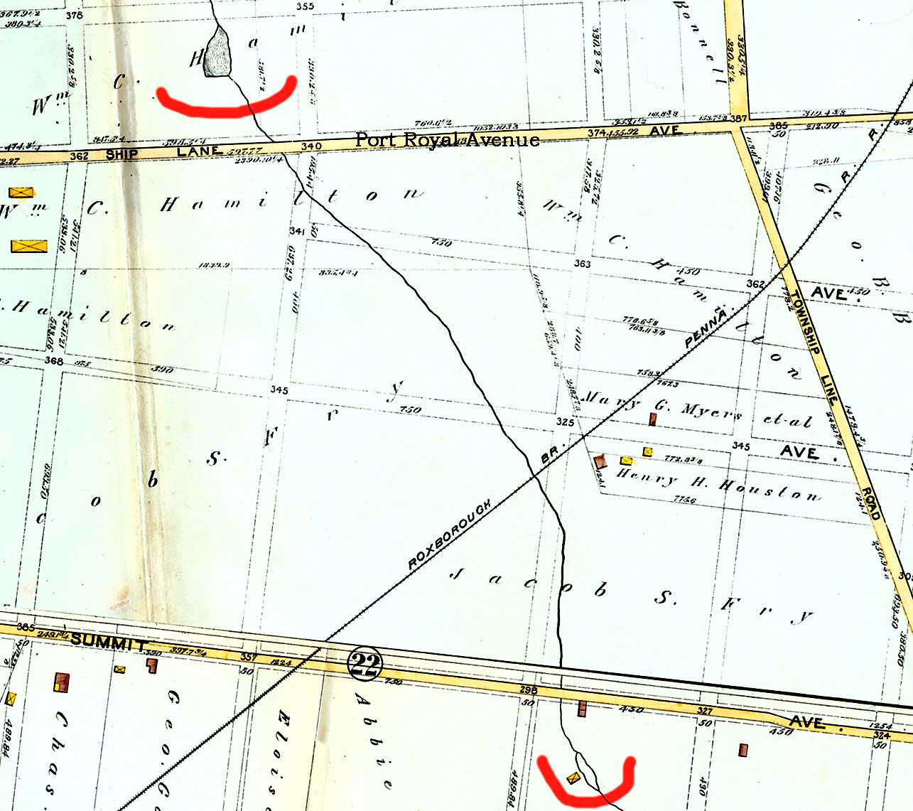
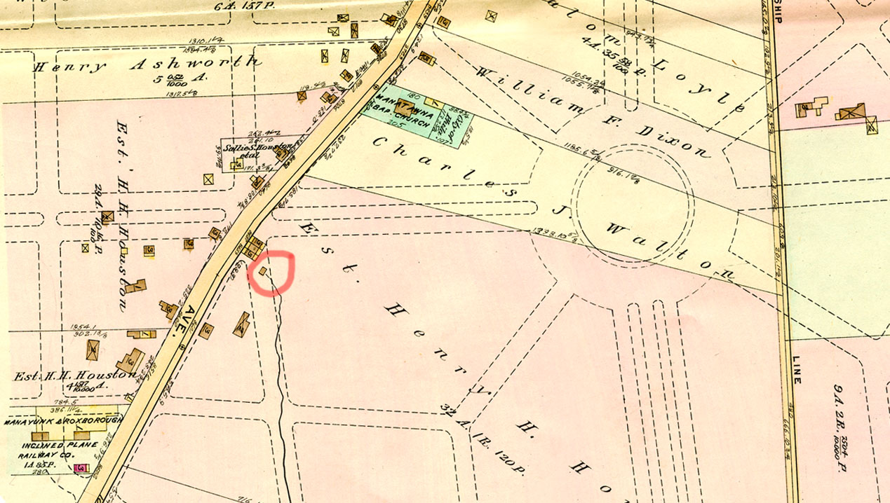
The 1884, 1892 and 1911 maps clearly show the source of Andorra Run, emanating from a spring house north of Port Royal Avenue near Ridge Avenue. The 1911 map (below) is notable because it shows street lines drawn over this entire stretch of the stream, which indicate a plan for development which was never fully carried out.
On the 1929/1945 map (below) the stream is only shown as far as Summit Avenue, with Brierdale Road (a street that was on the city plan for many years but never built) curving over the stream bed between Summit Avenue and Port Royal Avenue.

Henry Avenue was expanded from a two-lane road to its current boulevard configuration in the mid-1950s. By 1959 the first structures in what is now the Andorra Shopping Center appear in the aerial view, and the upper section of the stream disappears from view, diverted into stormwater pipes that now empty into the stream below Port Royal Avenue. This is where the stream currently begins its above-ground course. By 1961, plans to put the stream in a pipe were abandoned, and this narrow upstream corridor became part of Fairmount Park. This corridor also serves as a drainage right-of-way for the city’s sanitary sewer that more or less parallels the stream. (See PWD ERV plans 1066070 and 1066071.)
To download a PDF of all the maps and aerial photographs used in this study, overlaid to show changes in this watershed over time, click here. The maps are labeled by year only; any reader who wants the exact atlas volume should contact me. Aerial images are from the Delaware Valley Regional Planning Commission.
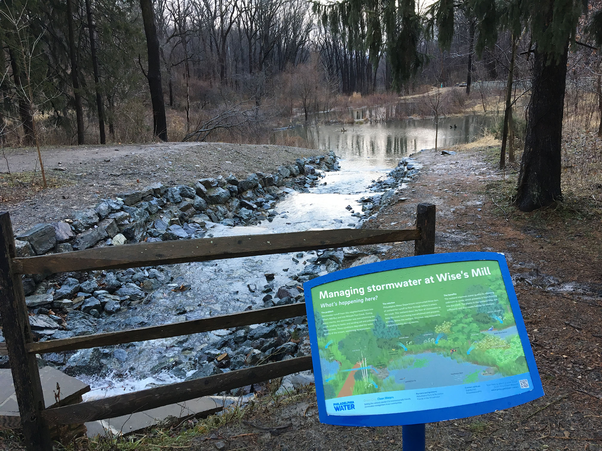
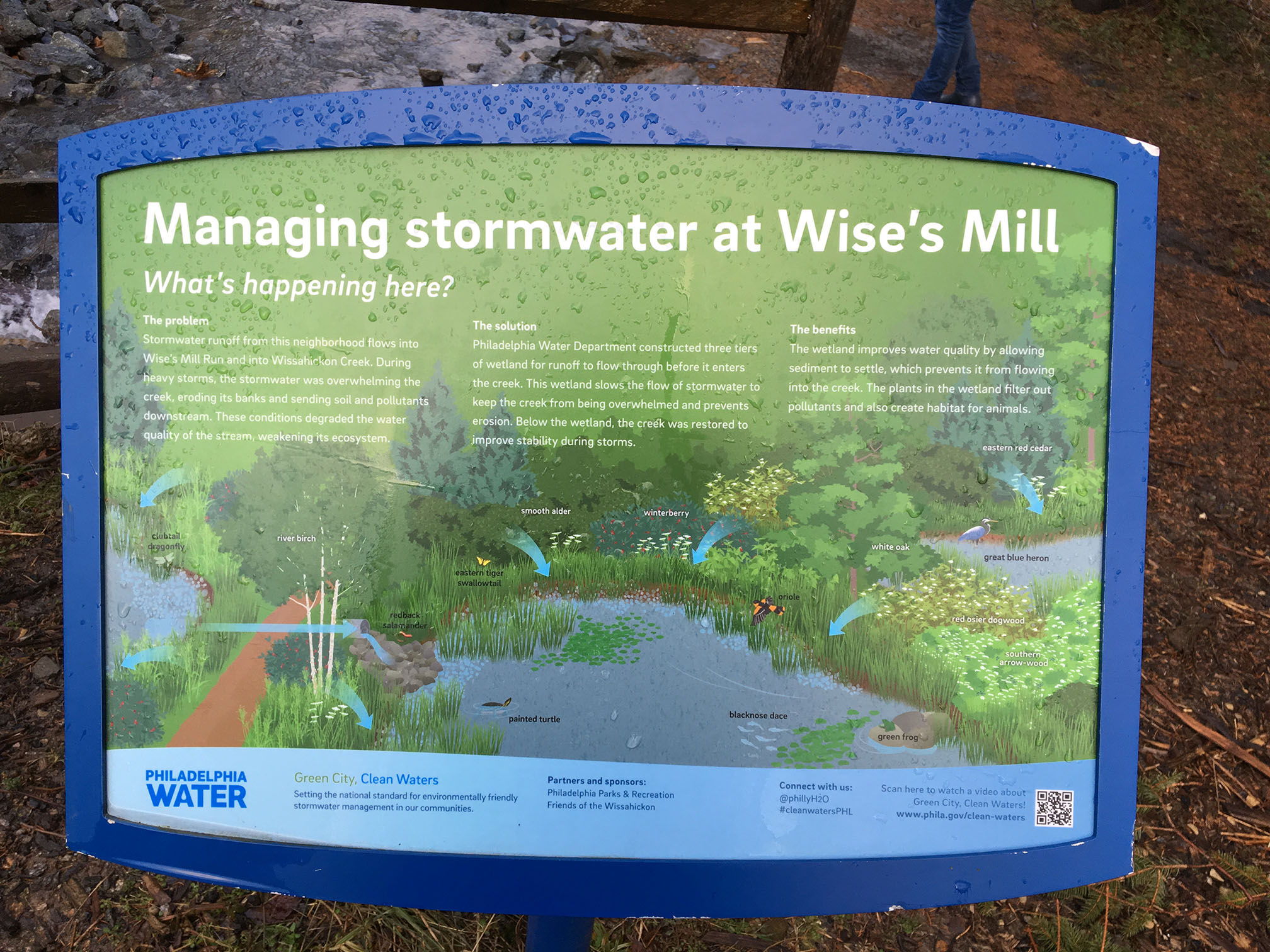
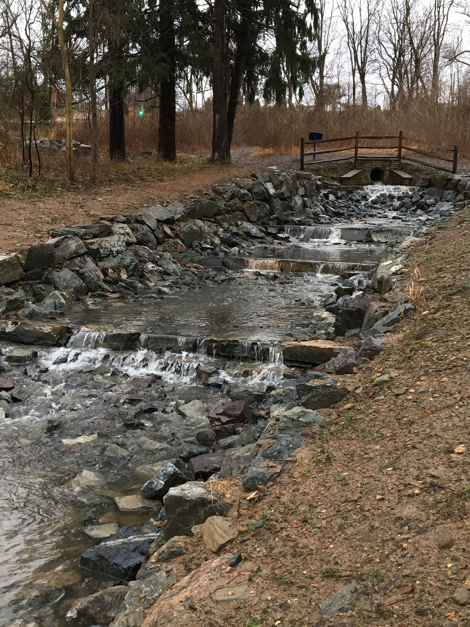
UPDATE: In 2018, the Philadelphia Water Department, in partnership with Philadelphia Parks and Recreation (the successor to the Fairmount Park Commission) and Friends of the Wissahickon, did build the stormwater retentions system pond mentioned above. Situated at the head of Wise’s Mill Run, on the northeast corner of the intersection of Wise’s Mill Road and Henry Avenue, it receives stormwater off of Henry Avenue and holds it in a retention pond. Below are a few photographs I took on January 24, 2019, just after this project was completed and before any vegetation had grown in. The stop at Wise’s Mill was part of a tour of similar stormwater management projects (what PWD calls Green Stormwater Infrastructure) with a group from Baltimore. The day was cold and very rainy, which was miserable physically (I hate wet feet). But all that flowing water showed how the GIS features were meant to perform much more clearly than if it had been a dry day.