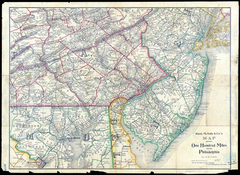
FULL TITLE Rand McNally & Co.’s Map Showing 100 Miles Around Philadelphia
DATE 1895
SOURCE New York Public Library Digital Collections
WHY I LOVE THIS MAP Railroads, railroads, everywhere! Of course, there are also regular roads in this area, but the cartographer wisely chose not to clutter up the map with them, which left lots of room to name just about every station on every line. This map is a remarkable testament to a form of transportation that has mostly been abandoned, the remnants of which – embankments, cuts, trestles, bridge, rails, ties, gravel beds – are visible in almost every community they once passed through.
MORE LOVE I love this map so much that I actually own a copy. I do have a scan of my copy somewhere on my terabytes of internal and external and cloud storage, but I wasn’t able to find it. In any case, my copy had been folded up for so long that I found it impossible to flatten, so when I scanned it the image had a lot of light spots and shadows at the many folds.
Not being able to put my cursor on my own copy, I searched for it online and found this one at the New York Public Library. Their copy must have been stored flat, or been flattened by a conservator, because it has none of the fold marks that my scan had.
But even though theirs was an improvement over mine, I had to make the image even better. If you go to the link above, you’ll see how murky the NYPL version is, as if you were looking at it through a brown scrim. This is probably the original unedited scan, which is how many institutions insist on presenting images to the public, even though I would bet my copy of the map that their original is not as dark as their scan of it. To make a long story a little less long: I downloaded a copy, edited it in Photoshop, and reduced it in size about 60 percent, and ended up with a 10mb jpeg image that I think does the original justice. That’s what you’ll see if you click the map image at the top of the page.