For me, when it comes to chocolate, or ice cream, or layer cake (do you see a trend here?) more is never too much. But when it comes to a map, too much information crammed onto a single page can make the end product undreadable. The art of a mapmaker (aka cartographer) is 1. to determine what a particular end user might want to see, and 2. to then create a map that presents this information in a readable way.
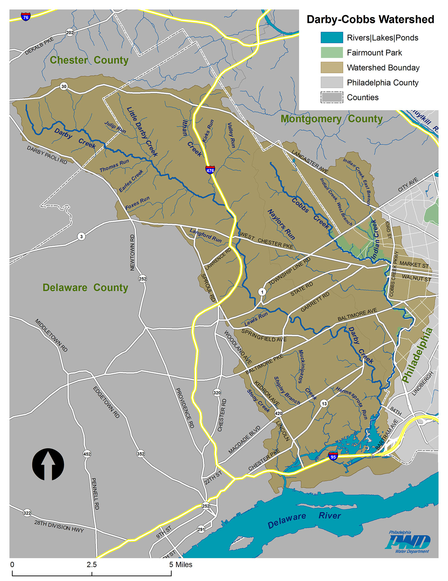
The two maps below show the 77-square mile Darby Creek watershed in Philadelphia, Delaware, Montgomery, and Chester counties in Pennsylvania. One of them shows municipal boundaries, illustrating a point often made about watershed management: that coordinating efforts between all the different government entities can be difficult at best. The second shows major roadways through the watershed and names of major tributaries, which always interest me. Both of these maps are somewhat crude, and to have put all that information together would have resulted in a map that would have been difficult to decipher.
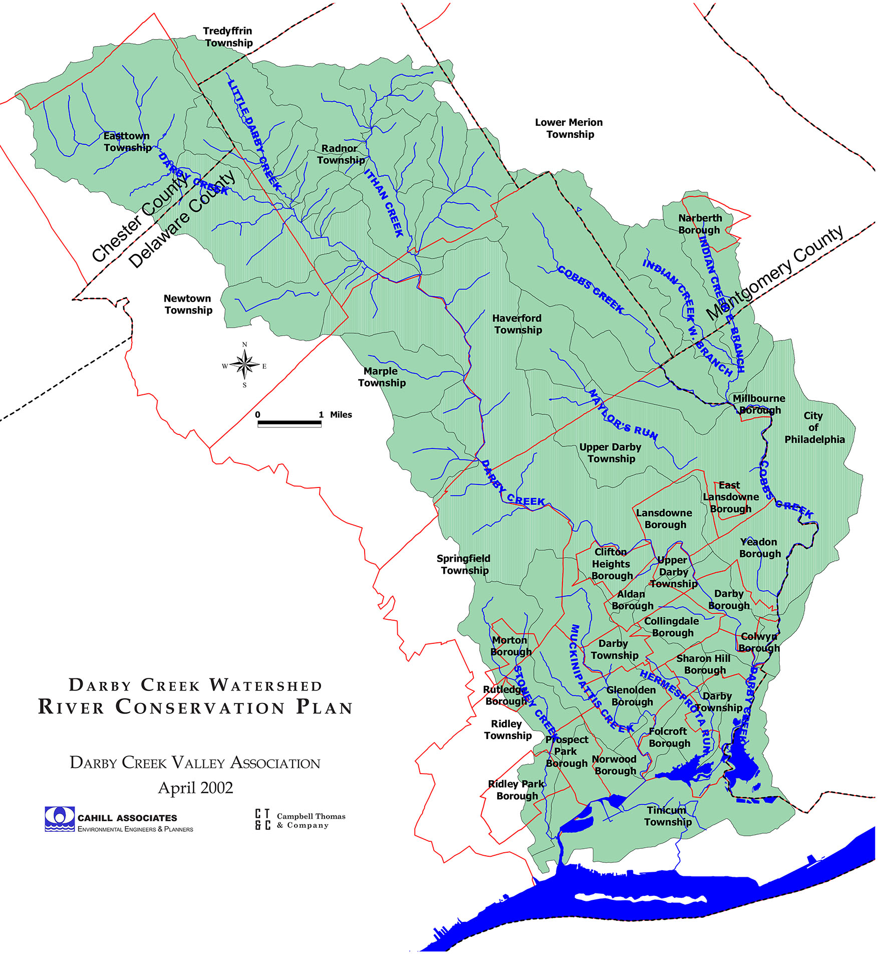
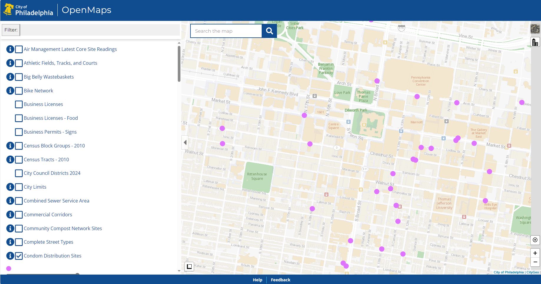
Most watershed reports (like this one, of the Darby Creek watershed, which features one of these maps on its cover) include many maps, each with a different focus that shows what it needs to and little or nothing else. With more sophisticated GIS (Geographic Information Systems) programs, a user can turn layers of maps on and off to see various aspects of infrastructure or landscape, and zoom in and out. One example of this is on the Open Maps section of the City of Philadelphia’s mapping website, an example of which is below.
But back to Darby Creek. I found the map below, on the website of the Darby Creek Valley Association, which displays it at a resolution that is frustrating to anyone who wants to zoom in on the details. I contacted the DCVA, and they told me they had no high-res version, and directed me to the county planning office, which was another dead-end. I noticed the initials in the bottom right corner of the map, so I typed “WCT SRC Darby Creek watershed” into a search engine, which led me to the Willistown Conservation Trust, in Chester County, Pennsylvania, whose lands encompass some of the Darby Creek headwaters. I contacted them, and found out that, yes, they had created this map in 2018, and they provided a high-resolution copy.
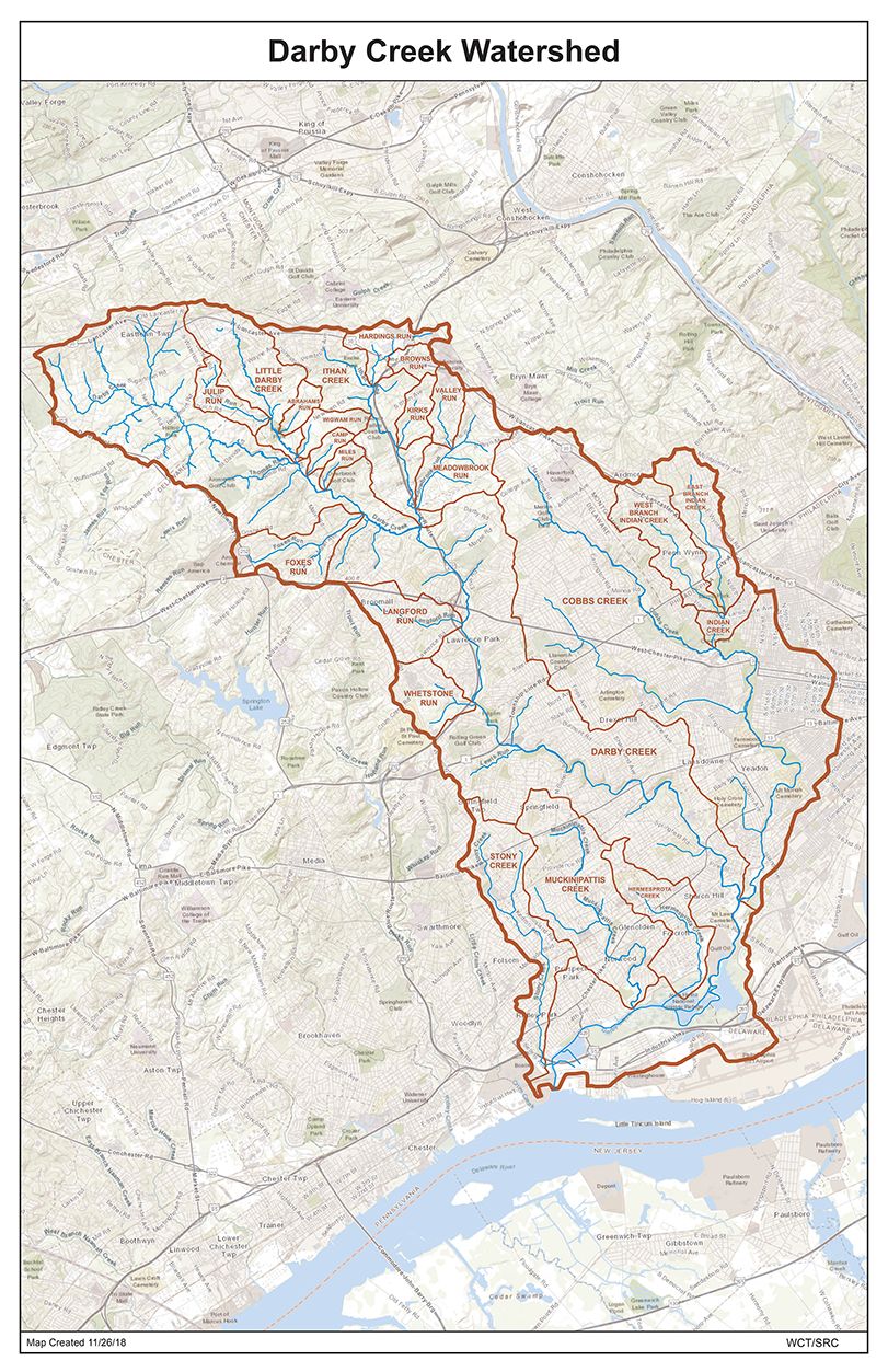
While this map does not show municipal boundaries, it has tons of details in the background, including sub-watershed boundaries, street lines, parkland, and much more, even for areas outside the watershed. Even with all this information, the cartographer somehow made it all legible without being crowded. Congratulations to the anonymous cartographer, to whom I would gladly give credit if I knew who it was.