Maps are as much works of art as they are conveyors of information.
Mapmakers must be selective about what features to depict, because if they try to show too much, the finished product becomes cluttered and unreadable. The Delaware River Watershed covers more than 13,500 square miles, encompassing 830 municipalities in four states, more than 2,000 tributaries, millions of public and private buildings, thousands of miles of roadways, ranging from the 12-lane section of the New Jersey Turnpike to narrow unpaved country lanes; and thousands more miles of underground pipelines which carry natural gas and other petroleum products, as well as drinking water and sewage wastes.
There are more than 6,000 miles of such pipes in Philadelphia alone.
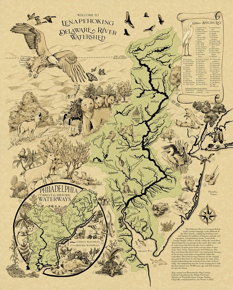
When artist Meg Lemieur was commissioned to create a map of the Delaware River Watershed before European settlement—when it was part of Lenapehoking, or land of the Lenape—she didn’t need to consider most of the items in the list above. Working with Trinity Norwood, a member of the Nanticoke Lenni-Lenape Tribal Nation in southern New Jersey, Meg was able to focus her map on natural features, such as the Delaware’s many tributaries, which would have been sources of water and food and routes of transportation for the indigenous people. She also included a selection of the plants and animals that the Lenape used in various ways.
(You can also get the map on a blanket!)
We’re sharing a link to Meg’s map today to honor the people who lived here for thousands of years before 1609, when Henry Hudson “discovered” the river and bay that they knew as the Lenapewihittuck. We are also bringing into the light the indigenous people who still live in Lenapehoking, and who are working to preserve their language and cultural heritage in a Eurocentric world that, to put it mildly, has at times in the past been inhospitable to them and their way of life.
And visit this page on WaterHistoryPHL, which celebrates Native American Heritage Day in2023 by featuring a 1934 map of Philadelphia before the European settlement.