Water
History
PHL
Show/Hide Menu
Items
Articles
Topics
About
Blog
Show/Hide Search
Search!
Item Types
Map
A map.
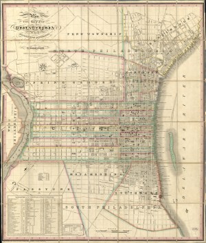
Plan of the City of Philadelphia and Adjoining Districts, 1830
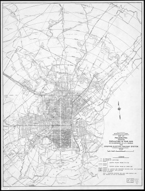
Map of Philadelphia showing Population in year 1920
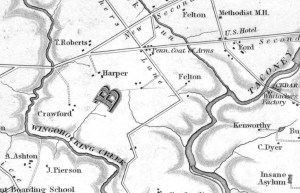
Map of the County of Philadelphia from Actual Survey, 1843
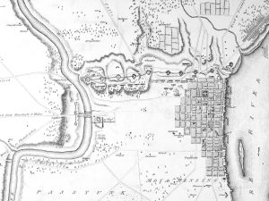
1779 Revolutionary War-era map of Philadelphia and environs
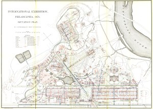
Centennial Exhibition situation plan, 1876
New Plan of Philadelphia, John A. Paxton, 1811