![Plan of Philadelphia, John Hills, May 30, 1796](https://waterhistoryphl.org/wp-content/uploads/graff02.04_Hills-map-1794.jpg?w=300)
![Bird's eye color view of reservoirs, green areas of foliage, pink roads and blue water, with a dam prominent](https://waterhistoryphl.org/wp-content/uploads/05_I6-2_1839_GRV17_750w.jpg?w=300)
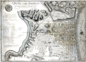
Fairmount and vicinity, 1839
![Color drawing of an elevated water reservoir on the banks of a river with green land shown on either bank](https://waterhistoryphl.org/wp-content/uploads/Course05_Graff0557.jpg?w=300)
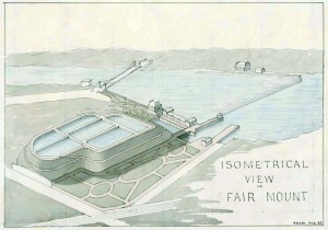
Isometrical View of Fairmount Water Works, 1843
![](https://waterhistoryphl.org/wp-content/uploads/Freshet-1869-10-04-Graff-collection.jpg?w=300)
Freshet, October 4, 1869
![Tinted image of a single-arch bridge over a river with landscape in the distance](https://waterhistoryphl.org/wp-content/uploads/graff09.04-scaled.jpg?w=300)
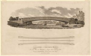
Lancaster/Schuylkill Bridge (Upper Ferry Bridge)
![Upper Ferry Bridge over the Schuylkill (Graff09.03)](https://waterhistoryphl.org/wp-content/uploads/graff09.03-scaled.jpg?w=300)
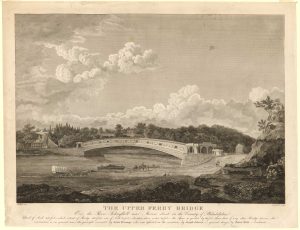
Upper Ferry Bridge, 1820
![Race Bridge, Fair Mount Water Works, 1834 (Graff05.63)](https://waterhistoryphl.org/wp-content/uploads/graff05.63-scaled.jpg?w=300)
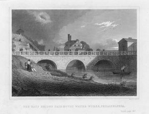
Race Bridge, Fairmount Water Works, 1834
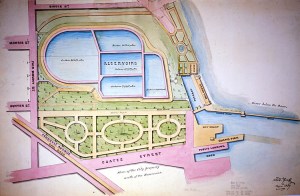
View of Fairmount Water Works, ca. 1827
![Lemon Hill and Sedgley Park, Graff Jr., 1851 (Graff05.21)](https://waterhistoryphl.org/wp-content/uploads/graff05.21-scaled.jpg?w=300)