When I used to navigate with actual maps, those that showed as many roads as possible and the distances from point to point, were the ones I found most most useful. The old oil company maps that used to be distributed by gas stations, for free, did this job beautifully. In many ways I miss using paper maps, and I sometimes find the detailed nature of GPS directions a little creepy. If “they” – by which I mean the all-knowing “powers-that-be” that control the satellites that track us everywhere – have the world so minutely mapped that they know how many feet my car is from a particular intersection, and if I am accessing that information through the phone I carry with me constantly, doesn’t that mean “they” always know where I am?
I am afraid the answer is yes, “they” do. But our privacy, as we have learned over the last 20 years, is a tradeoff for our access to mountains of information, including accurate driving directions.
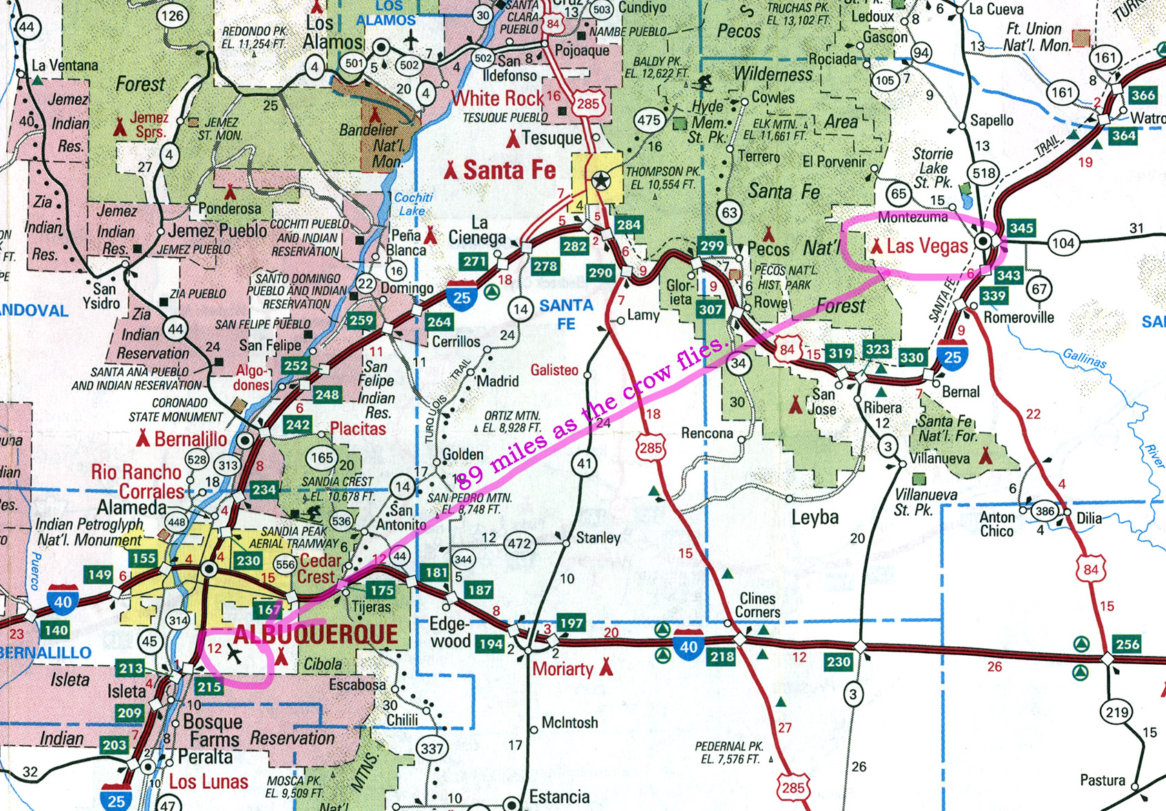
Which brings me to the map at the top of the page. In 1998 I went on a trip to the southwestern US with my friend Tom, visiting national monuments and national parks, including Zion and the Grand Canyon. For reasons that neither of us can now remember, we spent our last night in Las Vegas, New Mexico (no, that is not a mistake; see the map above). Before we went to bed I consulted my road map for the distances to the airport in Albuquerque, where we were catching a flight back to Philadelphia. On the map, each segment of the trip was marked with the mileage, and I added up those numbers, divided by 65 miles per hour, and figured out what time we had to leave to make our plane.
That morning we hung around the motel maybe a little longer than we wanted to. We got sucked into watching Sally Jessy Raphael, one of those 1990s talk show hosts who specialized in humiliating their guests while pretending to sympathize with them. By the time we managed to pull ourselves away from the TV and into the car, we were about half an hour behind schedule, but we still could have gotten to the airport on time – if my calculations had been correct.
We drove and drove, and didn’t seem to be getting close enough to the airport quickly enough. The distance to Alburquerque announced on roadside signs didn’t match my number, so I finally took another look at the map, added up the segments again, and realized that I had missed a few that added up to about 50 extra miles. By the time we got to the airport our plane had departed without us.
We eventually got home, minus about $150 in change fees, but this never would have happened if GPS had been available then. Computers have their limitations (although fewer and fewer, it seems, as time goes by). But one thing they have always been able to do – in fact, one of the things for which they were invented – is to add up numbers correctly. With GPS, I can always ask how far it is from where I am to where I’m going, and I’ll always get an answer, even if it’s not always helpful. I just asked my phone how many miles it was to Auckland, New Zealand. “I’m not sure how far Auckland is by car,” came the immediate answer,” but it’s about 8,732 miles as the crow files.” Which I guess would be useful, if I was a crow.